In Northern Ireland, the legal technicalities are slightly different from other parts of the UK.
(Pretty much all of the land that the roads run over is privately owned - even an ordinary person like me technically ‘owns’ my half of the road that runs past my house  - however a ‘common law’ right of way exists, which means the public have a right to pass along the road… meanwhile, since 1973, these roads have all been ‘adopted’ by an agency of a government department, called the ‘Roads Service’.)
The Roads Service classify all their adopted roads in to either
- motorways (M)
- trunk (A with green signs)
- primary (A with white signs)
- secondary (B) and
- tertiary (C) roads
…and all the rest are ‘unclassified’ (U)
The Roads Service give all of these roads a letter prefix and number.
Generally C and U numbers don’t appear on road signs, although very occasionally you will see a numbered C road of a sign (don’t ask me why!)
I prefer to reflect this practice by using the tag ‘highway_authority_ref=’ for C and U numbers that don’t appear on signs (rather than ‘ref=’). Arguably this is ‘tagging for the renderer’ but it does reflect a logical/practical difference in the use of the number.
All these adopted roads (apart from motorways) also have proper names, however these are assigned (and signed) by District Councils, not the Roads Service.
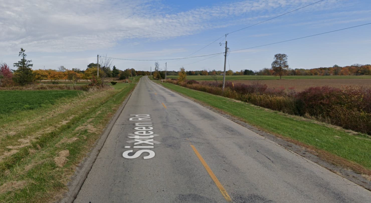
As to what the unclassified roads in Northern Ireland actually look like… well, it varies 
They will all be at least 4 metres wide (enough for one motor vehicle to procede) although occasionally they may have bends or gradients which mean the Roads Service have to put an ‘Unsuitable for HGVs’ sign up. Most of them are wide enough for two vehicles to pass in either direction, but it’s usually a squeeze and you both have to slow down, or one of you wait at a ‘passing place’ (usually these are informal - eg at a gate leading into a field).
Pretty much all of them are paved with ‘tarmac’ (asphalt); commonly this is resurfaced every few years by ‘tar and loose chippings’. Many (probably most) of them don’t have any white line down the middle nor cats eyes, lines marking the edge of the road are rare. You will often see warning signs on them. Or ‘SLOW’ painted on the road (to be morbid, this usually means somebody died in a car crash at that spot some time in the last 50 years!). Some of them even have grass growing down the centre line! It is rare for them to have kerbs, pavements or street lights. Usually there is a grass verge or hedge (they are bordered by farmers’ fields). National speed limit usually applies except for portions that pass through a hamlet or villages.
To understand more of the context of these ‘unclassified’ roads: for at least a thousand years if not more, the smallest unit of administrative land division in Ireland has been the ‘townland’ (Townland - Wikipedia ). And almost all the land was farmland, divided up into fields. There were farm tracks designed for horse and cart, passing through and linking up all these townlands. During the early 20th century, a large portion of these got tarmac-ed and made usuable by motor vehicles. Prior to 1973 they were (inconsistently) maintained by a jumble of district and county councils, until finally in 1973 they were all ‘adopted’ by the Roads Service. So essentially nearly all of these little ‘unclassified’ roads are centuries old.
Everything I’ve said above primarily describes rural areas… in Northern Ireland’s urban areas, most of the residential roads are post-war (WW2). I would usually use the tag ‘residential’ for them, although the majority of them are still ‘adopted’ ‘unclassified’ U-roads maintained by the Roads Service. But they look different to rural unclassified road - they will usually have kerbs, pavements, street lights, 30mph speed limits, and enough space for two-way traffic - so I think the different tag makes sense.
(There is also a bit of a fuss in Northern Ireland about a backlog of new housing developments and their residential streets where the Roads Service has not ‘adopted’ the road, meaning nobody will pay to maintain it… so these roads are definitely residential, but NOT part of the Roads Service’s ‘unclassified’ category). Again note that in Northern Ireland, the legal or common law basis for the right of way on a road is a separate matter to whether it has been ‘adopted’ by the Roads Service - the latter is just about who pays to maintain it! So whilst in England or Wales, these unadopted residential roads might typically be called ‘private roads’, the issue with them in Northern Ireland is not a lack of legal right of way, it’s just an administrative balls up about who will pay to fix the pot holes )
There are also a large number of old farm tracks and lanes in Northern Ireland’s rural townlands which nobody ever got around to tarmac-ing in the early 20th century, so in 1973 the Roads Service never adopted them.
This left them in a bit of a limbo. Many of these are ‘dead ends’ that just provide access to a few farm houses or farms, but no through route. So in the absence of anyone else having any business to go down them, they tend to be de facto regarded as ‘private’ (so typically on OSM they get tagged as service roads, driveways, or track/land-access-road). These could often be hundreds of yards long, sometimes even a mile or two. However some were not dead ends, and provide through-tracks across townlands, connecting to (what are now termed) unclassified roads at either end. Historically, local people had enjoyed a common law right of way on many of these.
The help clear the limbo, in 1983 the ‘Access to the Countryside Order’ was brought in, which mandated District Councils to rediscover these limbo-ed tracks and ‘assert’ that a public right of way existed on them, and keep them open as public footpaths and bridleways. However in practice, local farmers are often having none of this. Nevertheless, the tags ‘designation=public_footpath’ etc are useful in that scenario.
Phew, I typed a lot there
I’ve no idea if any of that helps tagging outside of the UK or not!