Not really, I think. Splitting up the area and posting it on a umap where folks can claim an area might work. Or simply add a query showing the newly added nodes, then one can start from the North and another from the south
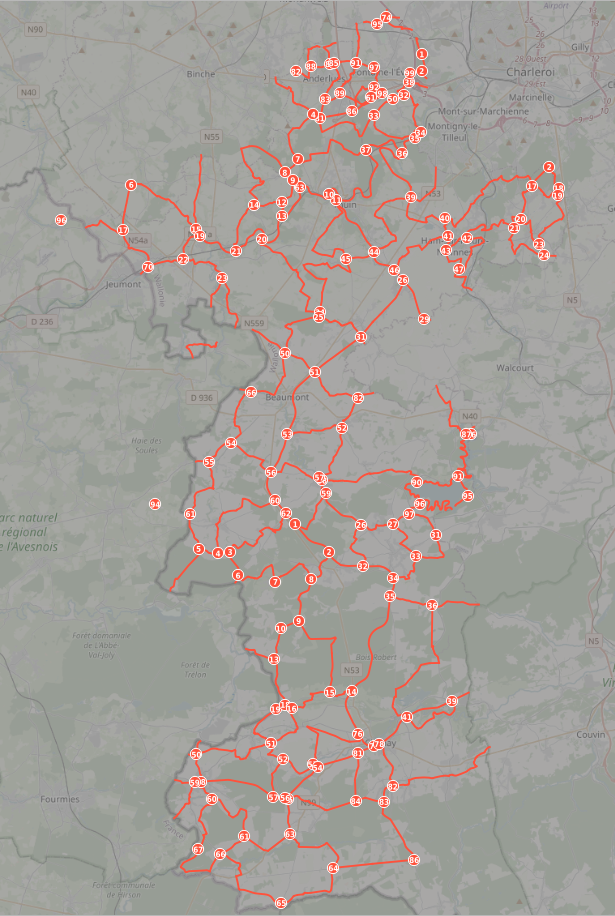
You can claim a sector to work on, or on a stretch of nodes within a sector (the node numbers are unique within each sector).
NL
Ik heb een uMap gemaakt en sectoren getekend. Je kan aankondigen dat je in een sector gaat werken, of aan een deel van de knooppunten in een sector (de knooppuntnummers zijn uniek binnen elke sector).
FR
J’ai fait un uMap et j’ai dessiné des secteurs. On peut annoncer de travailler dans un secteur, ou travailler à une partie des nœuds dans un secteurs (les numéros sont uniques dans chaque secteur).
Important update: as @Jakka pointed out, it’s a bicycle node network (network=rcn), not a hiking one. The initial mail from Visit Hainaut was not clear about this.
start Brown sector
It looks they are already added
So done
Think al the rest of shp files is already in/added.
mail tells:
“indeed two more “communes” ( Fontaine-lévèque and Anderlues) are now available in our network”
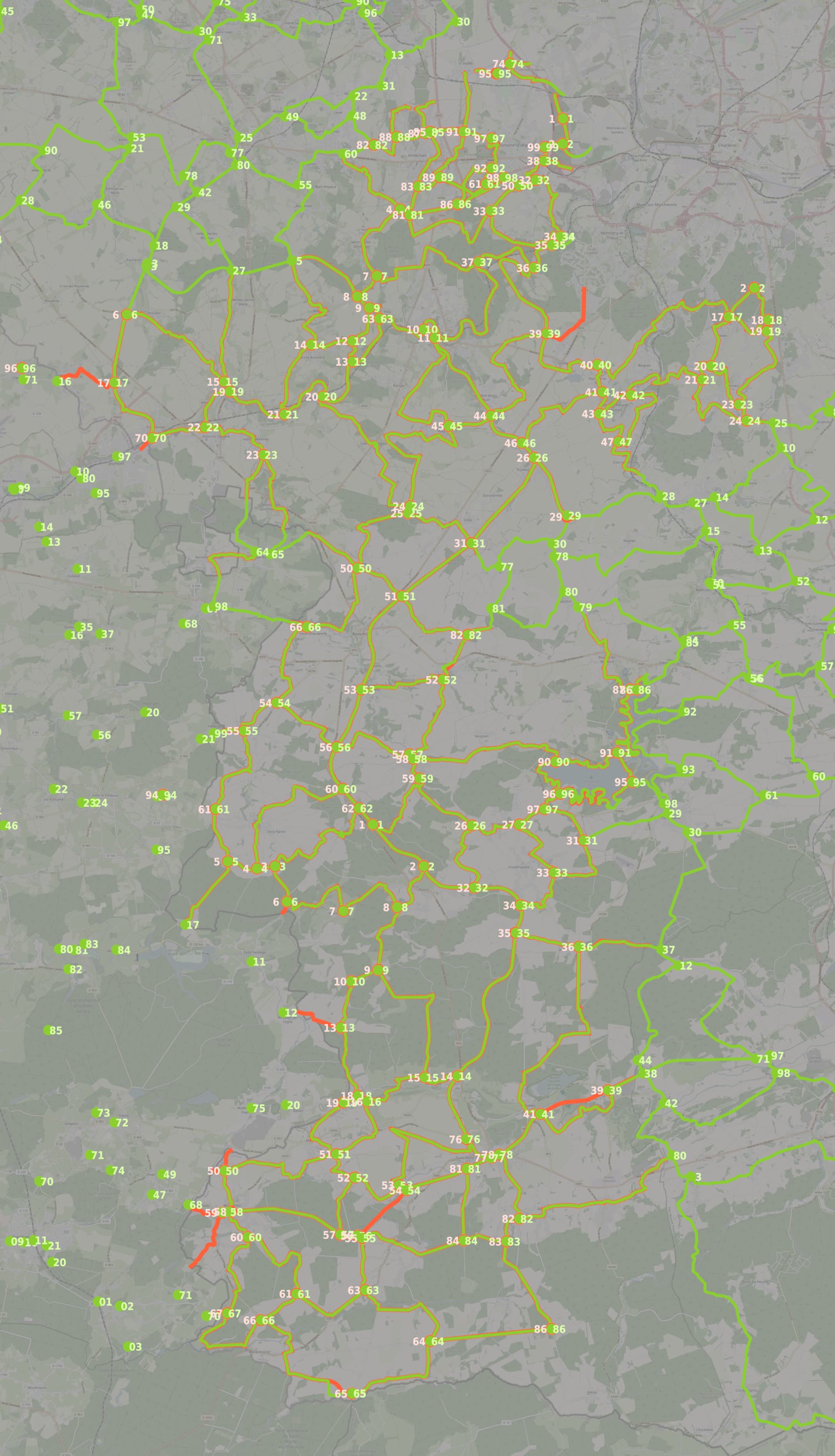
I checked visually in QGIS, these are my findings:
Missing connections in OSM / Ontbrekende stukken in OSM:
54 - 56 (magenta sector)
These connections use different roads / Deze verbindingen gebruiken andere wegen:
52 - 82 (cyan sector)
65 - 66 (magenta sector)
Between 39 and 41 Visit Hainaut has two connections, maybe a mistake in their data.
Tussen 39 en 41 heeft Visit Hainaut twee verbindingen, misschien een fout in hun data.
Their data is red and to the left of the nodes, OSM data is green and to the right.
Hun data is rood en links van de knopen, OSM-data is groen en rechts.