when placing these down; what is the universally accepted placement and direction of signal lights?
Is it the location of pole/lights and direction of lights on the pole controlling traffic. Or is it attached to the Roadway stop line and pointed in the direction of signaling traffic?
Any help would be appreciated…
The Wiki info on usage is very generic in wording and solutions…
If the question is about universally accepted practice, then it’s worth noting that there are two popular conventions for tagging highway=traffic_signals: somewhere along each incoming way or at each intersection node.
Along each incoming way
As @Nadjitapoints out, if you place the highway=traffic_signals node along each incoming way, routers don’t really care where along the way you place it, as long as it’s closer to the intersection than to another intersection. However, popular practice is to place the node at the stop line so that it corresponds to something verifiable on the ground. If there’s no stop line marking, you’d place it before the crosswalk or wherever drivers are supposed to come to a stop.
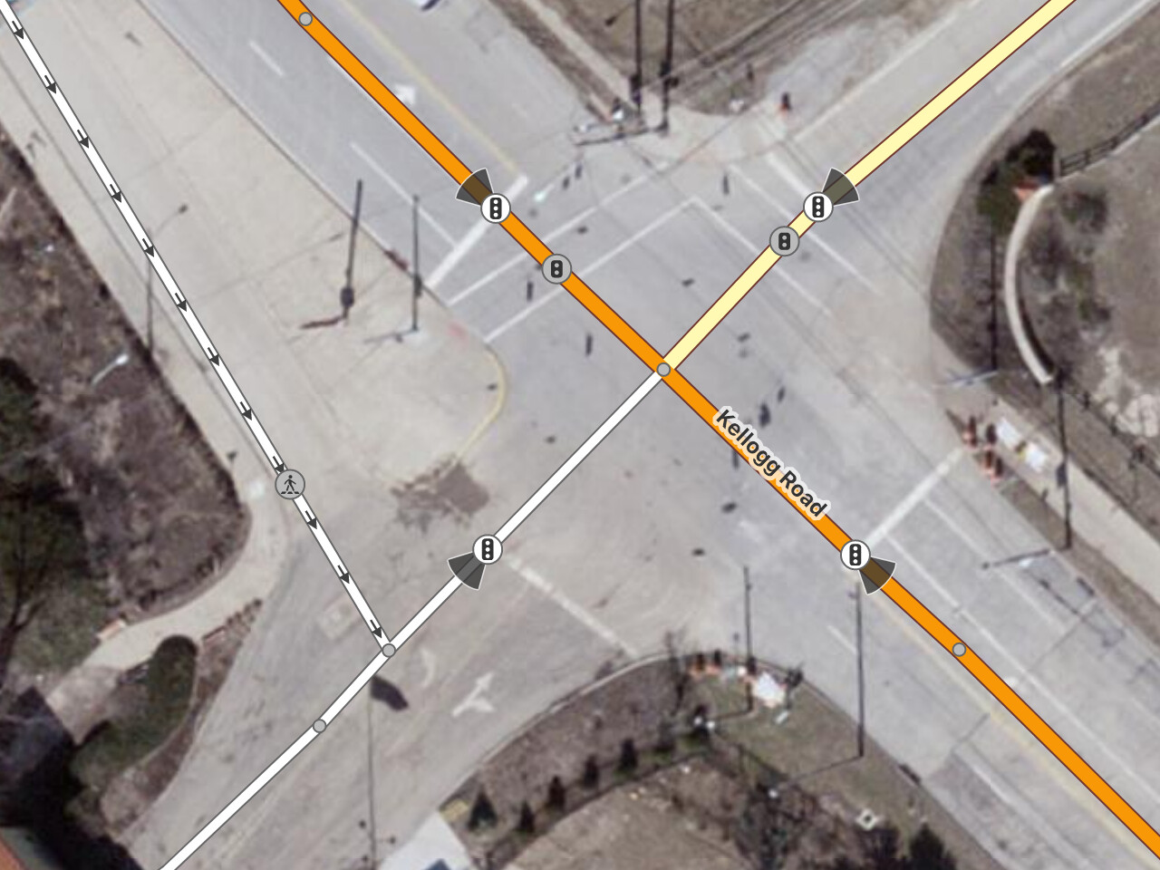
Sometimes the stop line is technically closer to an intersection with another street. traffic_signals:direction is a hint to the data consumer about which intersection to associate the node with:
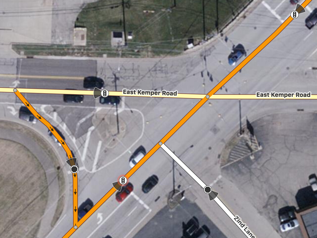
This isn’t perfect; sometimes the stop line is associated with more than one upcoming intersection node. For example, northbound traffic at this intersection waits for traffic on East Kemper Road, not Zind Lane:
A more complex intersection may require a junction relation to fully express the system, such as this continuous flow interchange.
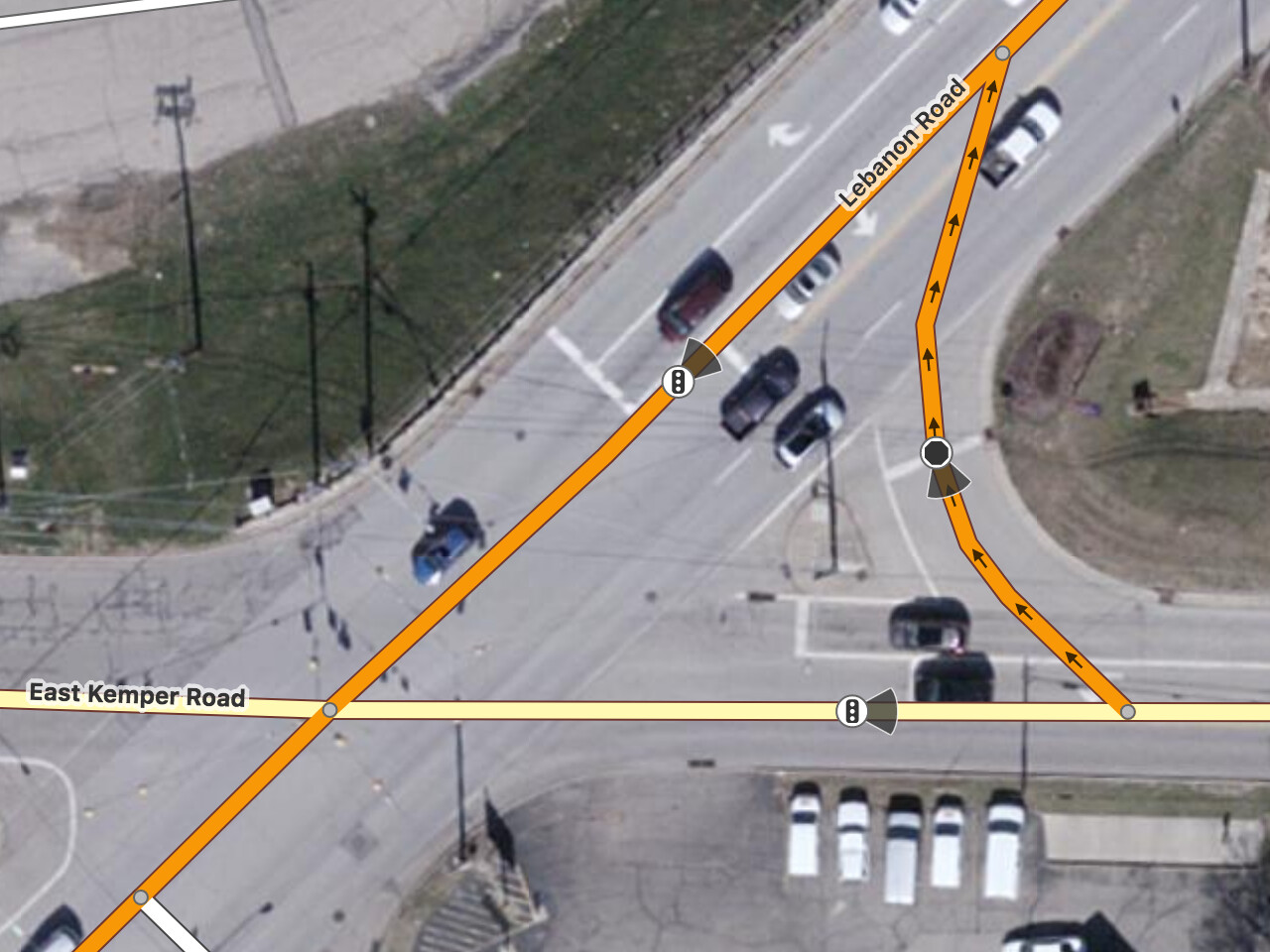
Another issue is that, in some situations, there isn’t a single stop line. For example, in the U.S., when the cross street comes in at an angle, the stop line is often staggered lane by lane. Some mappers place the highway=traffic_signals node at the average of all the lanes’ stop lines; others at the average of only the through lanes’ stop lines; others at the nearest or farthest stop line; and still others at none of the above.
Tagging the intersection node simplifies things for renderers and navigation applications that count traffic lights along the route, but it’s more ambiguous when an intersection between two dual carriageways has multiple intersection nodes. Most routers that account for traffic lights try to collapse such intersections into a single vertex in the routing graph, so the presence of multiple traffic signal nodes isn’t necessarily a problem. However, sometimes there really are multiple intersections in close proximity, making this an inexact science.
It’s on the incoming roads, but doesn’t state where exactly. For countries, where the traffic lights are on the opposite side of the crossing, putting the highway=traffic_ligths on the actual location of the traffic lights wouldn’t work. I don’t think that there’s a globally accepted “best” way to do it, but because of the problem with the traffic lights being on other sides of the crossing, I personally prefer to put the on the stop line. But there is no wrong or right, as long as it’s on the incoming road, close to the crossing/lights, but before the actual crossing.
Never considered the traffic_signals:direction as telling to which intersection they belong, just as with anything like traffic_signs, stops, yield simply which way the sign is facing the road participant. Notice a few that are directly on a junction node without any, where I would add the value ‘both’, but in cases where oneways join a junction would actually add the directions in degrees, semicolon separated so you’d get traffic_signals:direction=nnn;nnn;nnn . QA always prods "could directions be missing’ in those latter instances. Seems to not consider that the tag is present, therefor can be skipped.
I like the ID ‘beam’ on signs very much, seriously missing in JOSM. Found a little map paint style that does add little arrows to yield and stop spots. Not seen them on anything else.
")
")