Andy, this is something we mused over before on these boards.
As you probably know, by OSM tagging mechanics, Irish townlands get tagged by means of ‘admin level 10’ relations on their boundaries. (Typically those boundaries are agricultural field boundaries, rivers and roads that have been there for many many centuries…)
On Irish Ordnance Survey maps, traditionally, townlands were shown on big scale maps using labels with a ‘double stroked’ font (also known as ‘blackboard bold’ - the same as that naughty Mr Elon Musk has chosen for his X logo for Twitter…)
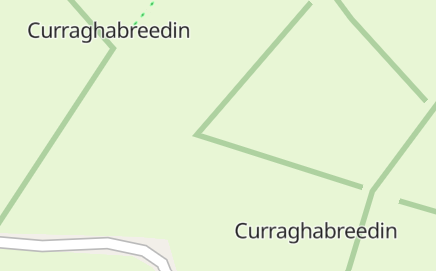
But the majority of OSM renderers tend to instead show admin level 10 names as little labels snaking along the boundaries themselves, only visible when you zoom right in.
I guess many Irish map users don’t find this all that pleasing, and would pefer to see a label for the townland name rendered in its ‘middle’.
This may have led some editors to use the locality tag to try and achieve this. But I think we can all agree this is probably not the way to do things - it’s tagging for renderer, and so probably when you find instances of it, the locality should go.
For a few townlands, I tried experimenting with adding a ‘label’ node to the townland relation – eg Relation: Legananny (4594970) | OpenStreetMap
I fairly swiftly gave up with this, as it generally looked even worse in most common renderers.  Although I don’t think it is bad tagging per se.
As ever, geographical and cartographical reality is often somewhat messier that the above description - OS NI currently seems to use a very dubious selection of fonts on its 1:10,000, 1:25,000 and 1:50,000 map series (serifs, san serifs, block capital, title case…) to differentiate between settlements (villages, hamlets), townlands and ‘localities’ - the latter seemingly being places which have somehow earned a name without being exactly a settlement or geographical feature, but neither are they a townland. The provenence of many of these seems obscure and in 21st century NI at least, I’m not even sure how anyone still alive knows they exist other that they’ve been shown on OS maps since the 1830s. They occasionally crop up on highly obscure things like Council Public Right of Way maps or Translink bus stop names, but usually there’s nothing on the ground to tell anyone that they exist. (Further weirdness can be caused by the Roads Services’ road signs something signing places that don’t correlate well with any of the above…)
I can see a case to be made for a OSM Ireland map render that knows what townlands are and labels them in a more satisfying way (similar to the traditional OS map labels). It would also deal in a nice way with bilingual place names (using an uncial font for Irish, as per Irish roadsigns).
