A lot of discussions recently about mapping waterways. The basics of mapping coastal geography in OpenStreetMap was also explained by Christoph Hormann.
Waterways Version 1.10_2023-11-08
In parallel, I continued adding new features for wetland and coastal areas to version 1.10_2023-11-08 of the JOSM Waterways Map Style :
- wetland : bog, fen, marsh, mangrove, reedbed, tidalflat, wet_meadow
- coastal water features + tidal=yes : beach, sand, shingle, mud, reef, shoal, bare_rock
Symbology
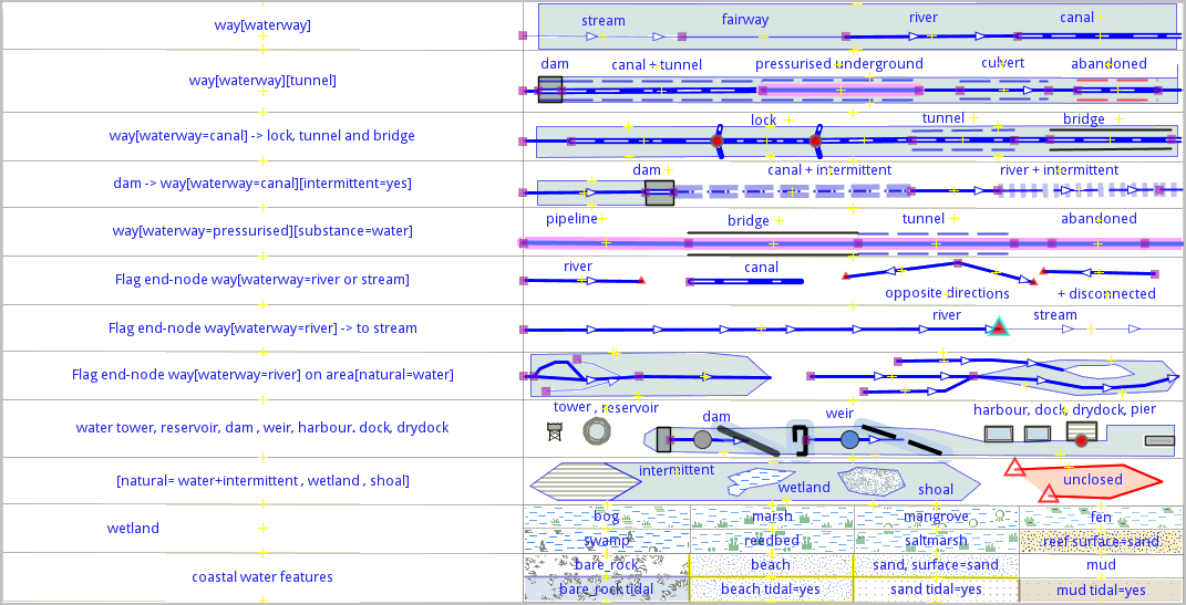
I have integrated the Wetland and Coastal features and fill-images proposed by the cartocss Style osm_carto and alternatives projects (osm_carto_alt, osm_carto_ajt and osmfr_carto).
If you are interested about this thematic and and want to discover through JOSM, you can simply :
1 - Add and activate the Style in your JOSM list of Mappaint Styles
2 - Download some OSM data for your area of interest
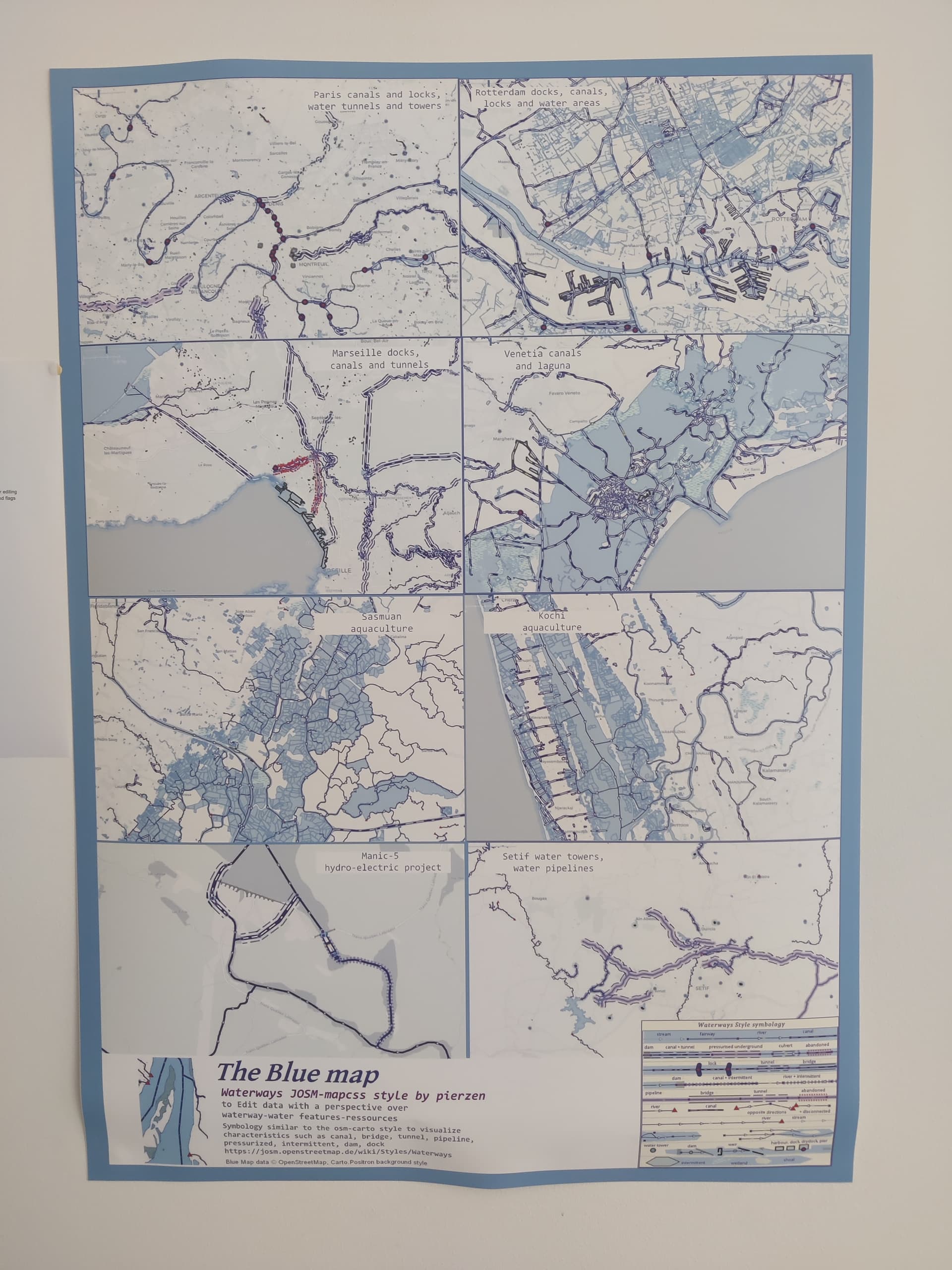
Map-Quiz with the Blue Map
A fun way to do it is to participate to the Map-quiz, and identify the 8 areas described on the image below. An interesting way to discover the Blue Planet !
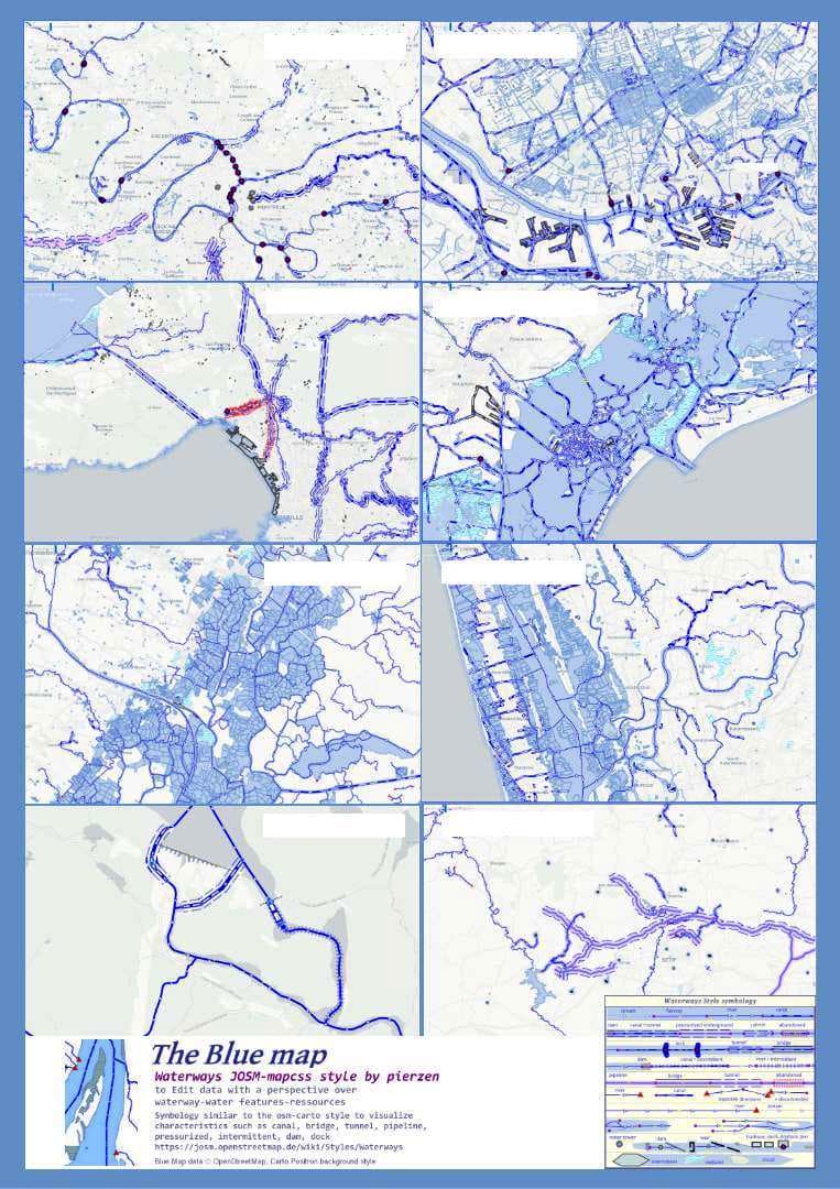
The Blue perspective with 8 mini-maps hides 4 cities in Europe, 2 coastal aquaculture areas in South-Asia, pipelines to distribute water to 1 african city and a North-America power plant project. Good search.
HowTo
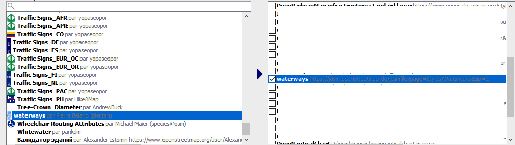
1 - Add and activate the Style in your JOSM list of Mappaint Styles
In JOSM :
- press F12 (Preferences) and select the MapPaint dialog.
- In the list of Styles, select Waterways. It should be automatically activated/checked on the list at the right.
2 - Download some OSM data for your area of interest
While the Waterways style is activated, only the Water and Waterways features will be showed from any OSM data downloaded. You can add a Light OSM style in the background to have a general view. You can also concurrently use other styles. You simply need to place these styles below the Waterway in the List of Styles on the right.
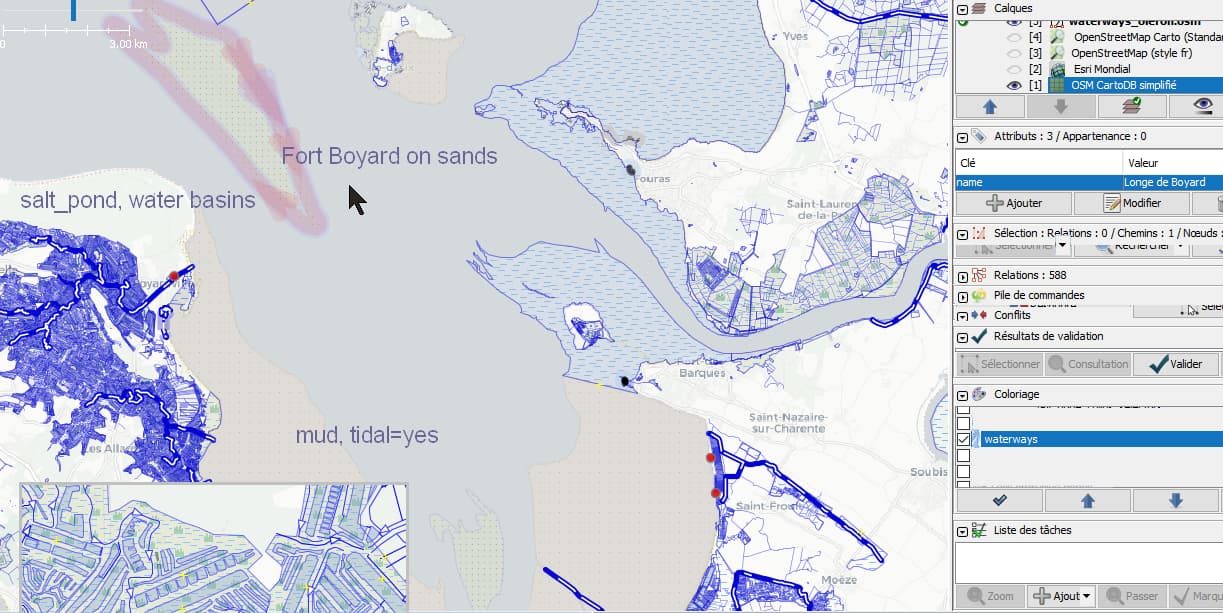
This JOSM editor SceenShot below represents the coastal water features (natural and man-made) around the Oleron Island and Fort-Boyard, south-west of France.
Have fun editing the OSM Blue Planet !