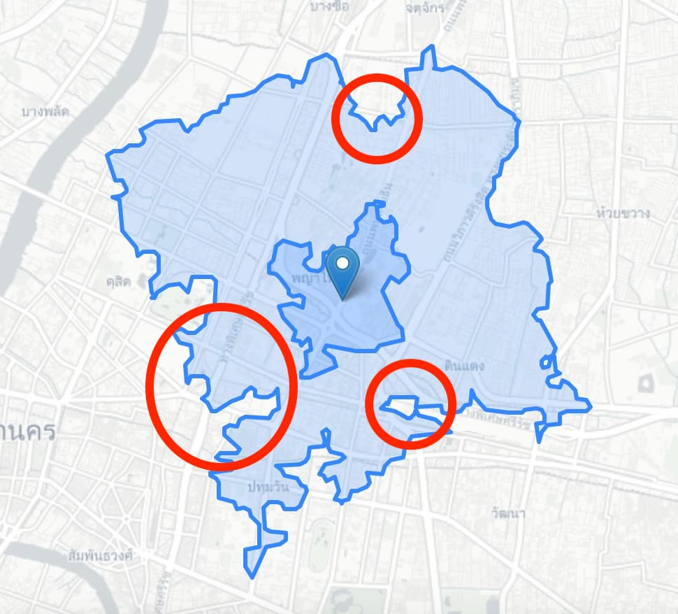
There’s a group called ปั่นต่อ (Puntor) who’s collecting data for the Bangkok deputy governor in order to help make Bangkok more cycle and pedestrian friendly. As part of the project a few of us have volunteered to create an isoline using geoapify for all the major public transport that shows travel distance from major BTS/MRT stations. The idea is that if the distance from the station is shortened (illustrated by red circles in the sample imagery below), then either the BMA can start looking into improving access, or there are possibly missing permissive roads that can be added to OSM to expand the network.
This is a very exciting project that I would like to share with the community as we can be having a huge impact on millions of Bangkokians  and the team is very impressed by the quality of analysis available using mostly FOSS tools. To that end I would like to say a big thank you to everyone who made this possible. When I have the code up on GitHub (or Colab) I’ll post it here.
ps. I also figured out how to do much of this by using chat.openai.com which was also a fantastic experience.
Sample below: