So there’s a little more to the story.
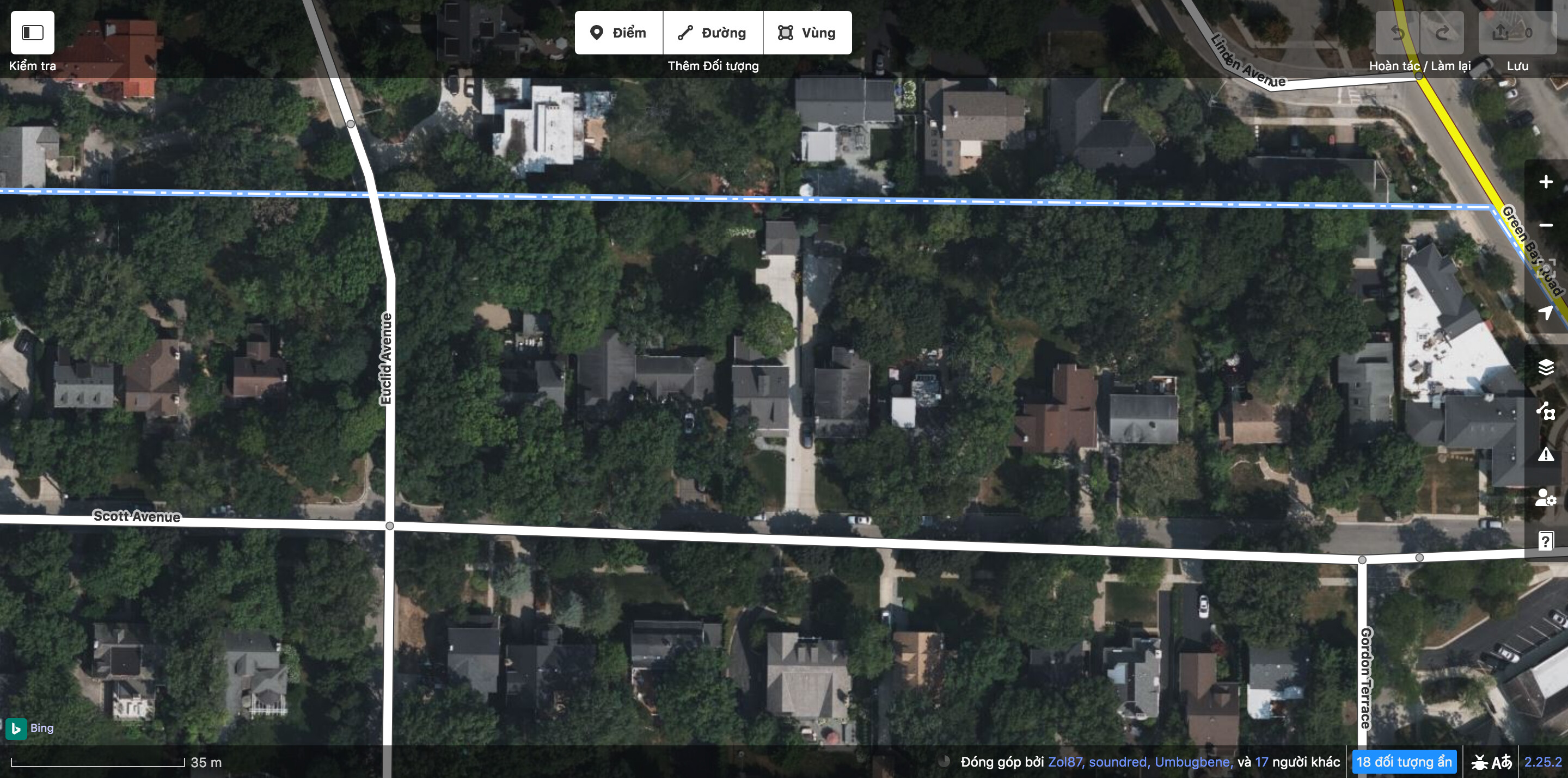
If OSM is to be believed, the boundary runs along a property line between two rows of houses, not an uncommon sight in an American suburb:
Most U.S. city limits were originally imported in 2009 from TIGER 2007 data. TIGER’s boundary data is full of wild exaggerations and hallucinations that would make ChatGPT proud, but on a good day, it tends to be consistent with old USGS topographical maps. Unfortunately, the USGS topo layer here seems to disagree with the boundary in OSM:
Sometime in 2013, a mapper apparently noticed how the boundary cuts through these properties and nudged it northward to align with the property lines. This is something I’ve done quite often, based on familiarity with TIGER’s boundary quirks, but it’s important to compare with USGS or more authoritative sources instead of purely guessing.
This January 2007 article appears to be behind a paywall or offline, but back issues are archived on Newspapers.com, which I have access to through The Wikipedia Library. I clipped a copy on Newspapers.com after writing about it on Wikipedia (to fulfill TWL’s requirements).
At the time of this article, the boundary had not changed, just the villages’ service areas:
Under the tentative agreement, boundary lines separating the two communities will not change. Homeowners who choose to disconnect from Glencoe will no longe pay a portion of their village property taxes to Glencoe. They will continue to contribute to Glencoe’s park district, library and schools.
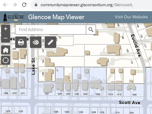
This does not rule out the possibility that the boundary has been officially adjusted since 2007 to reflect the homeowners’ choices. The Glencoe Map Viewer that you consulted has a municipal boundary base layer enabled by default. Its “copyright text” metadata field suggests that it might be more current than TIGER, but alas, we don’t know if the modifications are suitably licensed for OSM:
Created by the GIS Consortium’s members with ongoing updates. Original boundaries and data gathered from the US Census Bureau TIGER database.
All intellectual property developed by the GIS Consortium belongs to its member communities.
TIGER’s boundary layer is supposed to reflect the legal boundaries that state and local government agencies have contributed to the Census Bureau under its Boundary and Annexation Survey (BAS) program. The 2023 BAS maps for Glencoe and Winnetka appear to show the same sawtooth boundary as in the Glencoe Map Viewer:
Based on this information, you’d be well-justified in using the 2023 BAS shapefile for Illinois to update this boundary. As with all U.S. federal government works, these maps and shapefiles are in the public domain. Or you can ask the Village of Glencoe for permission to update the boundary based on their map viewer.