Come sapete in TomTom amiamo le mappe e ci piace guardarle in dettaglio per conoscere al meglio il territorio, anche i comuni più piccoli. Andando a vedere le mappe OSM dei comuni di San Bartolomeo Val Cavargna (CO) e San Nazzaro Val Cavargna (CO), abbiamo notato che mancano moltissimi edifici, strade e tutto il resto… insomma c’è tanto da mappare!
Abbiamo così pensato di fare qualcosa, ma creare una MapRoulette per aggiornare questi comuni non ci è sembrata la scelta più efficace; quindi abbiamo pensato ad altre piattaforme come Tasking Manager, in cui ci sia la massima libertà per tutti di aggiungere il mancante, qualunque esso sia… E così abbiamo creato un progetto:
hello @mcliquid, we have proposed ESRI as first source because it seems to be better than others; but if the imagery is unclear or insufficient, you may use other imagery sources.
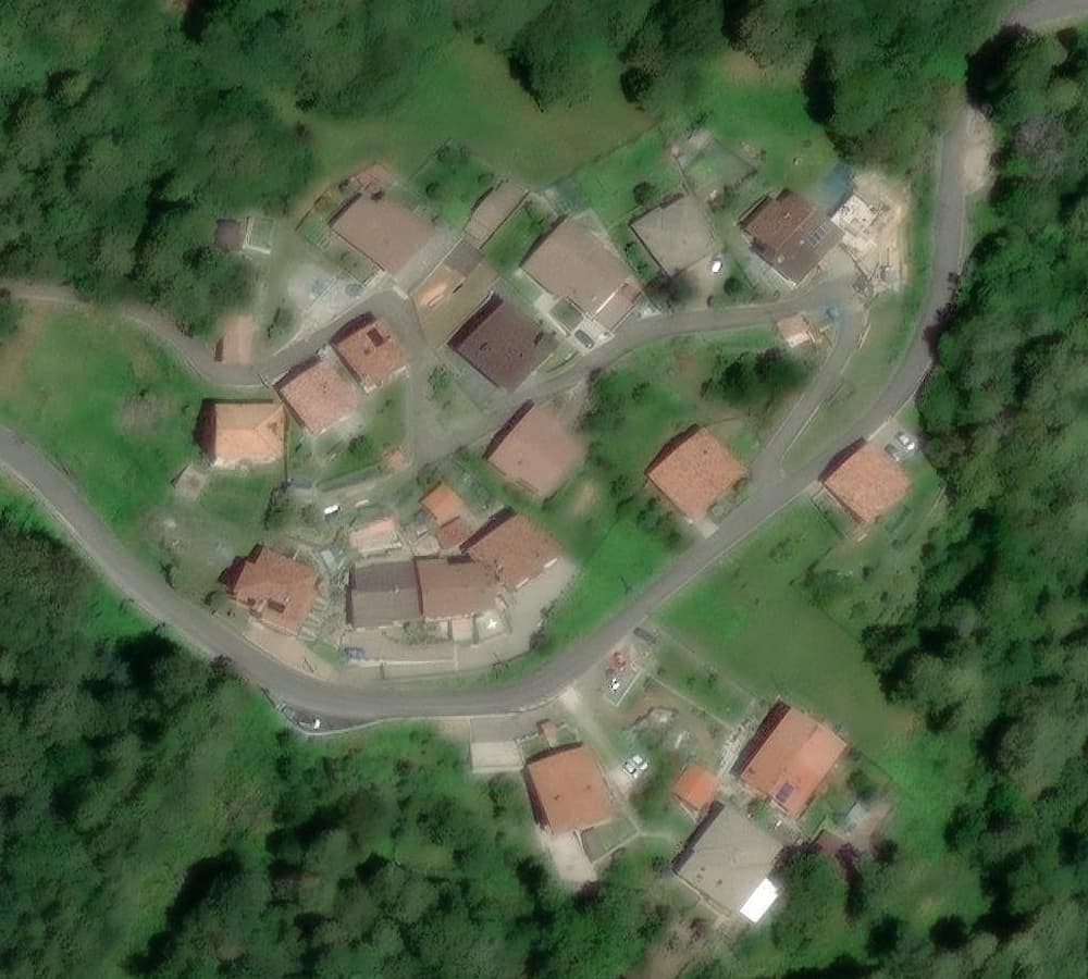
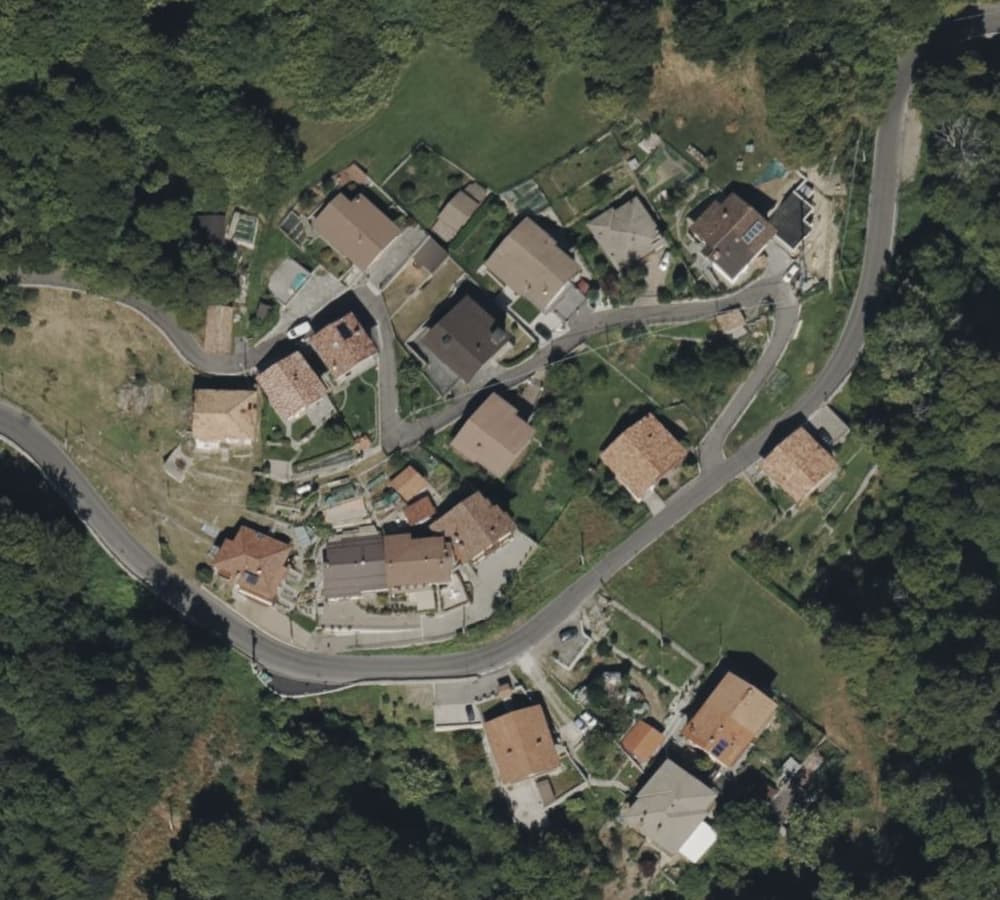
@DarioS_TT You’re welcome! But you may want to reconsider your recommendation in the Tasking Manager in this region based on the following comparison - or where in the region is Esri better than Bing? I’m curious!
you are right @mcliquid, as it said by images you provided.
When we created the TM project, we based the source considering the nature of the area, that is prevalent along mountains and imagery can be misaligned o mutable; in addition we analyzed the source as like a basic user that can have access to its related sources. Considering moreover that the Tasking Manager allows to select only one source, we have decided for ESRI. That’s the story
Anyway we have modified the instruction of TM project to give users the freedom to use the best source they know.
Thanks a lot for your feedbacks.