Not sure that you something a trailblazed if it isn’t visible. It would make more sense to apply normal life cycles postfixs instead.
@ezekielf What is it, that makes you cry when reading my post above? If I remember correctly, you belong the camp, that maps trail_visibility in the sense of path_visibility - not route_visibilty - something, that will become impossible when the documentation will be “clarified”, therefore my question.
Oops! I don’t remember reacting with a ![]() . I was reading the thread on my mobile phone and must have hit the button accidentally while scrolling. All too easy to do, and now it seems I cannot remove it.
. I was reading the thread on my mobile phone and must have hit the button accidentally while scrolling. All too easy to do, and now it seems I cannot remove it.
Yes I generally think of trail_visibility as the visibility of the path on the ground, since trailblazed:visibility also exists to indicate the visibility of blazes and markers. I suppose if only trail_visibility is tagged and trailblazed:visibility is not, then interpreting the tag as a more general measure of route visibility makes some sense. Context dependent meaning doesn’t seem ideal though.
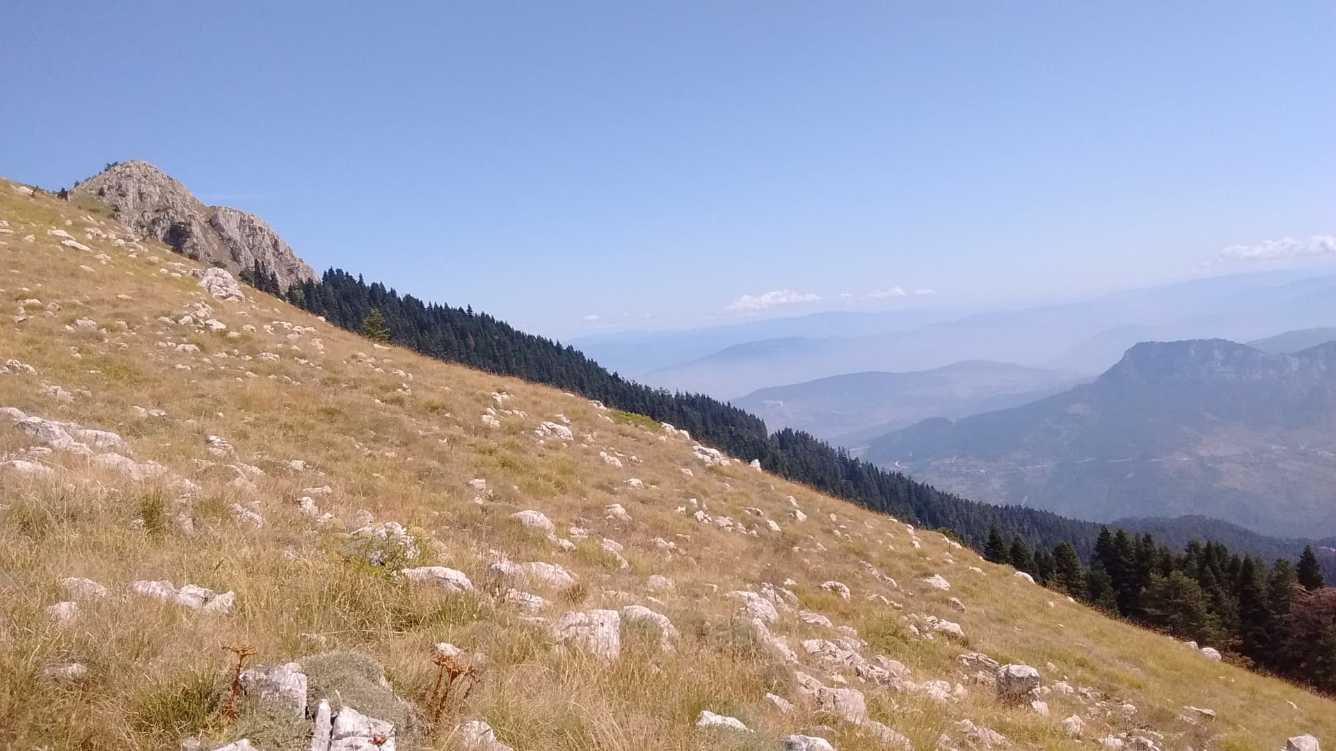
Looking at the path near Kraspes with excellent trailblazing by kerns but nothing else on the ground but scree, using Strava background, thanks to you only a few clicks, one more thing than trail_visibility I did not map: width=30m ![]() And the terrain there is not really contra GNSS being accurate.
And the terrain there is not really contra GNSS being accurate.
For some reason we keep misunderstanding each other.
I don’t think anyone here wants to change the Wiki page of trail_visibility to be about route visibility, that is, the visibility of a hiking route relation.
The warning in the Wiki that the tag is not about route visibility is important and should be kept in my view, because it discourages people from tagging a path as trail_visibility=no when they get lost not because they lose the path, but because they don’t know which of many paths to follow to stay on their chosen hiking route.
You said yourself:
Or as Richard said:
I agree.
To draw a distinction between “trail visibility” and “path visibility” risks confusing things further. I think of trail and path as synonyms here, so trail visibility is the same as path visibility. It’s just that markers - of any kind - help me see where the path is without constantly looking at my phone. Do I know where I’m supposed to be walking or not? Do I need orientation skills to follow the path? Do I need to stay alert or can I follow it easily without paying much attention?
In the end, the Wiki page should not reflect how we want the tag to be used, but how it is actually used.
If we can’t agree on that, then maybe the best option is leave it alone?
I thought this is about making things going forward. The best to start by clarifying the existing trail_visibility tag. Then we can see if there is hole that needs to be filled. Preferably starting with other already defined tag.
In this case I think case there is a consensus that trail_visibility should only refer to the physical condition of the trail. The condition of associated marking and orientation should be handled by the trailblazed tag.
I’ll add to your consensus [quote=“IanH, post:26, topic:97865”]
In this case I think case there is a consensus that trail_visibility should only refer to the physical condition of the trail
[/quote]… or if the trail itself can’t be clearly distinguished from the surrounding terrain, the presence of markers of any kind helping to visualise the trail.
Yes but that means that the markers are present and no obscured.
Please help in deliberations: Here picture of cairn on Bietschjoch (OSM node) from South.
With markers considered, such a “path” would correctly get tagged trail_visibility=excellent, after all the markers make it impossible to miss? All the while, isn’t this what commonly gets called pathless terrain? If there were no markers, would there be a path?
SwissTopo does not show a path there. Neither does it to the North, where the “normal” route goes, there the path ends a hundred meters before the POI. Remember, a path is not a necessary prerequisite for a route (at least outside of OSM terminology.)
In this case, I’d say that despite the destination being marked with a cairn, it’s not at all clear how to get there from where the photographer is standing. Maybe I’d try to go straight up from the snow to the slight pass just right of the cairn (definitely sac_scale=5 (or 6)). I’d tag it as horrible
1 Like
What happens when there are well maintained markers but the trail is completely overgrown or has been washed away. So you end up with a well marked but useless trail. See how the two are different attributes of the overall trail.
@rhhs We will never know the official SAC mountain hiking scale of this, because this is not part of the hiking network but lies on an alpine route instead. On OSM it is tagged difficult_alpine hiking, but certainly not because of the section pictured.
Didn’t you see the blazings? They do not conform to the standard laid out here, but humans certainly should be able to recognize them. I certainly would. The linked document is about blazing routes NOT part of the hiking network. Sorry, German literature. Note how they painfully avoid calling this trail, way or path, but rather connection/traversal/pass instead.
1 Like
My point is that the condition of the markers and trail itself should be seperate values.
Are you being provocative? For me, we don’t see exactly where the path is, but thanks to marker this is not trail_visibility = no, but rather intermediate.
1 Like
I see some white spots, which I thought were snow patches. If they are paint, that should be clear if you’re there on the spot. They help to make it easier to follow the mapped way, so then I agree with @yvecai that trail_visibility=intermediate
In the wiki text, we should make it clear that trail_visibility can be excellent even if the trail is not trailblazed, and that a trailblazed trail can still be trail_visibility=no if the markings are too hard to find.
We’ve been hiking this trail in Turkey that was trailblazed, but we had to search every stone to find the paint spots and there was no recognisable path on the ground (just grass and rocks everywhere), so we didn’t bother trying to follow it and went up in the general direction of the mapped way and occasionally checking the GPS trail to make sure we wouldn’t deviate too much. It’s this way Way: 117846300 | OpenStreetMap and I tagged it
trail_visibility=no (our GPS track is also visible).
2 Likes
I agree. Always hard to judge from a photo but I would have said maybe bad. We can argue if it should be horrible instead or intermediate, but in the end it doesn’t really matter. It’s certainly not excellent. It’s not obvious, for example, how to get to the first marker from the point where the photo was taken. It’s not no either, but without the markers and cairn there, it probably would be no. The point is, the markers improve it.
Are you saying that because the Wiki page only mentions markers under “excellent” and “good”? I don’t think that means that anything that has markers needs to be at least “good”. That is reading too much into it. This is where the mapper has to use common sense and fill in the blanks. For example if the markers are so sparse that “Path sometimes invisible, route partly pathless” applies and “Basic skills in orientation” are required, the path can still be mapped as bad although it’s marked.
That’s a great photo. I would probably use the lowest value above no (horrible) if there are markings, and they are just extremely hard to find. But that’s a very minor difference.
Let me throw another example into the mix.
@Hungerburg @IanH If you want to keep all markings out of trail_visibility, would you tag this path as trailblazed:visibility=excellent trail_visibility=no/ horrible?
1 Like
The Tenerife path I’d tag sac_scale=hiking and be done with it. Asked directly, trail_visibility=excellent seems firmly based in documentation: Unambiguous path it says.
I do not see any trail blazing there though. None of these rocks arranged as borders of the trail shows a marking.
Not by intent! Just reading the documentation to the letter.
Maybe drop markers from the text for the individual classes and place a note upfront “Markers/Blazes can enhance trail_visibility by one or two grades” - How about that? (Wording subject to improvement.)
1 Like
trail_visibility=intermediate and trailblazed:visibility=no. My reasoning is that the trail itself is consistently bordered with stones. Making it pretty easy to find and follow the path. It is regular enough that it stands out from what presume to to be ruins in the background.
On the other hand, there are no obvious marking any where near the path. My minimum expectation would be regular stone markers with some type system that used basic symbols or colores. I don’t even see anything on the border stones.
So I can easily find and follow the trail but nothing else. Other than what I can determining about its general direction and relative location, the trail goes nowhere important.