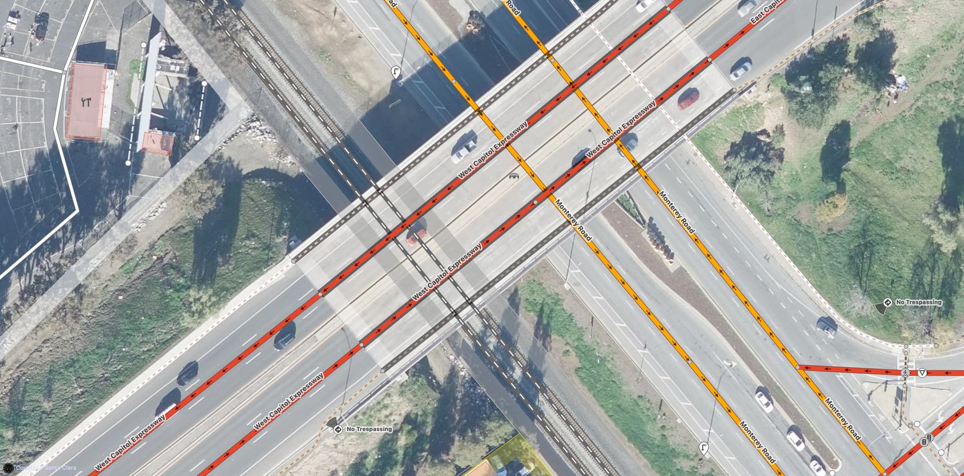
The photo shows the family walking along the soft shoulder while pushing the shopping cart along the roadway’s rain gutter. The shoulder is actually an unmarked bike lane, but it’s wide enough to accommodate cyclists comfortably. However, they just got off the overpass, which has neither a sidewalk nor a verge nor even a rain gutter. They would’ve had to walk directly in the bike lane. Worse, for about 150 feet, the bike lane becomes merely an advisory lane of sorts: motorists traveling at 50 miles per hour are encouraged to turn into this lane before turning onto the off-ramp.

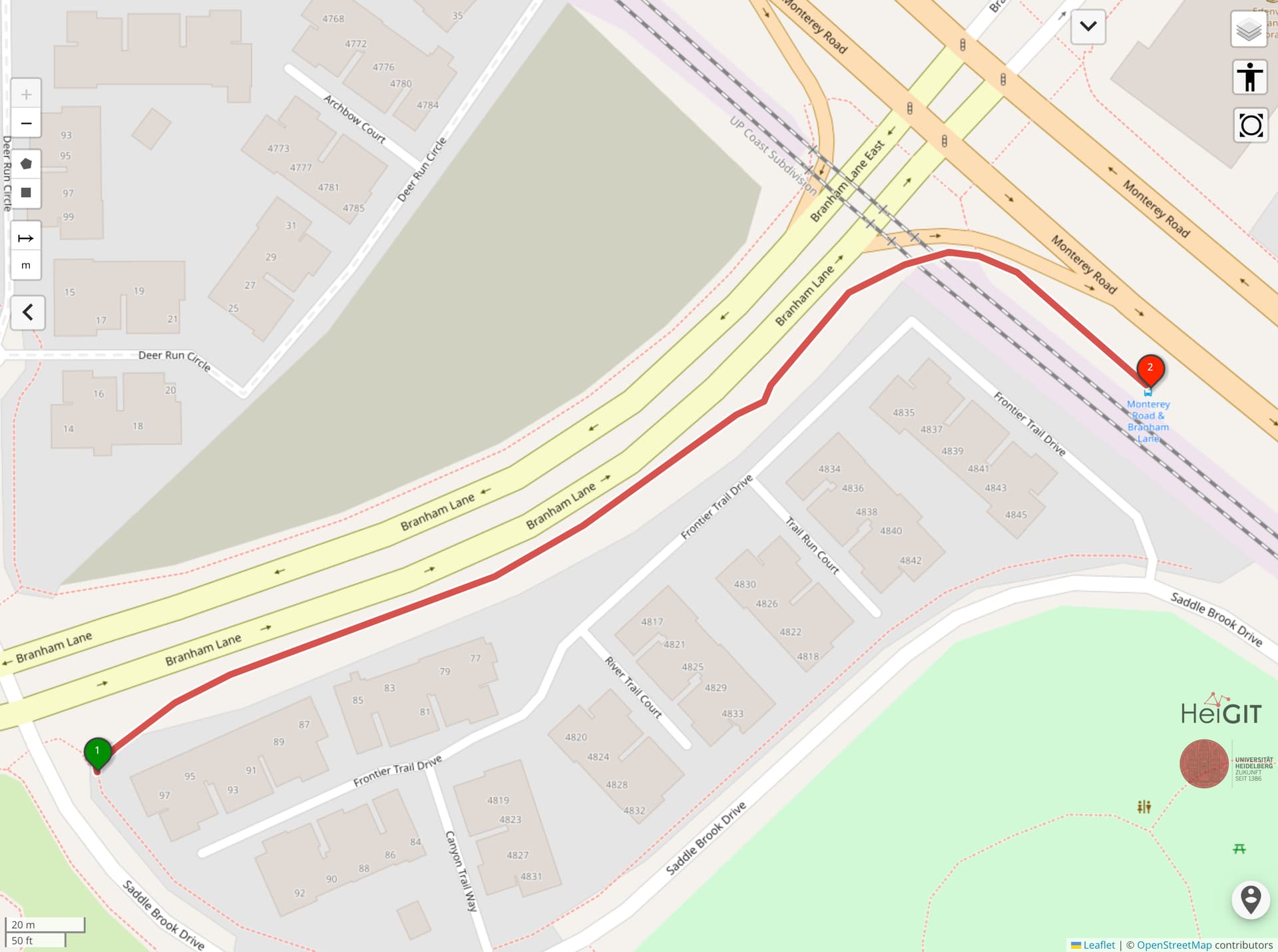
Here’s roughly the path they would’ve taken, if we were to map it as an informal path:
This is just one a litany of examples where people go beyond the formal pedestrian network out of a sense of necessity. A mile to the south, this desire line along a narrow verge connects a park and a large residential subdivision to a bus stop that is otherwise cut off by mainline freight and passenger railroad tracks. The informal route, courtesy of @UrbanUnPlanner, is 0.2 miles long.
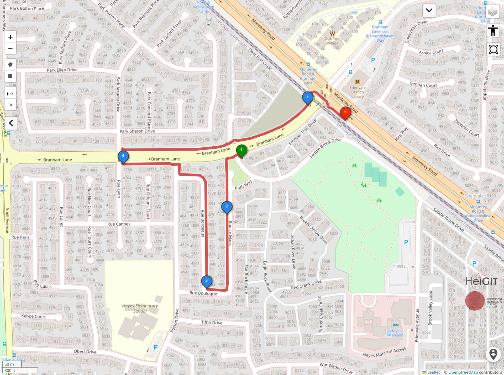
The formal route would send the pedestrian on a circuitous path in the wrong direction through a neighborhood to get to the next legal crosswalk, adding another 0.8 miles:
Both Mapillary and Bing Streetside show pedestrians taking the informal route.