I recently ran into an issue routing along a foot path. All osm.org routers (GraphHopper, OSRM, Valhalla) exhibit similar behavior, so I assume it’s a tagging issue.
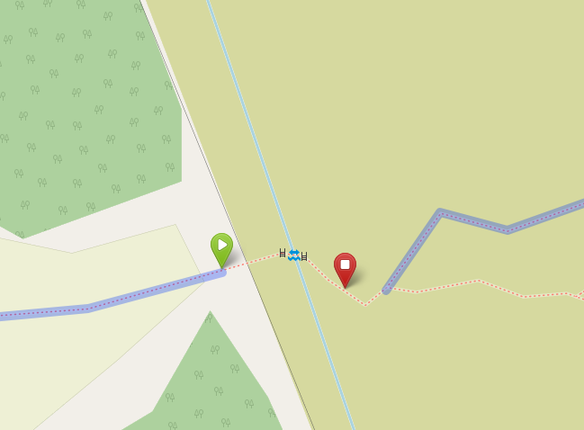
There is a highway=path with a barrier=stile on each side of a small ford=yes. There is no disconnect in the path that I can see. The routers all refuse to route across this, and instead route the long way around (see screenshots).
At first I assumed it was the ford, but that doesn’t break foot routing elsewhere, so perhaps the stiles are the problem? They are tagged barrier=stile, material=wood, stile=stepover.
Seems like this should be passable by foot by default, but all three routers seem to disagree. I could perhaps try explicitly adding foot=yes, but that feels like tagging for the router when it should be implied.
smoothness=impassable is pretty strong in combination with sac_scale=mountain_hiking. This is not the average path to take. Most routers try to cater to the average person, not specialist hikers with years of experience.
I can’t speak as to the accuracy, maybe you can provide images of the location?
By the way, the problem can also be shown without crossing the stiles: OpenStreetMap
They aren’t the issue here. The path itself is not considered part of the foot network.
As far as tagging is concerned, note that the path diverges just east of the stiles, and the northern and southern branches are tagged as hiking and mountain hiking respectively. The short section between the stiles and the junction is mapped as part of the southern path and therefore has the higher difficulty rating. If you have local knowledge you might be able to judge if that is appropriate.
Ah, that’s clearly what I was missing. Makes perfect sense.
Based on the network and aerial imagery of the area, however, I suspect that the short bit of path from the stile to the first junction east of there should not be tagged impassable, and instead the more northerly route (way 1095920651) should extend to the stile, with the “impassable” trail to Dumgoyne joining that trail.
But, I probably shouldn’t make that edit without a proper survey, and I’m not (yet) local so that will be for another day.
I’m especially curious about the impassible path in general. If this path really has become unusable 3 years ago then it probably has been overgrown by now and should be disused:highway=path
According to the wiki the smoothness tag is specifically for wheeled vehicles. So an “impassable” path may still be usable by hikers, and not necessarily overgrown?
EDIT: Having said that, it is a bit counterintuitive. So in practice many people might use smoothness=impassable to also include foot traffic.