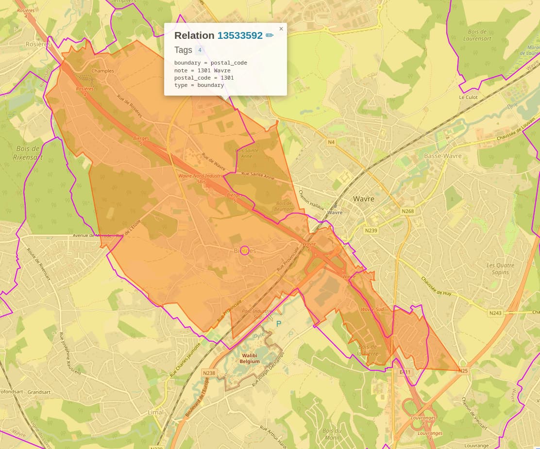
I was looking at boundary=postal_code in Walloon Brabant in overpass turbo and I was surprised to see that while the boundaries are perfectly interlocking, the one for postal_code = 1301 (Relation: 13533592 | OpenStreetMap) is strangely not matching the boundaries of its neighbours, leaving gaps and overlaps (see screenshot below).
Then I found out that there is actually a relation that perfectly matches the footprint left by the neighbours: Relation: Bierges (11064061) | OpenStreetMap but it is tagged differently with adminlevel=9 and wikidata and wikipedia references.
I guess I am confused as to why there are 2 different boundaries with postal_code = 1301 and I am wondering if something does not need to be corrected there.