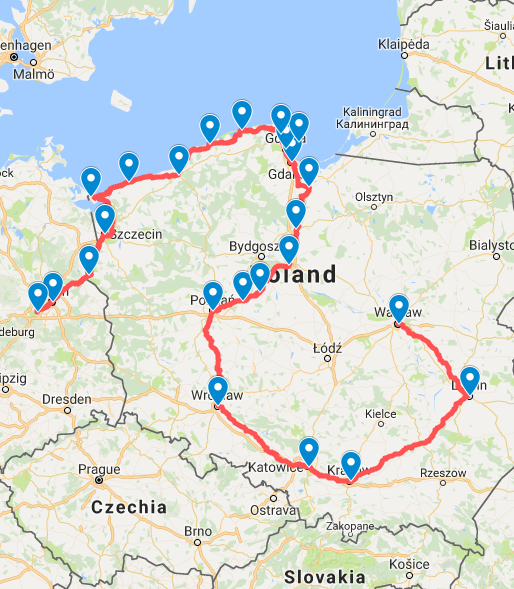
In this case, there is a lot of existing structure which means that, for this set of location, you might get a solution in reasonable time and the remaining difficulty is to find routes between the pairs in in each leg of the journey.
(The standard travelling salesman problem starts with the shortest routes between every pair already being known.)
Thanks. I gave Vroom a try, but it barfed with “Unfound locations”.
Actually, I had something much simpler in mind: The software should just take the GPX (KML, really, since GMM doesn’t export as GPX) as input, and provide a router that I could use to manually build routes between the waypoints, so it’d be lot easier than the “travelling salesman problem”.
Oh well, I’ll keep doing it the harder way, namely
keeping the Google My Maps open in one tab,
drawing a route in a second tab, switching back and forth with (SHIFT+)CTRL+TAB