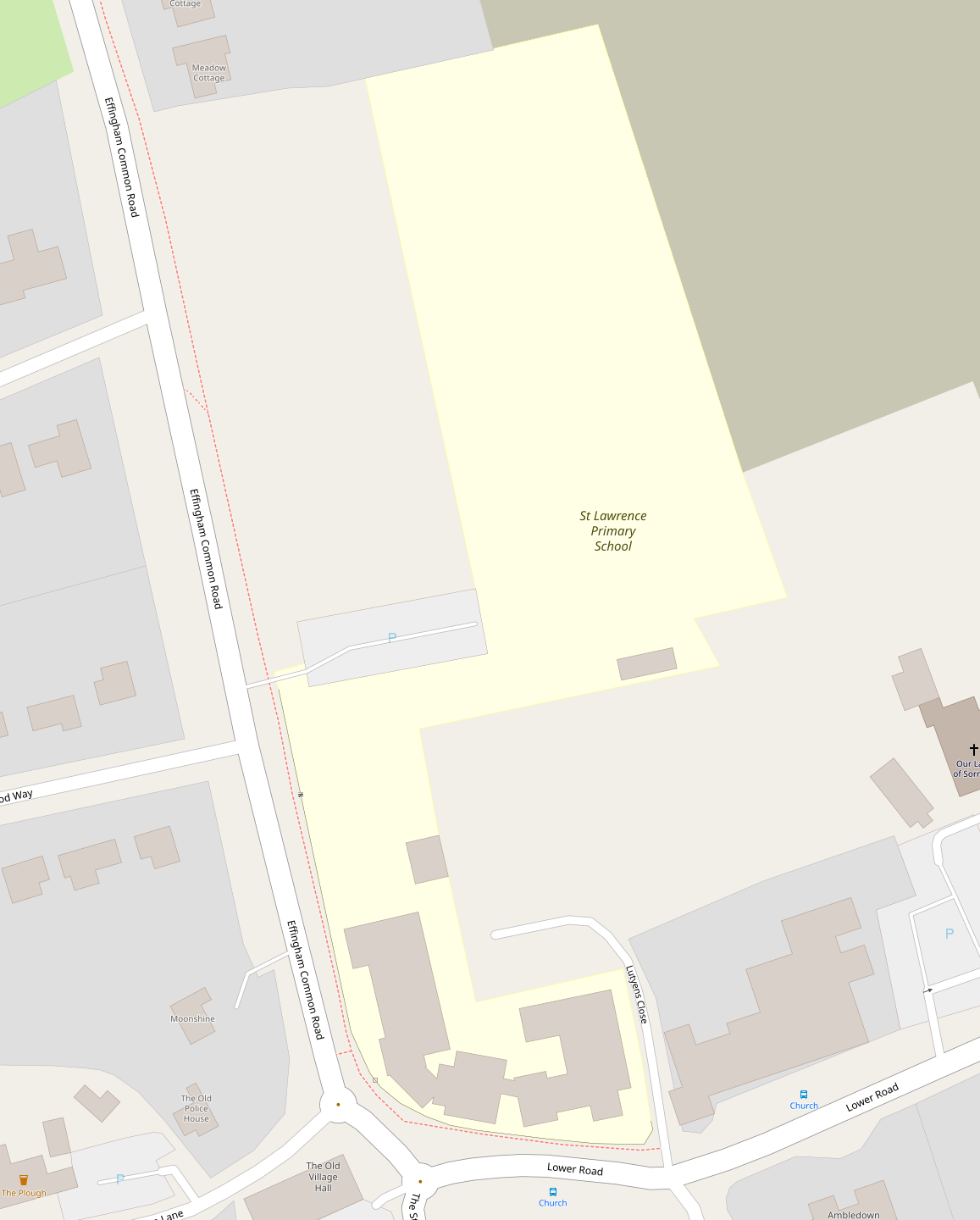
A few schools in my area have a simple field as part of their grounds/owned land, used by the pupils for recreation, sports, and semi-public events like fairs. (This isn’t quite a schoolyard, but is sometimes used as one.) Since this is within the boundary of the school and used by students on a daily basis, I’ve included it in the amenity=school area, but this has the unfortunate side-effect of moving focus away from the main building(s) of the school, which is the part that most people are interested in when looking at a map.
To demonstrate what I mean, in the image below the school field is the rectangle-ish bit to the north, but the main building and classrooms are in the area to the south. Because of how the geometry works out, the label has ended up far away from the ‘logical’ centre of the school and perhaps the amount of area highlighted is misleading.
Should these school fields even be included in the school’s area? Should landuse=education come into this? Or is this just a rendering problem that could theoretically be solved by tagging the main entrance/building and smarter rendering? I’d love to hear your thoughts.
