If we map a stream/river relation, does leaving out the lake sections not cause validators to act up with ‘you’ve got a gap’. If only consumers would be able to interpret the omnidirectional areas as part of the route we’d be done.
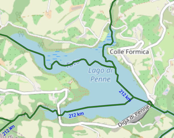
At any rate, as it is now got a reservoir that before it became one had 3 torrents converging in it and now the map show depending on the zoom all these names in the reservoir on top of the reservoir name. Fortunately the streams themselves don’t render in the standard issue else it would look a little perverted. It certainly would break in the present config Amanda’s river basin project showing the total tributary distances of watersheds like the sample below. Most of the 212km feeding the Tavo would be gone. Not ready for that yet.