For sure; this happens plenty with highway routes too. There are a variety of solutions, none quite as complex as osmc:symbol=*. Arkansas state routes are generally a white shape of Arkansas, but then for some reason Highway 980 has a blue shield with an airplane on it, and two others are brown with a boat on them, apparently because they were funded through taxes on boat fuel. The ref=* tag already gives data consumers enough information to special-case these routes.
Each of the routes in Canada’s Yukon has a different color, just like in a subway system; this information goes in colour=*, just like on a route=subway relation. Each of the touring routes of New Zealand has a different pictogram with a common motif. The local community at first tried to tag ref=* with emoji representing these pictograms, but they’ve since updated the routes to have unique network=* values. Spanish autovía signs are so varied and unpredictable that the background colors are specified in ref:colour=* as a property of the route itself.
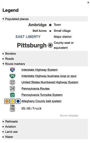
OSM Americana currently maintains its own mapping from ref=* or name=* to route-specific colors or symbols, though there’s a to-do item about making use of colour=*, ref:colour=*, or wikidata=* (the last one pending OpenMapTiles support), to be less vulnerable to descriptive naming. Even though the routes in these networks don’t consist of a common design defaced with a number, they still share a common identity. A common network=* tag results in a consistent minimum zoom level and a shared entry in the map legend – with a name that has nothing to do with the symbol.
That makes sense. For some of these organizations, the trail is their top responsibility and the trail’s identity is their only brand asset. Some organizations have an informal attitude reflected in quirkier logos.
Earlier, I described the U.S. highway authorities’ gradual takeover of bike route designations. As they took responsibility for more routes, they also began to deemphasize brands of individual routes (and their maintainers) in favor of a shared, functional identity, reducing each route to a number. Similarly, scenic byways used to have one-of-a-kind logos telling the route’s story, but over time these logos have given way to more uniform signs as part of regional marketing campaigns.
Toll roads are another category where every individual route traditionally has its own logo. How about symbol=![]()
![]() ! In states that have many toll roads, like Florida and Texas, confusion over these logos eventually led the state to impose a regularized system.
! In states that have many toll roads, like Florida and Texas, confusion over these logos eventually led the state to impose a regularized system.
This trend toward uniformity makes the remaining one-off logos all the more interesting to capture on a map with a nostalgic bent. I guess that makes it a particularly “Americanan” niche.
Generic shields or plain badges are totally reasonable too. Every map has its design goals. Unfortunately, most of the ref=* tags on North American trail route relations are initialisms cooked up principally for Waymarked Trails, some at odds with what’s signposted in the wild. I’m hopeful that the U.S. community will come together to build an alternative that renders something more graphical, to discourage hacks like that.
OSM needs to enable the full spectrum of approaches without unduly focusing on a particular use case. The variation we’re talking about is more than one kind of shell versus another. Data consumers need to be confident that mappers aren’t shoehorning information into a key that wasn’t designed for that kind of information. If osmc:symbol=* satisfies your needs as both a mapper and a user, good for you! Just don’t withhold from the data consumer what else you know about the route, just because you personally don’t envision using that information.
