Seeking opinions from mappers in rice-growing regions [稻田;水田;논, 무논]

I welcome input from non-rice growing area mappers. However, please do your own research on the basics. (My English is not good enough to explain the details to you.)

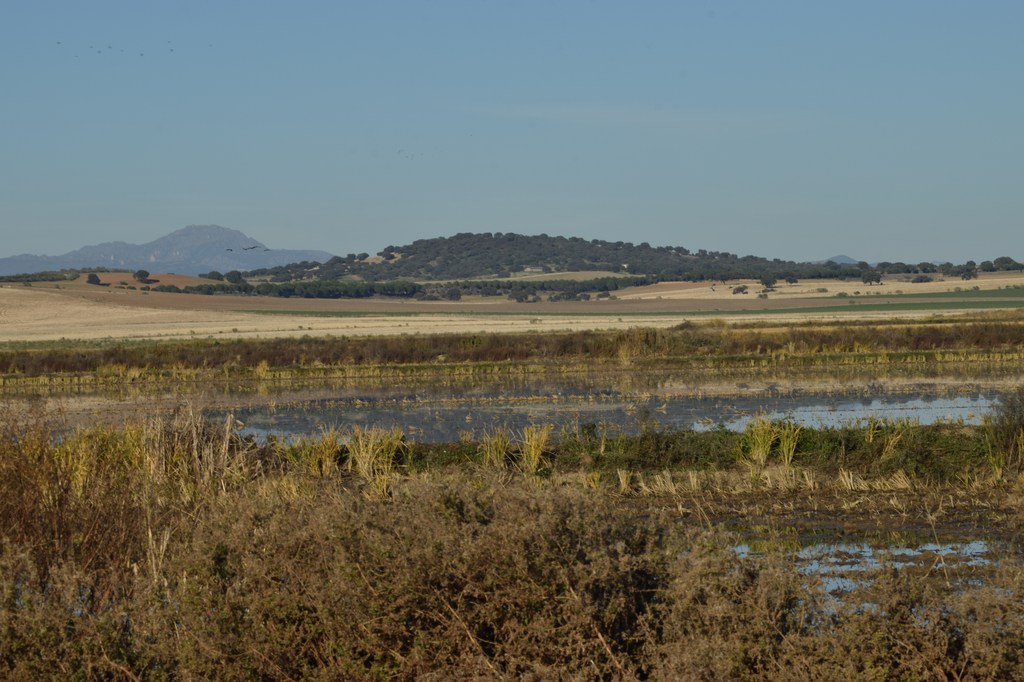
There are two types of places where rice is grown: submerged paddy field (wetted rice paddy; 무논;水田) and dry rice paddy (건답;旱田).
There are two types of dry rice paddy: those planted in farm fields and those planted in hills or natural grasslands.
Therefore, for the dry rice paddy, we would only need to indicate the crop grown (crop=rice) in addition to the ‘landuse=farmfland’ tag.
However, for the wetted rice paddy, the land is in a different state and I want to indicate this.
Of the two cases below, which do you think is better?

  1. tagging crop=rice in addition to landuse=farmfland and adding ‘surface=mud’ to indicate that the land surface is mud.
  2. create a new tag because the condition is different from the general farmfield.
    2-1. If you need to create a new tag, get suggestions on what it should be.

Why I think the ‘surface=mud’ tag is appropriate for ‘wetted rice paddy’.
I compared a few similar tags, but decided that they have their own uses and could potentially conflict with each other or cause confusion. However, I decided that the ‘surface=mud’ tag is a perfect fit for ‘wetted rice paddy’ because it only describes the surface condition of the soil.

I think this could work well if you start doing it (tagging in the map exactly as you state here) and document these conventions: you might write a wiki that shows how you are mapping / tagging like this.

First, please do some taginfo research on the tags you outline here. See you can determine from existing tagging if others are doing something similar (or the same thing already) and go from there. I think you are the right track, as what you suggest is quite simple and hence could be quite effective. But only if others are aware of how you are tagging and exactly why and under what circumstances. A simple (one screen) wiki could be enough to describe this and then the whole OSM world who map rice-growing areas will have a Talk page in our wiki to further discuss.

1 Like

surface=mud doesn’t say there is a layer of water on the soil. Only that the soil is wet.
There is already irrigation= for the watering system, and irrigated=for the watering status. In fact, Key:irrigated - OpenStreetMap Wiki already mentions irrigated=no for dry rice. However, irrigated=yes is not totally clear on whether it is a wet rice paddy. The result of this can only be inferred from crop=rice . Notably, drip irrigation has been developed for rice in recent years. Increase Rice Yield Using Drip Irrigation | Netafim
There are some unknown meaning at a hundred of https://taginfo.openstreetmap.org/tags/irrigation=flood , and a few https://taginfo.openstreetmap.org/tags/irrigation=flooded . Which would be mismatched, if taken to mean this. irrigation= should be used for water channel, ie =ditch for rice paddies usually. Then irrigated=flooded can be used.

Thank you for your positive and developmental comments.
I’ve already gotten some input from other informal communities, and after comparing different tags, I’ve come to the solution in the post above.
After hypothesizing and comparing several cases of tags, I’m convinced that the current conclusion is the best one, and if mappers in rice-growing regions don’t see any major problems with it, I’m thinking of implementing it on the wiki.
If anything, I’m a little concerned about the special meaning of “rice paddy” or “rice” to people in East and Southeast Asia.
To see ‘rice paddy’ as just a form of ‘field’ and ‘rice’ as just a type of crop is like lumping ‘spaghetti’ with ‘noodle’ for Italians, or lumping ‘whale’ with ‘fish’.
That’s why I’d like to hear from mappers in rice-growing regions.
Nevertheless, the tags I’m proposing seem to me to be the most reasonable solution to the problem without touching, conflicting with, or creating a new tagging scheme that already exists.

Additional stats for farmland= discussed for =paddy , =wetland , =flooded_crops Talk:Tag:crop=rice - OpenStreetMap Wiki

1 Like

Cool. I think you’ve found a great tag.

  • farmland=paddy : It’s not bad as a tag that simply and unambiguously represents “rice paddy”, but I think it can be confusing since “rice paddy” is often planted with other crops in the same ecosystem.(I wanted to keep it completely separate, but that’s why I chose a tag that can only change its status at any time.
  • farmland=wetland : I think this tag is unfortunately the most common example of misuse. Rice paddies are often, but not always, wetland conditions, and wetland conditions are not essential to grow rice, and in fact, if you look at the example used in the UK, it’s not even a rice paddy.
  • farmland=flooded_crops : This tag isn’t bad for indicating what crops are being grown, but as I said before, it’s a little unfortunate that the land doesn’t have a set crop. In fact, It might even plant different crops depending on the season.
  • irrigated=flooded : I think this tag is very cool because it indicates land that needs irrigation, and I think it would be great to use it along with the ‘surface=mud’ tag to indicate the condition of the land.

By comparison,

  • surface=mud : doesn’t directly and unambiguously represent paddy. As it is, it can always be applied to other crops. It’s perfect for representing the condition of the land surface, which is almost essential for growing rice.

Let’s recap where I’m struggling.

  • What is the core value of a (rice)paddy?
    Is it the condition of the land or the type of crop being planted? Is it irrigated or not, or something else?
  • Do we need to use different tags for different crops?
    If so, we have a problem with planting different crops on the same piece of land as it is.
  • Is it appropriate to not categorize rice paddies and just indicate their paddy status?
    Importance of rice or paddy to people in rice growing areas.
    Would Italians be happy if we lumped “spaghetti” with “noodles”? Would biologists be happy if we lumped whales with just fish?

Just a quick note to say I think this is a good initiative. Use of crop=rice as the only way to identify a highly distinctive type of agricultural landuse (and often landform) always seemed incomplete to me.

Here’s a picture of rice cultivation in Extremadura, Spain (not long after the harvest) showing both wet (flooded) and, possibly, dry cultivation. Current PNOA imagery shows the rice paddies well.

I don’t have it to hand, but I think Corine data shows these areas separately. Elsewhere in Europe, the Carmarque and Po Valley have extensive rice cultivation. Nothing seems to be on OSM to indicate these areas.

2 Likes

Just hiked through the rice fields in northern Italy (Western Po Valley). They mostly apply alternating wet and dry irrigation. The water is supplied by an elaborate canal system (when it’s not raining cats and dogs). Sometimes a field is completely wet, sometimes it is completely dry, and in between there is drying mud. By the way, they treat corn fields in much the same way. All other farmland is used for wood production, with areas of planted trees needing maybe 15 years to grow tall enough.

I think they mostly use landuse=farmland without further specification, in the area. Could be a wrong impression though, I didn’t do a thorough search.

I don’t know how -if at all- this would fit in with the proposed tagging.

3 Likes

To help you think and organize, here are some thoughts on the nature of “rice paddies”.
I’d love to hear further input, especially from local mappers who have a good understanding of the nature of ‘rice paddies’.

Organizing a place to grow rice

Wet rice paddy

  • Muddy land surface (almost always requires artificial irrigation.)
    ‘surface=mud’ is a good alternative to indicate the condition of the land surface.
  • Requires artificial irrigation and control (often impossible in wetlands that are always submerged or flooded). ‘irrigated=flooded’ is a good alternative to indicate irrigation status.
  • Soil quality is also affected to some extent (you can use a former rice paddy as a farmfield, but you can’t use a former farmfield as a rice paddy).
  • The difficulty with representing rice paddy as a crop (crop=rice) is that as soon as the land becomes dry, other crops can be planted, even double-cropping on the same land.

Dry rice paddy

  • Less affected by soil conditions (it can be grown in rather fine soil).
  • Rice is usually grown in combination with fireweed (so the surface soil is not exposed and may be covered with low grass).

Deepwater rice paddy(area)

  • No separate rice paddies are set aside. (Therefore, it should be considered an area rather than a specific place.)
  • Usually grown in areas that are subject to periodic flooding. Maybe the tags ‘crop=rice + wetland=mud’ would be useful.
  • For more details, we need more knowledge from mappers who grow ‘deepwater rice’.

In the end, I settled on ‘landuse=paddy’ tag.

In Japan, there are official map symbols (organized by Geospatial Information Authority) for:

  • 田 (in Japanese, crop field with flood irrigation), for rice, lotus root, rush, wasabi horseradish, or water dropwort
  • 畑 (in Japanese, crop field without flood irrigation), for rice and other cereals, vegetables, lawn grass, or forage crop

Rice is a special crop for the Japanese; however, the primary concern upon mapping is the landuse, landcover, and general vegetation, not the product. Products can be mapped with the subtag crop=*. So no need for a separate main tag exclusively for fields growing rice plants. (from this point of view, I feel strange there is a distinction between landuse=orchard & landuse=vineyard, but this is out of topic)

Rice fields, with or without flood irrigation, are a crop field in terms of landuse, so primary tagging should be landuse=farmland in view of the Wiki description. At the same time, wet paddy fields have apparent characteristics distinct from other crop fields, so additional tagging is required.

surface=mud is not good, because it means the surface is always muddy by analogy to other surface=* tags. Controlling dryness/irrigation of wet paddy fields during the growing period is crucial for rice farmers, and the paddy field under such control is not always muddy even during the growing periods. During non-growing periods, some fields are dried up and others are kept flooded. This tagging is only appropriate for the paddy field with full-term irrigation, thus not a general answer.

irrigated=flooded is nice because it directly shows the requirement for rice and other submerged cultivation. However, one concern is there are “alternate” fields, growing rice in summer with flood irrigation, and vegetables (or wheat) in the winter season

farmland=paddy is somewhat misleading since the English word ‘paddy’ (borrowing from Malay) originally means rice plant or unhusked rice and it could be considered a bad duplicate of crop=rice. But I think it is a possible option representing a crop field (landuse=farmland) very suitable for rice and other submerged cultivation with facilities for flood irrigation (i.e. paddy field, or paddy for short); such field may be used for rice cultivation in summer, and other crops in winter, for example.

3 Likes

Thank you for your clear and in-depth comments.

First, I researched the words for “rice paddy” and “field” in the three countries.

  • (wet)rice paddy : 논, 무논, 畓(in Korean) / 田, 水田, 稲田, たんぼ(in Japanes) / 水田, 稻田(in Chinese)
  • farmfield : 밭, 田(in Korean) / 畑(in Japanes) / 旱田(in Chinese)

I think this is a key part of defining “rice paddy” and developing the right tags.

Given the other tags already in use, ‘field’ clearly deserves a unique tag, and I think it’s best to follow the use case of ‘field’ and tag ‘landuse=*’ for consistency.

So I think it’s a good idea to be consistent with ‘landuse=paddy’ and tag it so that it’s obvious that it’s a ‘rice paddy’.

  • paddy : a wet field where rice is grown (in english dictionary)
  • paddy : 1620s, “rice plant,” from Malay (Austronesian) padi “rice in the straw.” Main modern meaning “rice field, ground where rice is growing” (1948) is a shortening of paddy field. (in Online Etymology Dictionary)

I could be a little more explicit here, like ‘rice_paddy’, but I think that would be an error that would limit what can be grown, so I think the word ‘paddy’ is appropriate instead.
As you said, in certain periods of time ‘rice paddy’ may be used for other purposes, but it doesn’t take away the characteristic of ‘rice paddy’, so I don’t think this is a big issue either.(I think it’s a bit like being able to plant something other than fruit trees in an orchard).

Additionally, the OSM Japan community is building its own environment, and it’s unfortunate that I don’t see more of them here on the official forums and in other informal communities.
I hope to have more interaction with the Japanese community on the official forums and in other communities, and there is also an OSM Cultural-spheres Group (Telegram group/Matrix room) for those who are not fluent in English.

Unfortunately, rice fields do not appear to be mapped as such in French Camargue. At least, the couple I checked are just mapped as farmland.

Still, I’m wondering: could the seasonal tag value be useful?

In the Po Valley I think not. There is probably a seasonal variation, but what I observed looks more like multiple rotation schemes with varying frequencies, growth phases and field use/rest.

1 Like

I’d second this impression for Extremadura (observations of rice fields just outside the cultivation cycle in November & February, when they are very attractive to Cranes).

With the development of agricultural methods, the meaning of “rice paddies” may have changed historically, but based on the present, I think “rice paddy” is landuse with distinct characteristics from landuse=farmland (approved), “orchard” (approved), “vineyard” (de facto).

For example, It is simple to pull apple trees out of the orchard and plant orange trees. It is also simple to pick carrots and plant radishes in agricultural land. However, apple trees cannot be planted immediately in the agricultural land where carrots are planted, and radish cannot be planted immediately in the orange tree orchard. Such a thing is only possible if landuse is fundamentally changed through cultivation.

Likewise, we can’t plant carrots in rice paddies right away. Only after drying mud, plowing soil to allow water to escape well, removing the banks at the edge of the paddy field, and making furrows can the paddy field become a field where carrots can be planted. Likewise, in order to turn a field into a rice paddy, it is necessary to eliminate furrows in the field, stack soil around the field to prevent water from escaping, and change the properties of the well-drained soil to prevent drainage. Only when water is filled after that, the field turns into rice paddies.

irrigrated=flooded is a good tag to express the state of discussion, but simply representing rice paddies as landuse=farmland + irrigrated=flooded seems to be no different from representing orchards as landuse=farmland + furrowed=no.

(Actually, I don’t know why we have separate orchards and vineyards. The vineyard tag is not officially authorized and just used, so it seems to have hardened what was widely used before the proposal process was established as it is now.)

However, it is a special landuse in that you can plant various crops such as lettuce, radish, and carrot in the landuse=farmland, and you can plant various trees such as apples and persimmons in the orchard, while only one crop called “rice” can be planted in the rice paddies.

(In autumn and winter, barley is planted in rice paddies, but this is largely because rice cannot be planted in winter, so they do not want to make fun of rice paddies. In fact, hot and humid places like Southeast Asia do not plant barley in winter, but harvest rice two to three times a year.).

I suspect that people weren’t thinking about it very deeply in terms of ecology, agricultural science, or redevelopment potential. It’s just that vineyards are always known by a different word in English (among other languages) and are conventionally marked differently on land use maps and even general-interest maps. By this reasoning, I suppose (rice) paddies would be in something of a gray area.

Thank you, @LuxuryCoop.
I think this is the view that has the deepest understanding of the unique properties of ‘paddy’.
I didn’t want to overtag either, so I was going to append a tag to any other ‘field’ tag to indicate the paddy attribute, but given the tagging flow and the unique attributes of ‘paddy’, I was convinced that a new tag would make the most sense.
So, following the trend of the tagging scheme in OSM, I think it would be best to create and use the ‘landuse=paddy’ tag, at least for the common wetted rice paddy.

Likewise, we can’t plant carrots in rice paddies right away. Only after drying mud, plowing soil to allow water to escape well, removing the banks at the edge of the paddy field, and making furrows can the paddy field become a field where carrots can be planted. Likewise, in order to turn a field into a rice paddy, it is necessary to eliminate furrows in the field, stack soil around the field to prevent water from escaping, and change the properties of the well-drained soil to prevent drainage. Only when water is filled after that, the field turns into rice paddies.

Actually, we DO grow rice plants in summer and vegetables in winter on wet paddy fields. Of course, it requires careful consideration of crop choice and additional tricks to improve drainage; however, once such tricks are introduced, the field can be switched between two states (dry crop field and wet paddy field) without works on banks or furrows.

1 Like

I feel negative about the primary tag landuse=paddy for wet paddy fields.

One reason is we need a clear-cut distinction between landuse=farmland & landuse=paddy. Currently, landuse=farmland is relatively clear definition (farmland used mainly for tillage, annual crops). I think it is possible to make a primary tag for subclass farmlands (as landuse=greenhouse_horticulture is) if it is hard to change between them, as explained by @LuxuryCoop. But we must be careful about many marginal cases, for example, dual-use paddy fields as I mentioned. We must make a consensus on the change of definition for landuse=farmland that is tangible for mappers unfamiliar with rice farming.

Another reason is from a more practical point of view. We already have a huge number of wet paddy fields tagged with landuse=farmland. Suppose we change the definition of landuse=farmland and create landuse=paddy, all such existing features become wrongly tagged. We need a long time to fix them. On the contrary, it would be no problem if we keep the definition of landuse=farmland and gradually add more precise tagging like irrigated=flooded or farmland=paddy.

1 Like

Pineapple and banana plantations also aren’t referred to as orchards usually.

The special treatment of vineyards really doesn’t seem justified.

2 Likes