Seattle Healthy Street Classification

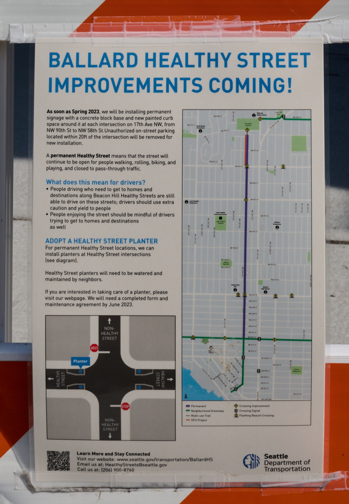
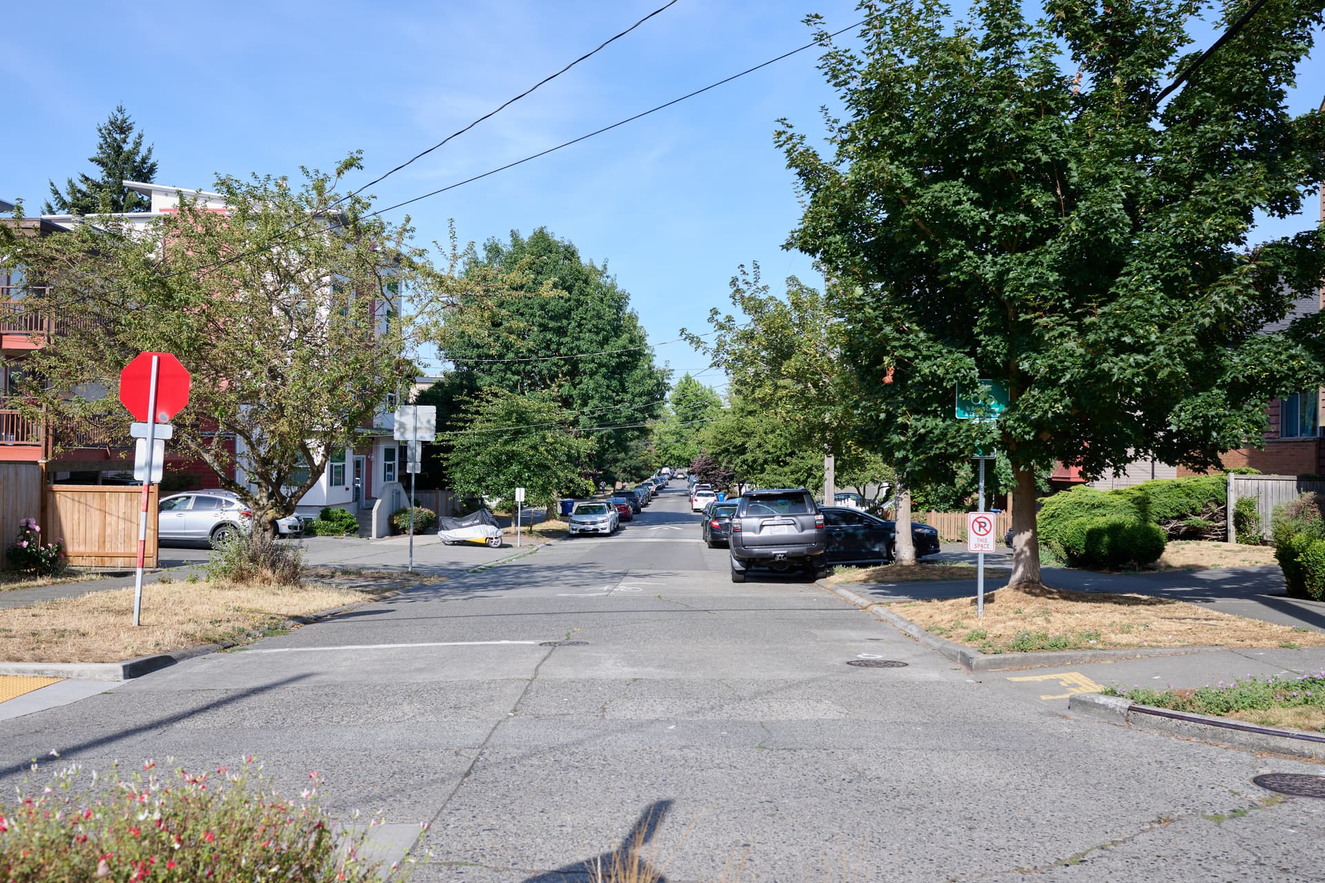
There’s been some discussion of if Seattle’s Healthy Streets are highway=living_street or not, so when I was in Seattle for the OSM birthday BBQ, I went to Northwest 58th Street and 17th Avenue Northwest to take some pictures of the Seattle Healthy Streets and Neighborhood Greenways. From the intersection, north is a Healthy Street, and the other three directions are Greenways.

I parked to the south at the Ballard Post Office and walked north.

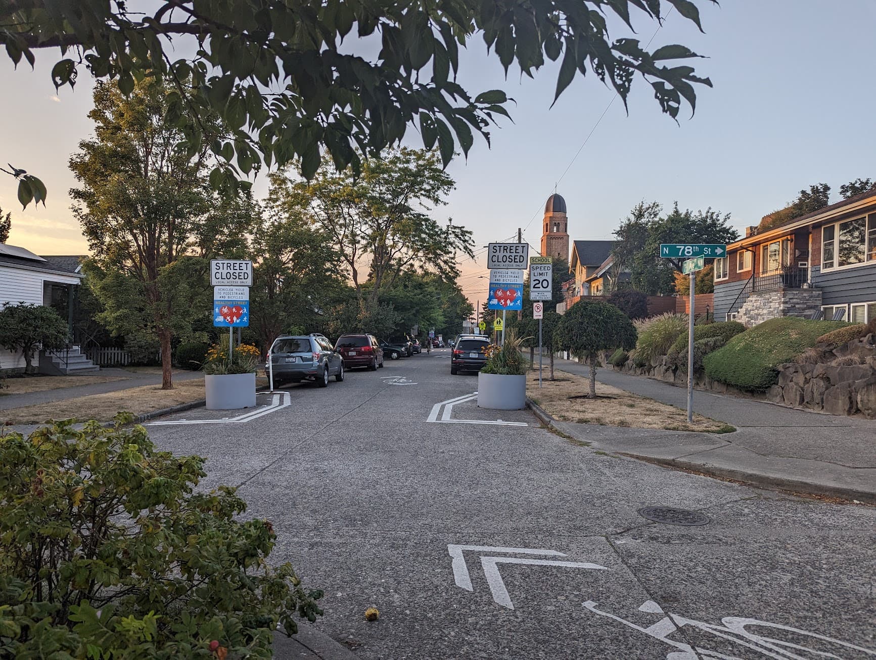
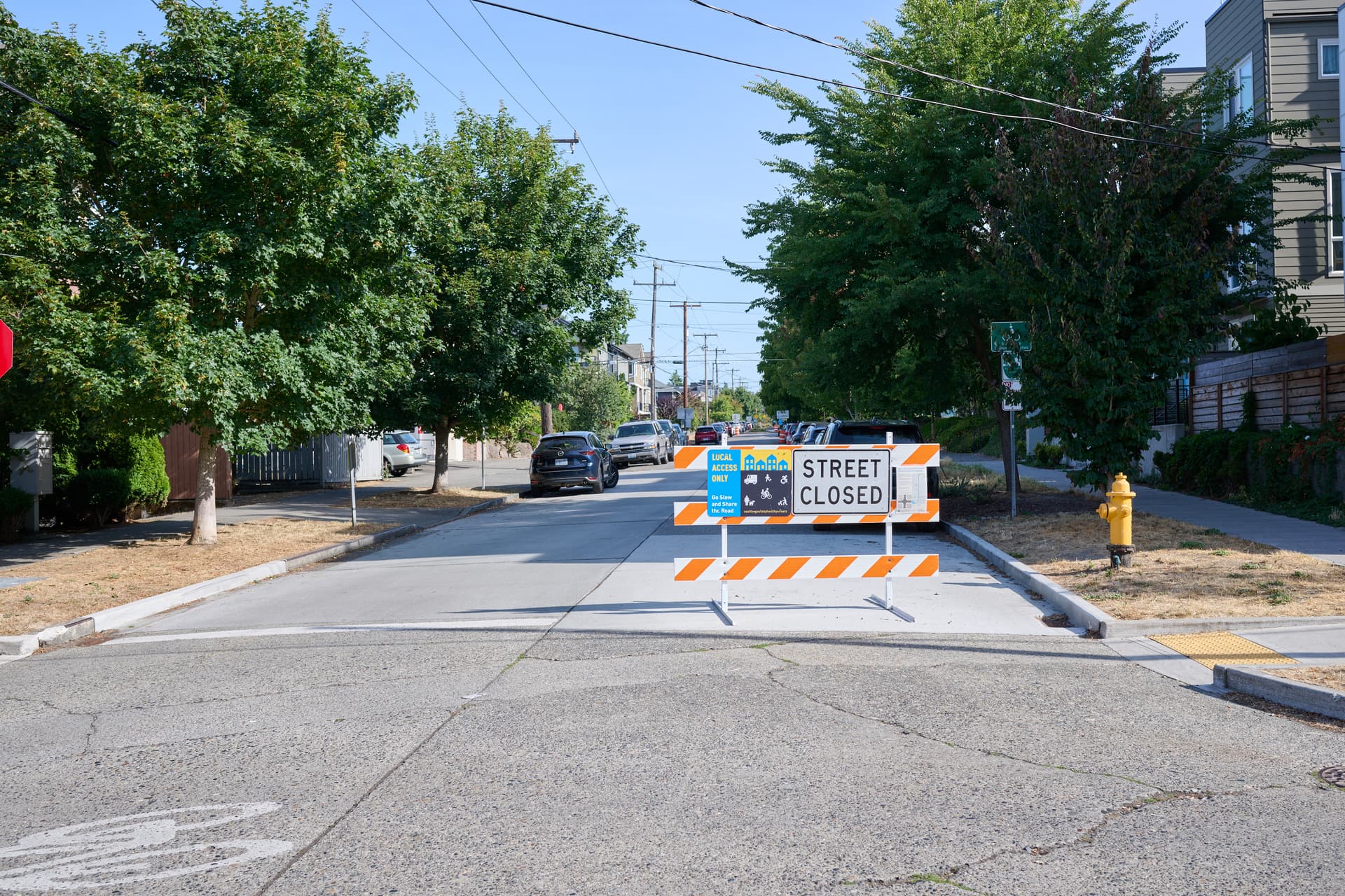
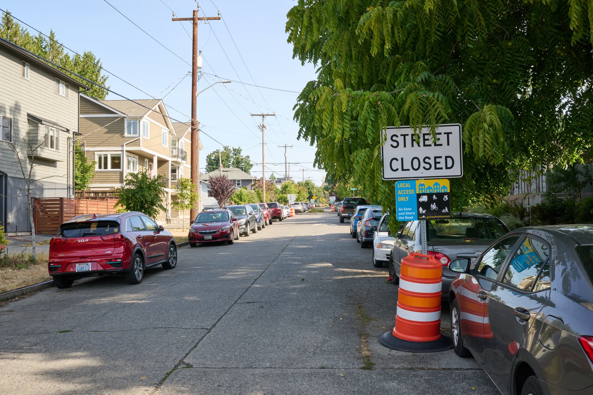
Approaching the Healthy Street from the south, there is signage indicating local access only for the Healthy Street. It is on a barrier like you’d see for construction works, but there are signs that say they’re being replaced by planters.


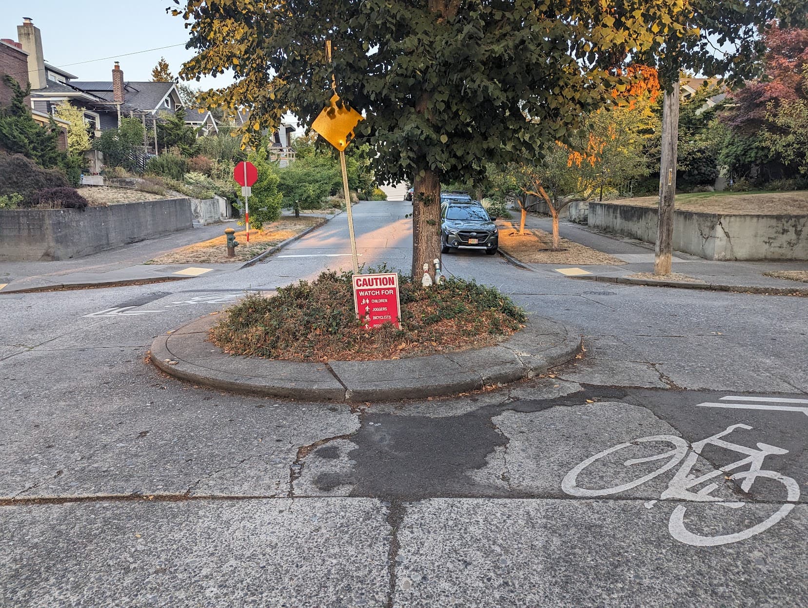
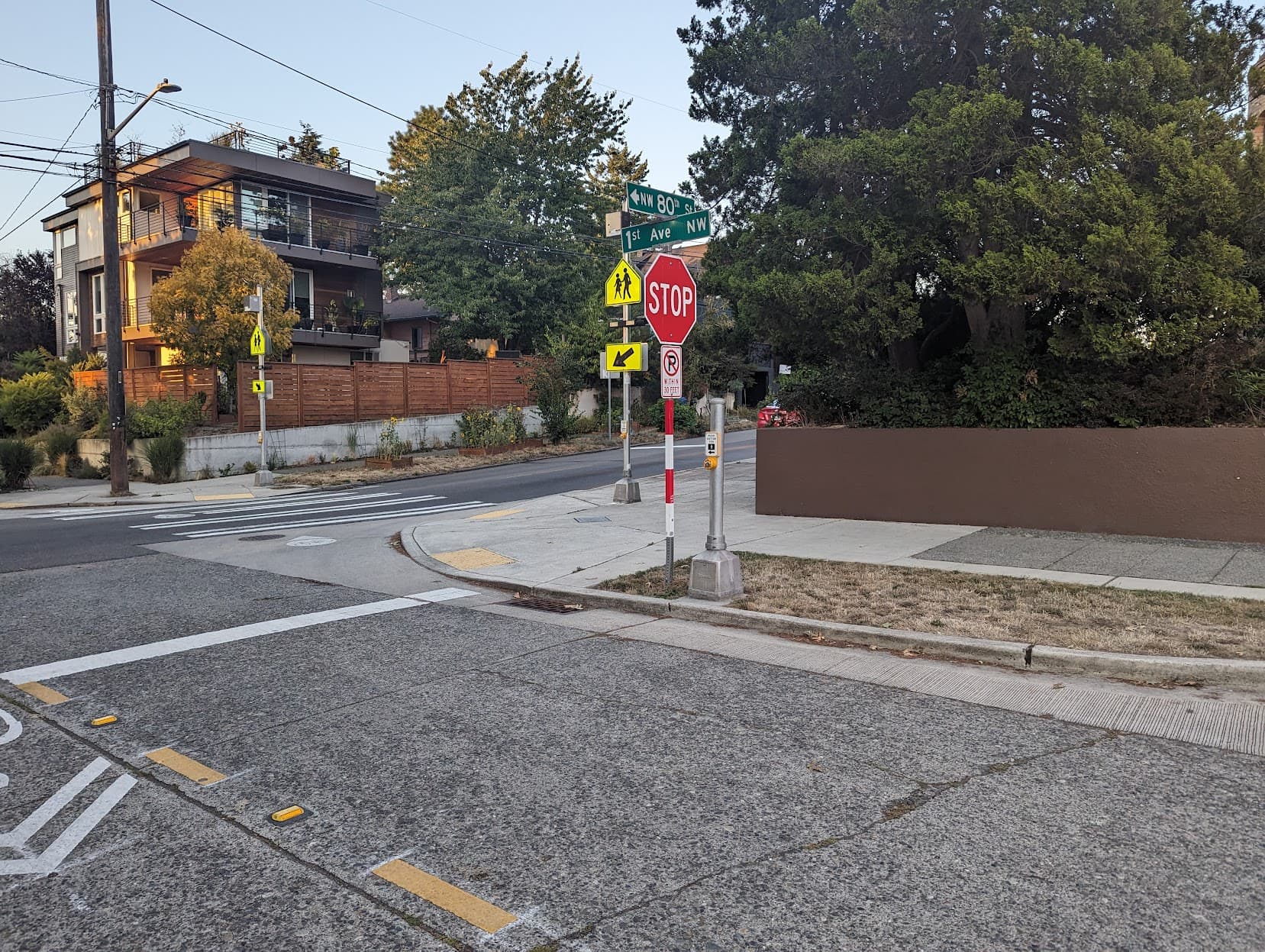
The other three directions are signed as bicycle routes with sharrows but have no unusual features


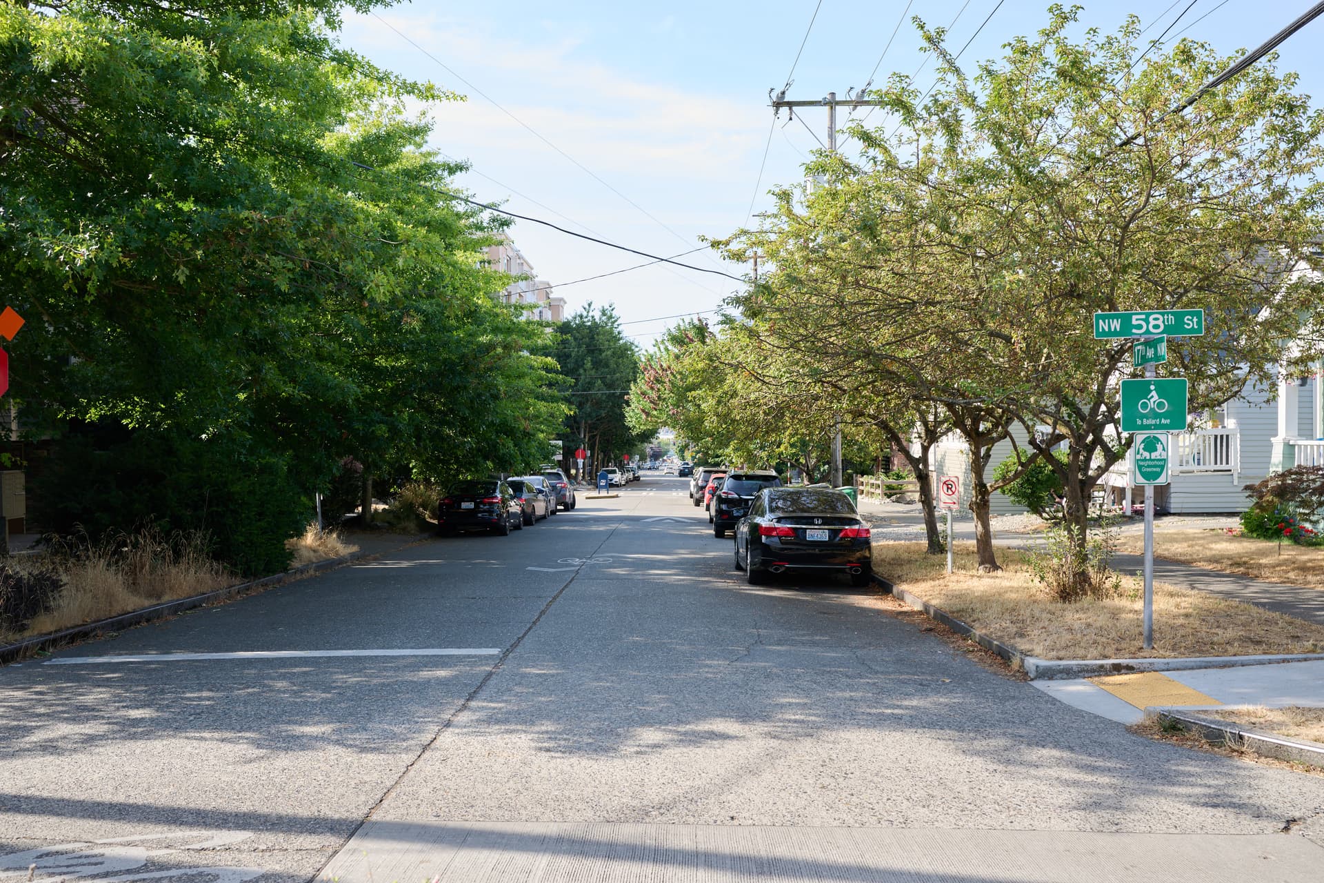
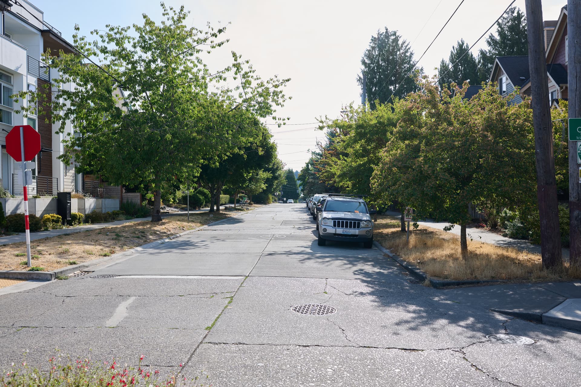
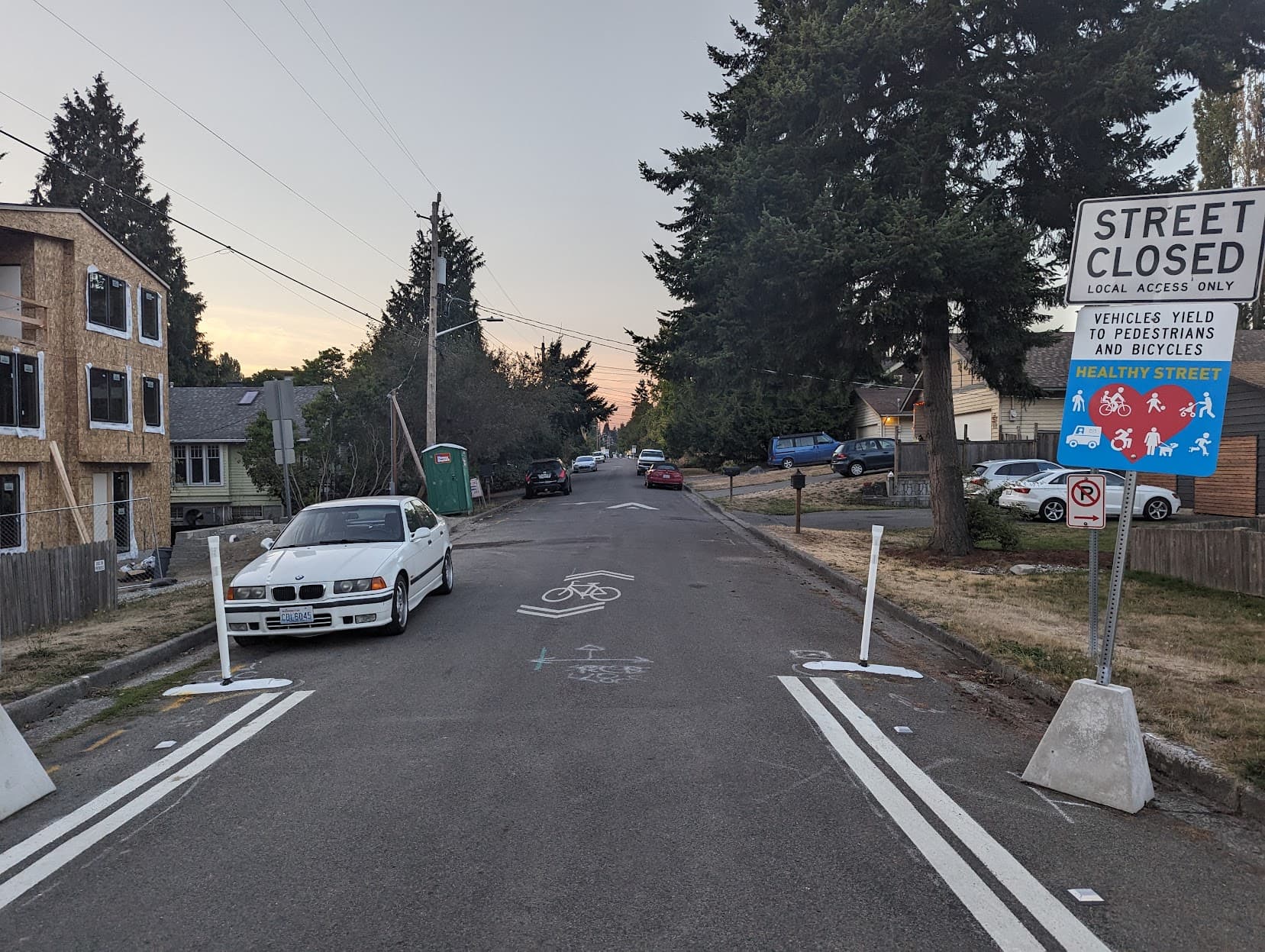
Continuing north to 59th and 17th the signs change to being on poles, still indicating local access only and go slow and share the road.

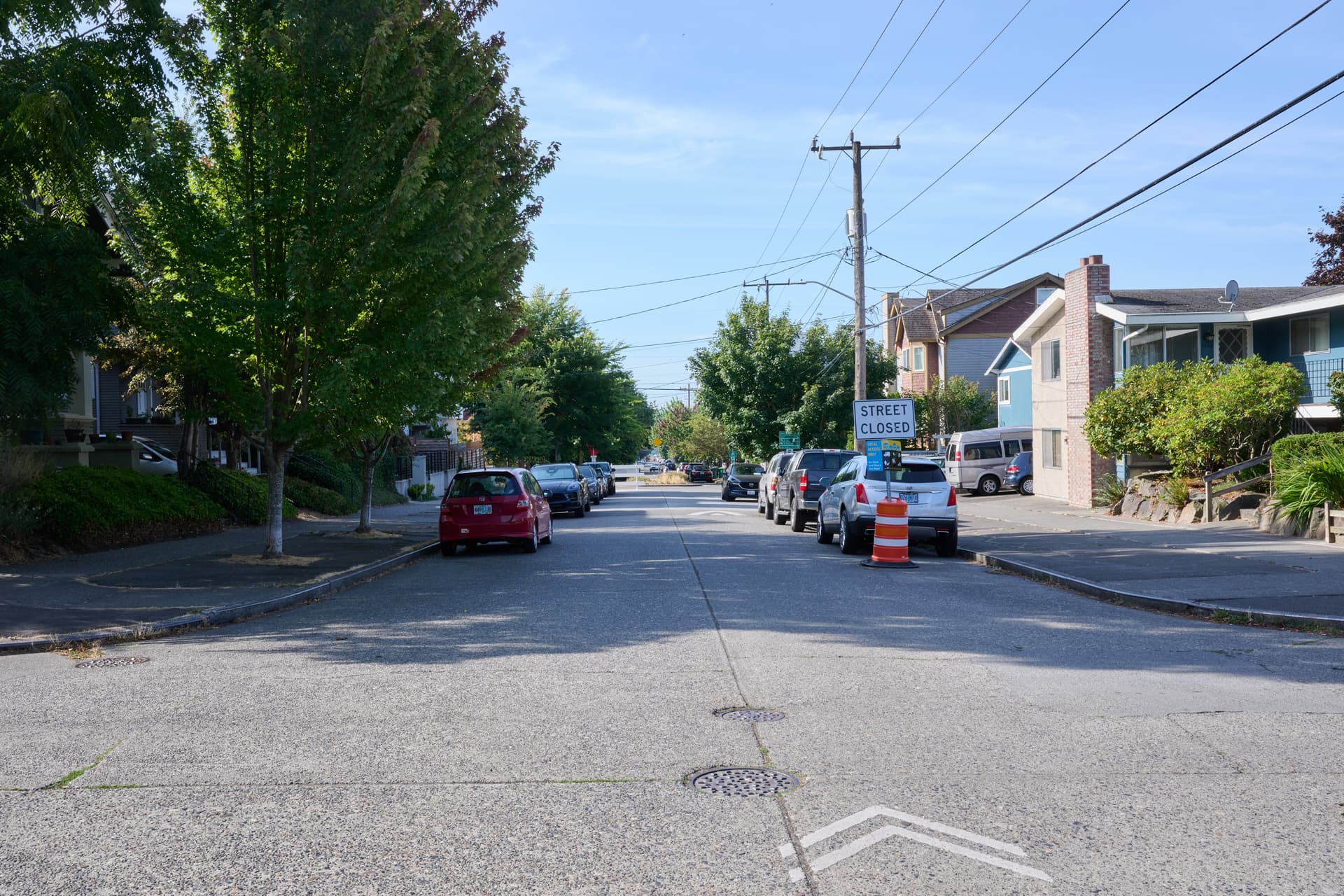
Looking back, it’s the same sign on a pole for headed southbound.

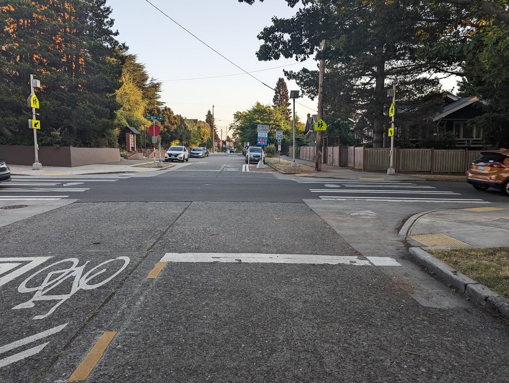
I have pictures of the next intersection too, but it’s more of the same.

Physically, there are no special characteristics. The sidewalks and road are constructed like any others in the area.

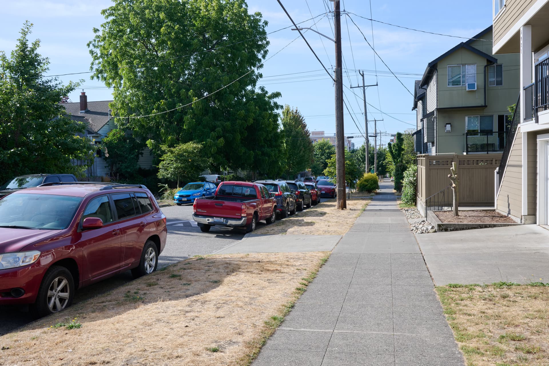
It was about 8:30AM, so there weren’t huge numbers of people out, but everyone except me was using the sidewalk. There were no signs of people using the street for purposes other than operating or parking a vehicle, like basketball hoops or anything else near the street.

After visiting, I think I can draw a few conclusions.

  1. The Greenways are normal highway=residential, with appropriate tags to indicate they are part of a bike network and have sharrows. There is no special access or street infrastructure.

  2. The streets are motor_vehicle=destination. The signage is clear on this, with “local access only”.

  3. They are highway=residential, not highway=living_street. When looking at a living street, I would expect

    1. a reduced speed limit;
    2. physical design that gives greater or equal priority to pedestrians and no barrier between different road areas such as kerbs;
    3. people to naturally walk on the roadway; and
    4. signage indicating pedestrians have right of way, not just to share the road.

    None of these are present. Walking down the middle of the road seemed like no different than walking down the middle of any other residential road in the area. The street has access restrictions, which should be noted in access tags, but I don’t see that that makes it a living_street.

I don’t see that any of this changes when they get planters as described in the posters.

5 Likes

I live in Seattle and I agree living_street is rather nebulous for some of these neighborhood greenways, so I support your assessment. While some of these streets have had speed bumps installed, there haven’t really been too many other physical improvements made to indicate they are indeed living streets. I support adding a relation, as can be seen in this example here

This might also be relevant - Talk:Tag:highway=living street - OpenStreetMap Wiki

I’ll share my experience with the segments of the Aurora-Licton Springs Healthy Street that I live adjacent to. I frequently walk (and occasionally bike) along N 100th St (between Aurora Ave N and College Way N) and Ashworth Ave N (between N 92nd and N 100th St).

I frequently see people (myself included) walking in the roadway. I will note that N 100th St only has a sidewalk on one side for most of this segment, so that may be an influencing factor. I rarely see people walking in the roadway on parallel residential streets (other than to cross).

Motor vehicle traffic and speed are noticeably decreased compared to parallel residential streets.

I believe state law restricts the minimum speed limit for non-arterial roads to 20 MPH (other than alleys), so the Seattle Department of Transportation can only slow traffic down with street design.

Another thing worth noting is that the permanent signage being rolled out does specify “Vehicles yield to pedestrians and bicycles” so that should be clear going forward (the Healthy Streets website also mentions this but signage on the ground hadn’t been crystal clear).

Good topic. When Baltimore city implemented a similar project we settled on
living street though agreed it is not perfect. It does have the effect of
disrupting routers which is potentially a desirable outcome (or not).

I spent 30 minutes walking on the 1st Avenue Healthy Street (completed), followed by another 30 minutes on parts of the neighboring 100th Street and Fremont Ave Healthy Streets (temporary signage) yesterday evening, just before sunset.

I counted people and vehicles who entered my line of sight, traveling along the Healthy Street. I did not count people/vehicles crossing the way.

Totals:

  • Pedestrians: 31
    • On sidewalk: 14
    • On street (sidewalks available): 5
    • On street (no sidewalks): 12
  • Bicycles: 6
  • Cars: 7
  • Escooter: 2

Characteristics of the completed 1st Ave Healthy Street:

  • Every intersection traveling along the way has permanent signage indicating that vehicles must yield to pedestrians. Between 73rd and 85th the signage doubles as a traffic choker reducing the street to one lane.
  • Most intersecting ways have signs warning of pedestrian traffic (“Caution”). These are not as durable or visible as I would like.
  • There is one speed bump in every block 73rd-84th. There are 2 speed bumps in every block 87th-100th (longer blocks).

Signage along the way. These are at every intersection, in both directions:

Warning sign on (low-traffic) road intersecting with the healthy street:

My thoughts on living_street tagging:

  • In 2020, I walked 1st Avenue at least once a week, and there were far more people walking - or just standing around - in the middle of the street. At that time, I would have 100% argued for living_street designation. People owned the road, regardless of the design. I still think it is closer to a living_street than anything else, and I think it should be tagged as such to aid discovery. It is certainly a better walking route than surrounding streets. But I can see the argument otherwise- without a critical mass, the traffic calming is not quite good enough to make it feel safe at all times, especially at intersections (I felt safe today, but not sure I would at night). I wouldn’t want to give any politician the idea that this is “done”…but I do think it’s better than the average greenway.

Other random observations

  • 7pm on a Saturday evening may not have been the best time for a survey.
  • 1st Ave’s sidewalks are very nice and I can understand why most peds would use them instead of the road when there aren’t many people competing for space.
  • I think the full-width speed bumps make this route less appealing for cyclists, especially when there is a decent (albeit doorzone) bike lane along the more direct neighboring arterial (Greenwood Ave).

A few more photos:
(even more available upon request…perhaps should find some place to upload an album instead of overloading the post):

Representative section north of 85th (no sidewalk, 2 speedbumps per block)

1st and 80th intersection


100th and Greenwood intersection (only bikes can go through on 100th):

I like this sticker :slight_smile: (100th and Greenwood, below signal button):

2 Likes