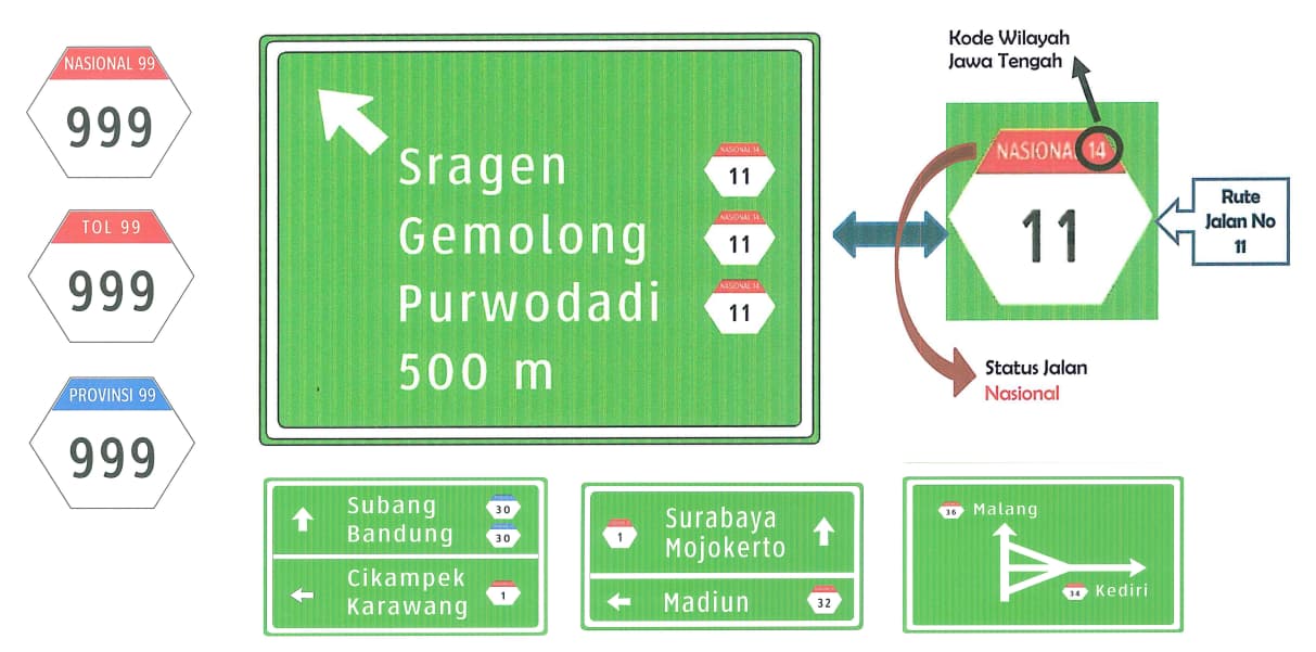
There seems to be some inconsistencies in how road route relations are being tagged in Indonesia. The only route relation for a national road (jalan nasional) is tagged network=ID:national, with the second part in English, but there are toll roads (jalan tol) tagged network=ID:toll as well as some that are tagged network=ID:tol in Indonesian, as on the signs. Which language does the Indonesian community prefer for network tags in Indonesia?
The OpenStreetMap Americana project currently displays route shields based on route relations in a number of countries, but in Indonesia they’re currently only plain numbers. We’d like to make them look like the hexagonal signs on the road, but to do this, we’d need to know which network values the local community prefers.
Eventually it would be great if we could show the correct route shield icons on provincial, regency, and city routes as well, but first they would need to be mapped as route relations. For a variety of reasons, we wouldn’t be able to tailor the appearance of route numbers to each country based on ref tags on ways alone. But if there’s agreement on the network values and someone maps a few of these routes to start with, then we can easily add rendering support.
Here’s what I know about the road network in Indonesia
National road is different than toll road. That’s why there are two different tagging scheme. Put it simply, national road is more open than toll road, while there are both vehicle-type restriction and obligatory fee in toll road.
But, in legal and administrative sense, “toll road is just a subset of national road”. This is making the definition quite fuzzy and difficult to distinguish.
But at least, people on Indonesian Wikipedia already documented this topic quite well. See here.
In short, to put it in local context, “toll road network is more important than route shields”. People in Indonesia frequently refer to toll road network name instead of route number. Only the government use the route number for administrative purposes. So, I propose to emphasize toll road network first instead of route number. (I mean, not every country should be forced to follow US-approach in road networking scheme right?)
Regarding the tagging convention, assuming that English first approach should be used in any tagging convention, then we should follow network=ID:national and network=ID:toll. “tol” is just Indonesian localization of the word “toll”.
Oh, certainly, we aren’t forcing a U.S. tagging scheme on anyone. But there are two multinational tagging schemes for network and it appeared that Indonesia was following one of them, mostly, so I was hoping to understand whether the inconsistency was intentional.
OSM Americana is seeking to label roads and routes more or less how they appear on the ground. In many cases, people don’t actually use the shields or route numbers as much as road names; this isn’t just an Indonesian phenomenon. Are the hexagonal shields posted reasonably prominently along national and toll roads or on most published maps that ordinary people use, even if people ignore the shields in practice? If they only exist on paper in a government filing cabinet, or if they’re only posted out of the way where travelers wouldn’t be able to use them, then maybe you could consider replacing the route relations’ ref tags with unsigned_ref to avoid confusion. Americana automatically hides such route numbers, regardless of the network.
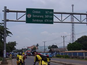
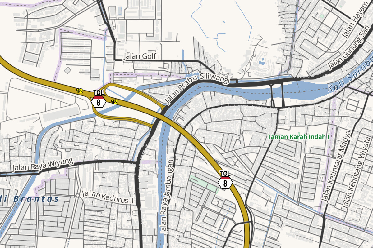
As you can see from the screenshot above, Americana already renders toll roads in a different color (golden yellow) than ordinary trunk roads and motorways (shades of red), based on toll=yes on the ways. We also label road names when there’s enough space; it’s just that the route number is taking up space that could go to the road name instead. But unsigned_ref would fix that problem. Does that address your point about distinguishing the toll road network?
Thanks for the photo; that’s very helpful. We can implement the red and white hexagon for network=ID:national based on your feedback. Maybe we should render the same shield for network=ID:toll to avoid an unsightly bare number when the relation has ref. If signs like the one above don’t appear on the toll roads, then you’d be able to suppress both the shield and number by retagging the relation with unsigned_ref.
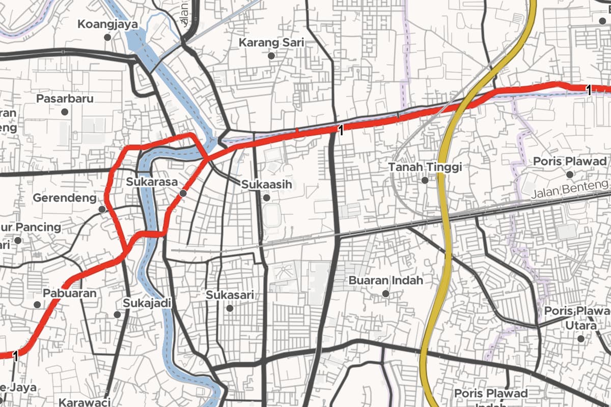
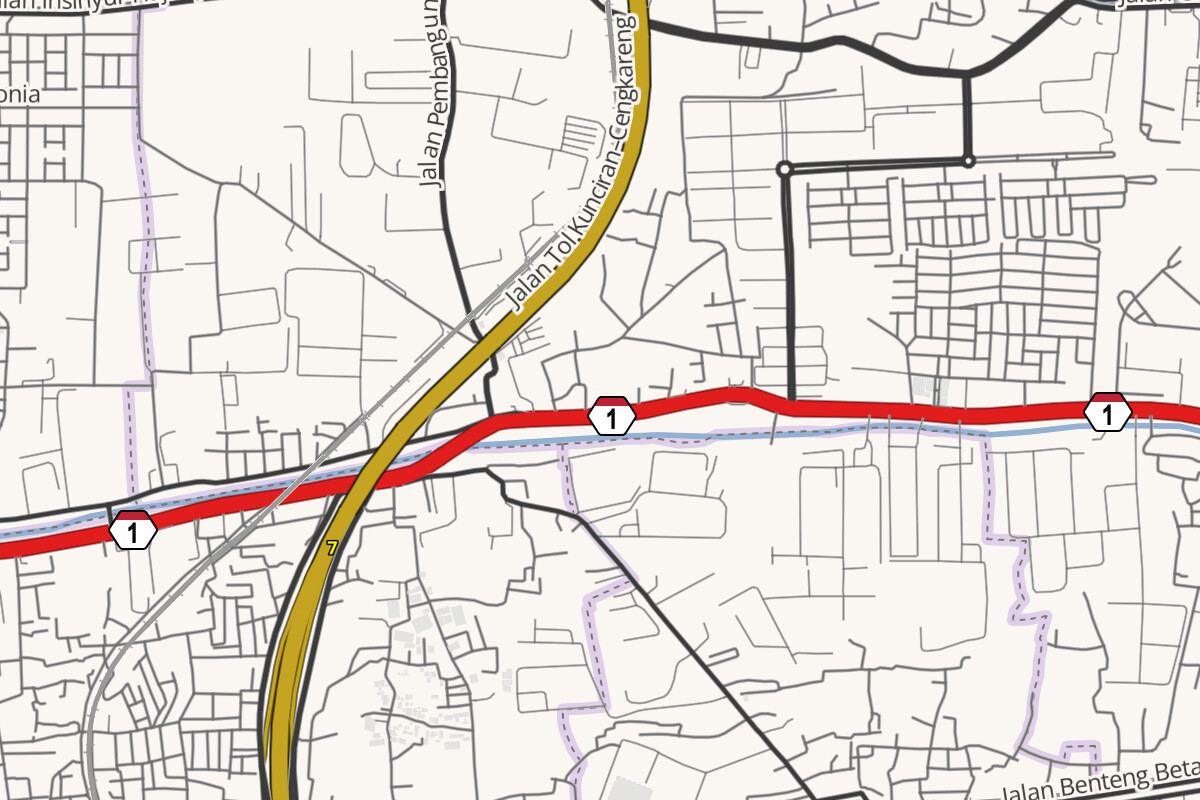
OSM Americana now shows the national road and toll road shields on the map, for the route relations that are tagged network=ID:national and network=ID:toll.