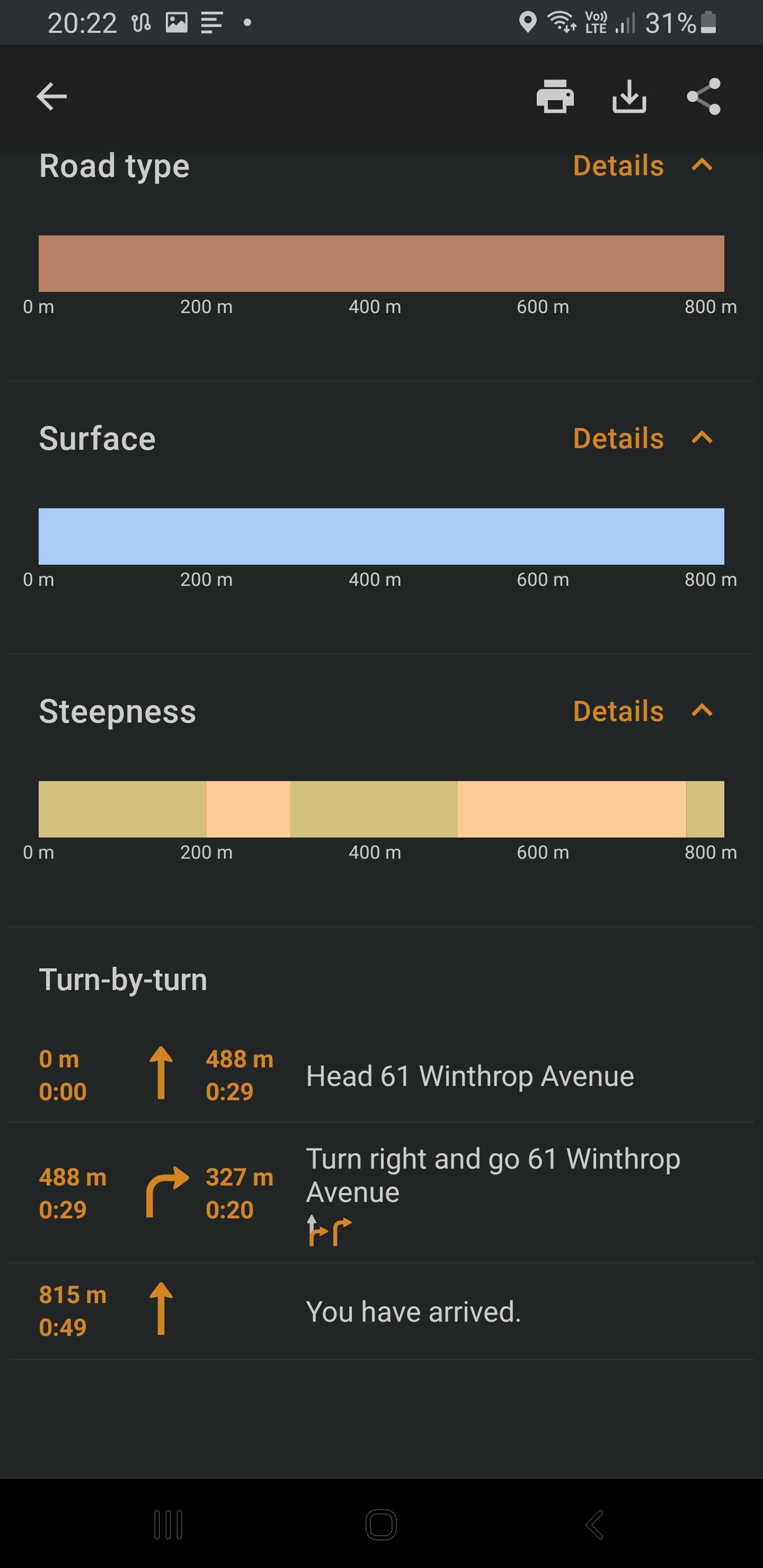
Using OsmAnd+, the directions when traveling on Winthrop Avenue towards UWA and turning south (right) onto Stirling Highway say to turn right onto Winthrop Avenue (SR61). I would have expected this to say to turn right onto Stirling Highway, possibly mentioning direction Fremantle (unsure if there’s a road sign at this intersection though).
I assume this could be because there are 4 segments in the turn as it is mapped, all named Winthrop Avenue. Is there a way to update this to result in clearer directions from the routing application?
OK, now that I have taken a look in JOSM, it does appear that the intersection modelling was a little too complex. I have simplified it, so I hope OSMAnd will have better luck in the future.