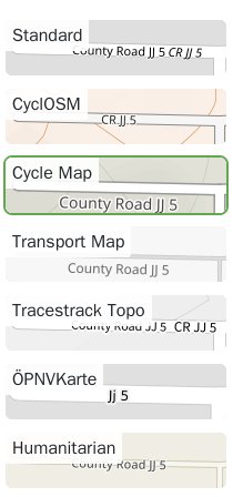
Just the other day we were discussing how terrible some of the layers looked in regards to the name of this road.
Terrible because of the repeated information.
and many nearby.
See also Redundant Road Names?
Hmm, if the name was “Nordbert Road” and the ref was 35, I would want them both rendered. But I suppose one shouldn’t use both tags if they are almost the same…
As far as I can tell, the road has a name of “County Road JJ.5” and no route number (or reference, in OSM jargon). TIGER lacks information about letter case or punctuation, so it stores the road name as simply JJ 5. The TIGER import turned it into name=Jj 5 before a mapper corrected it to “County Road JJ 5”. Someone needs to clean up the road names throughout Otero County, Colorado, to place a period between the letters and number in each name.
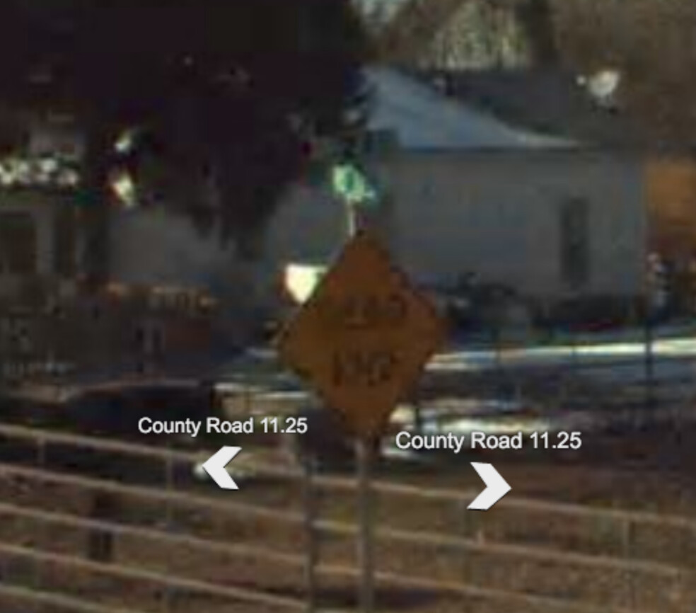
Like many rural counties across the U.S., Otero County names its county-maintained roads according to a coordinate grid based on PLSS sections. North–south roads are numbered and east–west roads are lettered. The county is tall enough that the letters wrap around from Z to AA. County Road JJ.5 is halfway between CRs JJ and KK, and CR JJ.75 runs just to the north. The dead-end street intersects CR 11.25, which runs slightly to the east of CR 11. I’d contend that these road names are akin to the numbered or lettered streets that you often find in a city street grid. We wouldn’t tag ref=E22 on an East 22nd Avenue.
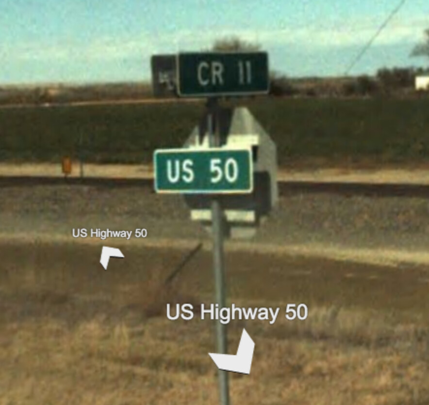
There are no county route shields around. This is in contrast to some other counties in Colorado that post the standard blue pentagon or some other shape as a trailblazer or reassurance marker:
In some counties elsewhere, the highway department posts route shields as if there are route numbers. For example, Fulton County, Ohio, uses the state-standard county route sign for its county and township roads:
This makes it necessary to isolate the number from the overall name, for the benefit of renderers that need to depict county route shields wherever they appear in reality. It’s less of a problem to conflate names with numbers if the highway department did it in the first place. In addition to ref tags on the ways, we’ve added route relations corresponding to these “routes”.
However, few counties outside of Ohio post street name coordinates on county route shields. Next door in northeastern Indiana, the roads are numbered similarly, but we don’t tag way refs or route relations because there aren’t any route signs to justify them.
This is an unresolved tension in OpenStreetMap. Many people say that names like this are not names because they include the reference number. Many others say they absolutely are names because they can show up on street signs and as the street name in addresses. Probably what we need is a tag to indicate when name and ref are redundant like this so data consumers can choose to display one or the other instead of both if they want to.