Rivers update

Hello,

I am participating in a project that is trying to clean up and update river data globally and was thinking of going through Panama. It basically deals with disconnected waterways, overlapping water areas or waterways, fixing mistagged features, removing duplicate objects and also moving older river tags (waterway=riverbank) to the newer more numerous version natural=water + water=river (looks like that most of the river areas in Panama are already tagged with the new scheme so it would be about ~96 remaining). Let me know your thoughts.

Hi Mashin, thanks for writing here (before editing!) :wink: :slight_smile: :slight_smile:

the project, is it formalized as an “organized edit”? or is it just a personal initiative? if you don’t yet have a page for it, do you need help setting one up?

I shared your post on a Telegram group, that a few Panamanian mappers use for chatting.
https://t.me/Comunidad_OSM_Panama/14154

how’s your Spanish? in the group I told the fellow mappers that … “he is welcome and that I personally think it is even better if he would start with a couple of editions giving us the time to review them, so we can confirm that we are more than happy with the help that he’s offering us.”

how about it?

you mention the items:

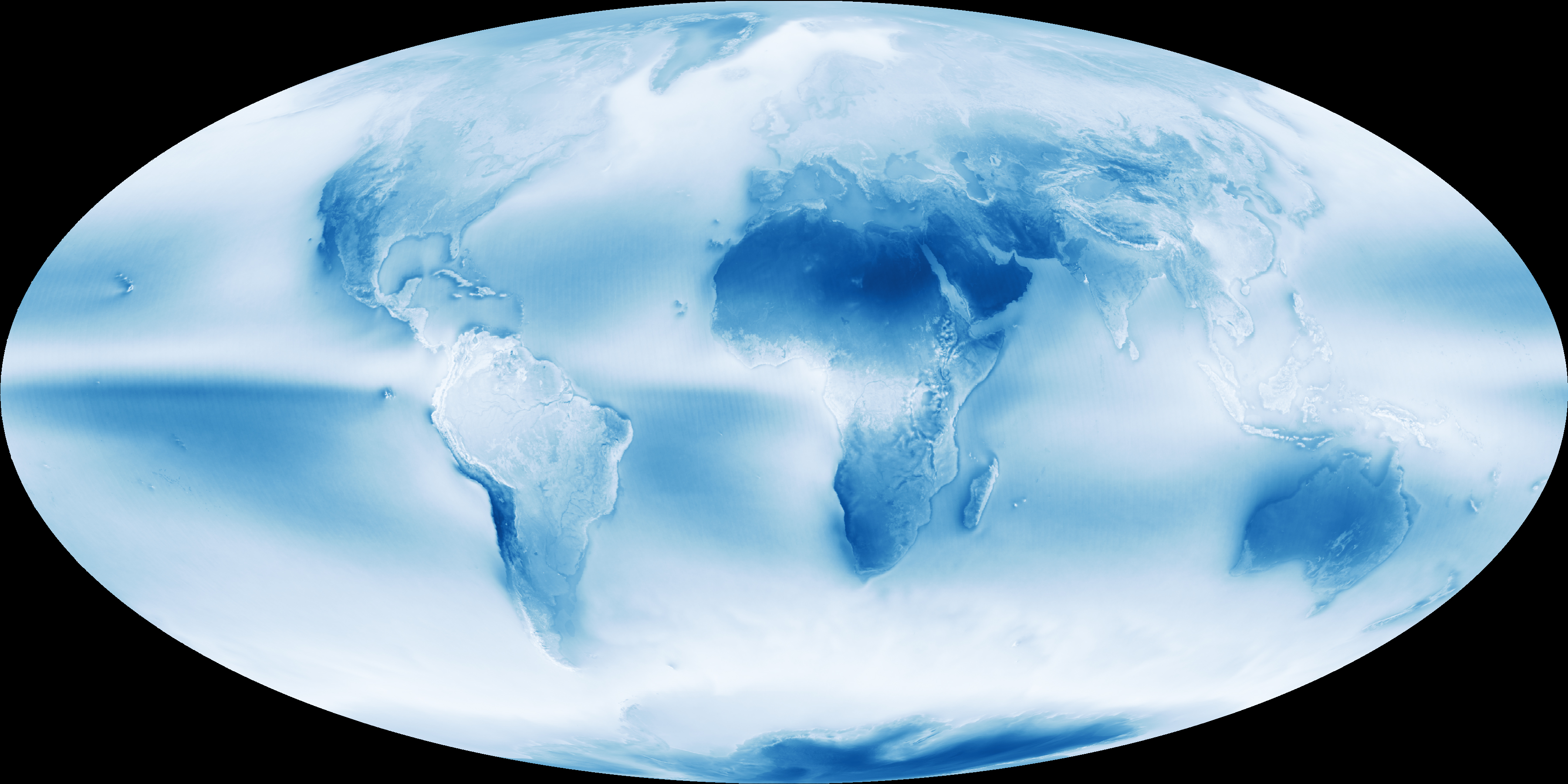
disconnected waterways — this may be hard to fix, because of cloud cover in the country.

overlapping water areas or waterways, — I’m not sure what you mean by that. we have several rivers where the waterway goes coupled with a water area, but does not fall inside it. but we also have places where the water areas are intermittent, the waterways vary year after year, the intermittent river area might be marked as natural=shingle.

fixing mistagged features, — I’m sure there are loads of that, but it’s a very generic description. can you provide examples? so we can try to categorize them.

removing duplicate objects — we have several provincial borders that run along rivers, and wherever the rivers are dynamic, the provincial borders keep following the rivers, because that’s how they were defined. some provincial borders have been added from very rough public maps, and yes in this case the river flows sort-of-parallel to the border … it’s a bit of a mess, and I’m afraid I also contributed to it. some day we might be allowed to import official data, but not yet.

and also moving older river tags (waterway=riverbank) — that would be fine, thanks.

my addition would be regarding natural=shingle and intermittent=yes.

one more VERY HELPFUL thing you might do for the country and OSM: you could add nodes for places if you see any along the rivers as you review them. that would help us map settlements that might be exposed to floods. just count the number of buildings and classify the place as farm (1-2), isolated dwelling (3-6), hamlet (7-19), or village (20-), or if you don’t agree with the rule of thumb I’m suggesting, please refer to the general wiki. in my opinion this would be a huge service you can do to Panama.

Hi mariotomo,

Thanks for the feedback. This is part of a larger project that has more details marked here: https://wiki.openstreetmap.org/wiki/WikiProject_Waterways/River_modernization Let me know if some of the text needs clarification.

Regarding the individual points:
disconnected waterways - From my experience there can be some waterways that are not connected to the waterway they flow into or they don’t continue trough lake/reservoir and are thus disconnected to the outflow waterway.

overlaps - often crossing or self crossing waterways. Water areas that are drawn on top of each other. etc.

mistagged features - typically reservoirs/lakes/canals water areas tagged as riverbanks. Streams tagged as rivers and similar issues.

removing duplicate - This I’ve seen when there were a multiple rounds of imports in the area or at country borders where two imports from different countries imported the same object multiple times. Sometimes it happens with manual editing as well e.g. I’ve seen culverts drawn as a second way on top of the waterway itself
Do you mean that the border is tagged as waterway but there is a separate waterway next to it? I could leave them untouched if that is preferred.
Did you also have any specific suggestion for the natural=shingle or intermittent=yes?

I can try some small scale edits if I find some of the mentioned problems and I can also mark some of the populated places when I see them

I can translate the replies with google, but I am afraid I won’t be able produce any responses :slight_smile:

»they don’t continue through lake/reservoir«

true, I’ve seen that often enough.

also happens in correspondence to dams/dykes, I’ve been mapping some pressurised waterways, I’m sure there’s many more.

»mistagged (river/stream)«

also true, that’s again common enough. what happens here: streams often bear an official name starting with “río” and local mappers tend to translate this into the classification of the waterway, up to the very source of the “río”. should you reclassify the upper segment of a “río-river” to “río-stream”, I suggest you add a note to the object, in Spanish, something like “este sector del Río Xyz tiene tamaño que corresponde a la clasificación ‘stream’, por favor no la cambien con ‘river’.”

»Do you mean that the border is tagged as waterway but there is a separate waterway next to it?«

nope, it’s a bit more complex than that: given that the administrative border is defined by law as following waterway, the easy scenario is (1.a) some time in the past some administrative border has been mapped as border but not as waterway, (1.b) subsequently the waterway has been mapped but not activated as administrative border. I guess a viable option within your project is to forget about administrative borders.

a worse case is when (2.a) the border was copied from the official source, (2.b) tagged as waterway regardless the real placement and extension of the waterway. in this case you would need to decide where to end the waterway and leave the administrative border. I’ve had one professional hiking guide telling us that he found a mapped river without any river on the ground, but hills and peaks … I trust that the local community will be grateful if you would comment on our dubious/low quality changesets. we can only learn from criticism.

»Did you also have any specific suggestion for the natural=shingle or intermittent=yes?«

not really. we can talk about it, I hope your team has already met and solved the issue. we have shingle in the South of Mariato District, and around Volcán. all that is shingle would be included in the intermittent, but I would expect the intermittent to cover a larger area. I don’t know if you have access enough pictures as to highlight any seasonal variations. the rainiest period is October-November, while there’s little-to-no rain around March. since rainiest is also cloudiest, you will probably only have good aerial pictures not showing the maximum extension of the waterways.

» … I can also mark some of the populated places when I see them«

I understand you’re focusing on waterways … see what you can do, thanks in advance!


finally: would you need concrete examples, in the form of links to objects? I would need to look for them.

I’ll check your wikipage, thanks for the link.

Mario
I’ve done just a handful of edits that fixed some of the overlap or crossing ways issues.
The bbox is a bit large but still can be viewed here: https://resultmaps.neis-one.org/osm-change-viz?c=110882705#7/8.076/-79.942 or https://dev.overpass-api.de/changeset-map/#110882705

hi. thanks for the edit and for alerting us here. I’ve just an impromptu perplexity (perplessità estemporanea), related to “one feature, one entity”: you have seen that we have more than several “Río Tuira” in the database, shouldn’t we do a relation where we collect the common properties?


I see only one point where I might have done it differently, around Node: 6868159379. you connected the rivers to the coastline, where they were connected to the administrative border. … no, it doesn’t matter, I was thinking, I might have wanted to keep the coastline and the administrative border together, but it doesn’t matter, because it’s a mistake we’ve been doing systematically, to use the coastline as administrative border, that’s not as described in the decrees, it’s just how Panamanians have been mapping it all the time. for the sake of uniformity, I would have kept the two together, not because it’s really the right thing to do, just for the sake of uniformity.

Logically rivers would flow into an ocean, but if it’s is your local convention that’s understandable and I’ll move the node back.

There is the waterway relation (https://wiki.openstreetmap.org/wiki/Relation:waterway) that groups together different parts of a river. I’ve seen many of those, but mostly for big rivers. For “Río Tuira”, if there are so many, would be a perfect use.

I moved the relation to match the coastline. have a look if it’s still correct from your point of view.

your team/project does not plan doing that? it’s so few mappers here, and the ones able and willing to create (interested in creating) proper relations for rivers … I don’t think we have anybody to spare for this. in my (very personal) opinion this is something where armchair mappers would be highly welcome.

I think that looks good. Just double check if that adjacent island is supposed to be inside or outside the border.

I can certainly create some of those, looks like a fun thing to do. Someone will have to review afterwards if rivers are assigned correctly and fill in missing information.

:roll_eyes: :roll_eyes: :roll_eyes:

that adjacent island should be inside the border, as well the whole water area between the island and the “terraferma”, and quite a few miles into the sea as well. I am fine trying to cope with the mistake we’re making (identifying the coastline with the administrative border), but considering that some day we might fix this, I prefer not to go too much into the error.

sounds nice. looking forward to seeing your changeset!

I think at this point all major rivers in Panama (that have a name tag) have their own waterway relation. I tried to assign the correct wikidata id, but it would be good if someone could go through and double check. Like there are at least three Rio Chico and there might have been a mix up.

https://overpass-turbo.eu/s/1bap

https://osmcha.org/changesets/111174115/
https://osmcha.org/changesets/111203955/

Hola Mashin
Muchas gracias por tu contribución.
Mapear los ríos es un trabajo en que pocos se enfocan, algunas veces resulta difícil porque muchas áreas en las imágenes están nubladas. Otra vez gracias por tu aporte.
Saludos desde Panamá