Anywhere the wiki includes a traffic sign diagram, there should be a caption that clearly labels it as a traffic sign and indicates the jurisdiction(s) associated with the sign. We can’t assume everyone is even familiar with the sign system, let alone the specific sign. I’ve corresponded with more than one mapper from North America who didn’t even realize the blue discs are traffic signs. To someone who has never encountered Vienna Convention signs in person, they look like cute icons representing modes of transportation, with an arbitrary blue background. No wonder users reach for the tagging combination without regard for regional legal quirks.
Even so, highway=path is nuanced enough without turning the documentation into an eye-watering sign gallery like we have for maxweight=* or hazard=school_zone. If something inherently country-specific like a traffic sign is really so important for understanding when to use highway=path, then ideally we’d document it on country-specific pages, leaving the global page to focus on the meaning of the sign.
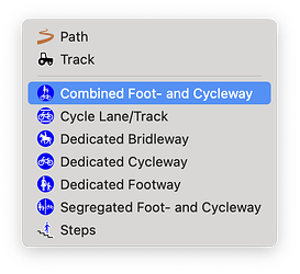
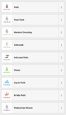
Like the wiki, JOSM’s Preset menu also optimizes for Vienna Convention countries using Vienna sign icons. It’s actually a pretty good idea to use a traffic sign as an icon if there’s a one-for-one correspondence between the sign being present and the preset being applicable. It saves users the trouble of deciphering yet another custom icon, such as the trapezoid that means “path” in iD. (It’s a path going off into the distance, not the side of a milestone.) But the traffic sign becomes counterproductive if the application also shows it to users who aren’t from the relevant countries.

