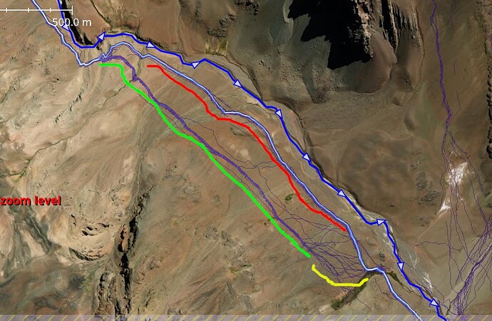
I sometimes map based just on Strava (locals in Chile encouraged the use of it - a lot of even very frequented hiking trails there are still unmapped ). However, usually only in areas where I have previously been - that usually allows me together with satellite imagery and also possibly looking at topo map to judge whether there is a path or not. For example ( -32.7555355, -70.0967133 ):
-
Red line – The path above it is definitely a highway, I would have no hesitation at mapping that. In that landscape, 4x4 track would be visible on a satellite.
-
Green line – Usually in the Andes, this also indicates a trail (a number of people walked it practically identically with little variation).
-
Yellow line – the trail around the green line peters out. That definitely should not be mapped.
-
I would not map those lines on the top right corner (though I think there is some interminent path; however it is not connected to the rest of path network – it would need to be a stub) on their own. Upon inspecting satellite, the path is actually cleraly visible, so it could be mapped.
I add source=strava when I map something like that. Highway=path + strava=source is an invitation for survey; just as highway=path without additional tags is.
Strava is a very useful tool, but it must be used sensibly.
