Proposing to deprecate railway=razed and railway=dismantled

The OpenRailwayMap wiki page defines railway=abandoned as an “Abandoned track”:

While the track no longer holds any rails or signals, the former line (or even a trackbed) can still be seen. These remains might include embankments, trenches, bridges and tunnels.

To me, this all sounds entirely appropriate to include in OSM. What is being mapped is the currently existing terrain features, that used to be part of a railway. For sections where no such terrain features are present, I don’t think a way should be mapped.

The same wiki page defines railway=razed as an “Overbuilt track”:

A former track that has been built upon. While some remains might still be seen, the former route is subject to educated guesses for the most part. Note that mapping demolished railways without traces should be done in OpenHistoricalMap - not in OpenStreetMap.

This really doesn’t sound like something that makes sense to to have in OSM. If the track has been built over with something else, then mapping the thing that has been built over it takes precedence. With any significant construction, earth will be moved making the former railbed no longer recognizable.

I’d make an exception if the railbed has been re-purposed as a cycle path (or similar) that now follows the exact same route. In this situation, the shape of the terrain is still recognizable as a former railbed while also currently being in use for a different purpose. Many former railbeds in my area have been converted to cycle paths with a secondary goal of preserving the right of way for potential future railway use. It seems reasonable for these ways to be tagged as a former railway as well as a cycleway. I’d prefer a tag like historic=railbed as this suggests the presence of terrain features recognizable as an old railbed. railway=razed rather suggests the absense of a railway that used to be there, inviting use in places where there is nothing recognizable remaining.

3 Likes

(With my hat on as an OpenHistoricalMap advisor, but not even remotely as a lawyer. Do lawyers even wear hats?)

OpenHistoricalMap is in the public domain under a CC0 dedication unless otherwise noted.[1] As long as you omit those negligible “otherwise noted” portions, you should be able to combine it with OpenStreetMap data without any legal hurdles. It’d be like any of the public domain datasets that data consumers use in conjunction with OSM data, such as Natural Earth coastlines in openstreetmap-carto or TIGER addresses in Nominatim. If you want to be on the safe side, you can get your abandoned railways exclusively from OHM and ignore OSM’s coverage of haphazard fragments of the same.

On the technical side, OHM publishes a planet. There’s no extract service similar to Geofabrik, but the entire planet is still quite small compared to OSM. We also publish an official set of vector tiles. These tiles power OHM’s new experimental Railway style. If you’re OK with depicting any former rail infrastructure as such, regardless of time period, then you don’t need the interactive filtering capabilities that come with vector tiles; you can render them more naïvely using a Mapnik–Leaflet raster stack.

Even simpler would be an old-fashioned mashup: a MapLibre GL or Mapbox GL map can include both an OHM vector layer styled on the client side and an OSM raster layer styled on the server side, one as an overlay of the other.

OHM would prefer not to adopt the ODbL outright, so the current advice is to only transfer a feature if you personally authored it or have secured permission from its authors to transfer it. This sounds very limiting until you consider that the degree of micromapping in OSM is probably less relevant to OHM, so you can often get away with mapping a road or waterway more crudely than in OSM. That’s not to say that OHM doesn’t micromap; it’s just that we’re more focused on micromapping history, filling in gaps in the historical record.

The process for transferring is more complicated than it should be. We’re working toward a more streamlined solution as part of iD and will hopefully have more to announce on that front later this year.


  1. A minuscule number of features have a license=* tag (yes, American English…) indicating that they have additional restrictions, typically an attribution requirement. In my personal opinion, OHM should work to eliminate these exceptions in the long run. In the meantime, you can filter out anything with a license=* that doesn’t mention “public domain” or “CC0”. ↩︎

4 Likes

The railway= tag is used to map the trackbed geometry, just as the highway= tag is used to map the geometry of what Americans call “pavement”.

  • railway=rail means that there is an active railway on the trackbed.
  • railway=disused means that there is a disused railway on the trackbed (rails still down, no trains run).
  • railway=abandoned means that there is no railway on the trackbed, but that the trackbed is still extant. This is the standard tag to use for rails-to-trails cycleways.
  • railway=dismantled (or railway=razed, they’re synonymous) means that the trackbed is no longer extant but that the former presence of a trackbed is still an observable fact worth mapping.

The canonical example near me is Hook Norton Viaduct:

224672_140bd399

(photo by Stephen Craven from geograph.org.uk, CC-BY-SA. More photos of the viaduct: Photos of hook norton viaduct :: Geograph Britain and Ireland. It’s really quite something!)

The trackbed here, made of iron, was removed in the 1960s after the line closed. The pillars remain. As a result, the individual pillars are mapped with historic=ruins and the line connecting them is mapped as railway=dismantled. The latter gives context and meaning to the former, showing that the pillars were built as part of the railway and therefore have a design and construction appropriate to that.

That this structure is a railway structure is an observable, documentable fact. I grant that an ancient people could have come along and built the pillars as part of some sort of mysterious Stonehenge-like ritual, in praise of the Prophet Ba-Ron B’Ching. But until we have any evidence for that, railway=dismantled it is.

There are lots of examples like this, where a bridge deck has been removed but the abutments and (often) pillars remain. This is the core use (in my view) for railway=dismantled. I am not going to man the barricades for people who use it across ploughed-up fields. But then, I haven’t surveyed those fields and it’s possible there are details I haven’t seen, so nor am I going to delete it. (I would be a bit miffed if someone deleted the obscure bits of the former Oakham Canal which I spent my 20s traipsing around fields discovering, just because they can’t see them on Bing imagery.)


Incidentally, I wonder if TNS-MN's Diary | OSM Leave of Absence | OpenStreetMap is connected with this episode. If so that’s very sad - it looks like we may have lost a good contributor with local knowledge.

8 Likes

(just to reply to this one bit) - or, presumably, if that data in OSM was sourced completely from sources compatible with OHM, such as out of copyright maps?

That’s much less clear to me; I would want someone with a better understanding of the ODbL to weigh in on that one.

Hopefully whoever added that data to OSM has cited the out-of-copyright map so that you can track it down yourself. In that case, you might as well map it from scratch in OHM using the same source. This gives you an opportunity to do a better job of drawing it, research the start and end dates, etc. This guide to tracing old maps can help you get started.

We’ve had similar discussions about OSM’s major imports in the U.S., particularly GNIS. Sad as it might be for the OSM community, I think importing directly from the source, ignoring OSM’s improvements to the data over the years, might be a better starting point in some of these cases. In the case of GNIS, OSM deliberately deleted anything that was tagged as “historic”, so not all of those improvements were improvements from an OHM perspective anyways.

1 Like

Taking a step back from the most recent flareup, I’d like to reflect a bit on the “on-the-ground” verifiability principle. Verifiability is an important rule for any online crowdsourcing project with as low a barrier to entry as we have, and especially important for any map that people trust as part of their daily lives. Both sides of the abandoned rail debate have passionately invoked the verifiability principle, both in this thread and in the parallel German thread. Who is right?

There’s often more than one way to verify a fact about the world. Scientists distinguish between observation and inference. OpenStreetMap is built around the ethos that each of us is an enterprising surveyor, GPS unit in hand and bedecked in full high-vis regalia. Anyone can do it! Of course, the reality is that most of us end up staring at aerial imagery most of the time instead. Anyone can do that too! Either way, this is mostly an exercise in observation. But usually we don’t just record what we see verbatim; we apply local knowledge or common sense in interpreting these observations. This is inference.

Both observation and inference have a place in OSM. Observation matters somewhat more, as it aligns with OSM’s goal of democratizing mapmaking, but it’s insufficient. There’s a reason no one likes to hear, “Don’t map [the thing you wanted to map]; just map the signs!” Robots can just map the signs, but we are not robots. If we were to take a fanatical stance of mapping only pure observations, then OSM’s landuse coverage would consist of nothing but coloured polygons, no different than posterizing satellite imagery, a cheap trick that some proprietary maps like to employ to seem like they have more detailed coverage than they really have.

A venture capitalist once asked me why I waste my time contributing 3D buildings and navigation details to OSM when the future is clearly in LiDAR point clouds and HD mapping. I wasn’t going to win him over with a diatribe about licensing, but I did have this to offer in our defense: against a constant drumbeat of automation, OSM provides unique value by inferring semantics from our observations. (I left that encounter empty-handed anyways. Oh well.)

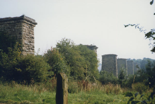
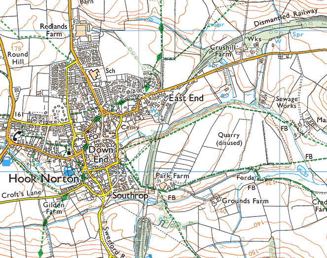
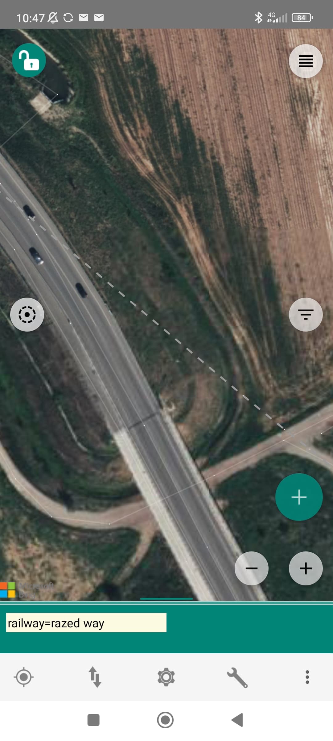
On the other hand, a crowdsourced project can only admit inferences up to a point. On the Internet, no one knows you’re a dog with a postdoctorate degree in ferroequinology; you could just as well be making it all up, and we need to be able to tell the difference. A darkened strip in a field, visible only from the air – is that the residue of a former trackbed, a crop mark left by an ancient wall, or a geoglyph of unknown meaning? When a self-professed railfan excitedly proclaims it to be a trackbed, one hopes it’s because they have other corroborating evidence or external context to make that inference. I can cite my personal experience or professional expertise, or Occam’s razor, but to the community it can look like a personal bias.

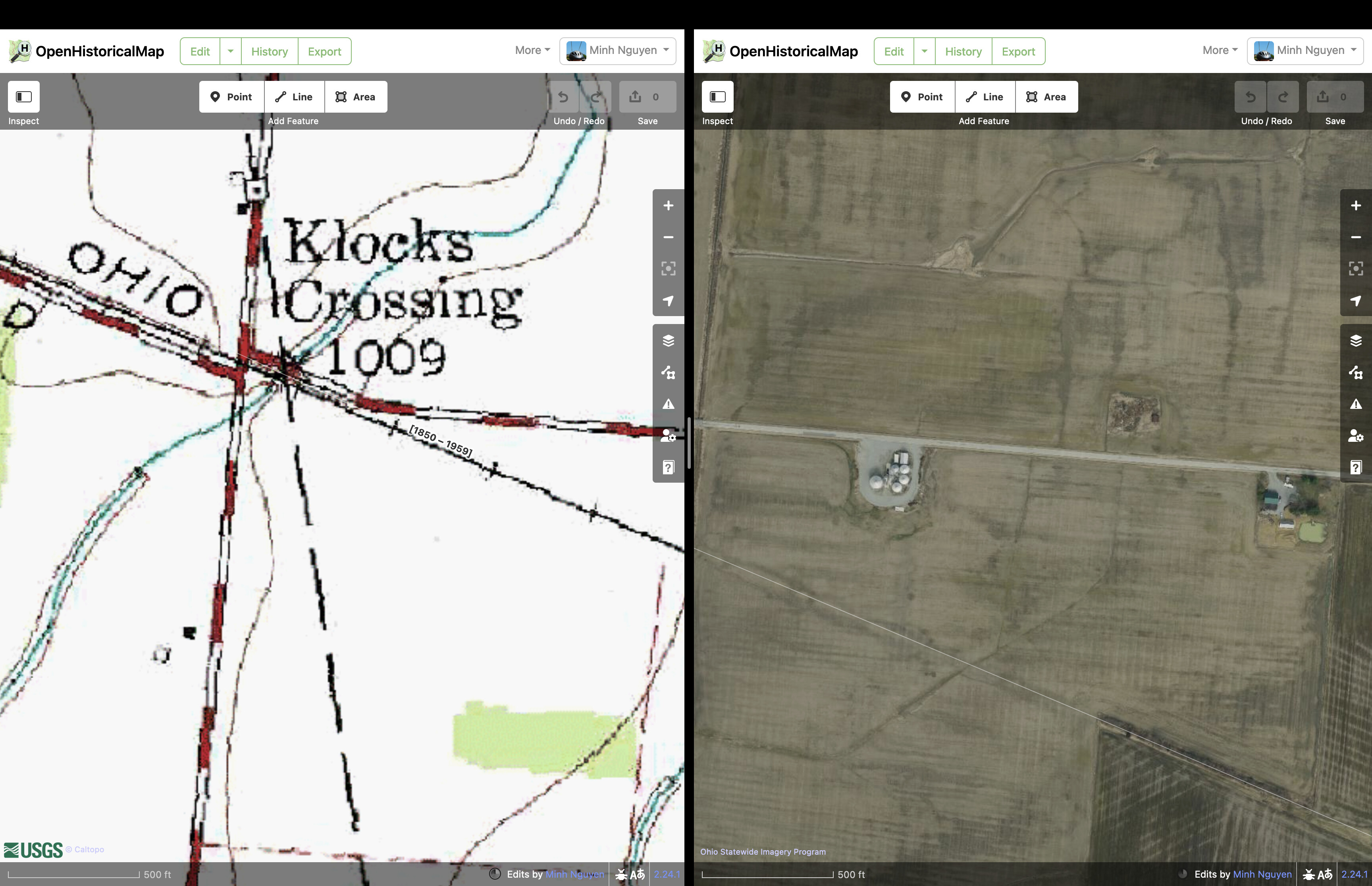
OpenHistoricalMap does things differently than OSM, by necessity. No one has developed a FOSS time machine yet, so observation can only get us so far. With observation alone, we cannot fully tell the story of a people molded by colonialism, of a minority community that was wiped out by freeway construction, of human folly that was smitten by a natural disaster. Without any observable details, any inference becomes rank speculation. This is why OHM prioritizes a third method: research. We want mappers to show their work: if you consulted a newspaper article, cite the article. If you traced an out-of-copyright map, tag the georeferenced map’s URL. If you had to guess a date out of a range of possible dates, there’s a syntax for that. And if you just came in from a field survey, that’s fine too.

Whenever tensions flare around abandoned railway mapping in OSM, I’m saddened to see someone distort what is clearly their personal passion in order to somehow shoehorn it into OSM’s rules and methods. Yes, it’s true that someone with a keen eye can spot a former trackbed in a field. Yes, as someone pointed out in Slack a couple years ago, a diver could potentially verify that these tracks from chapter 35 of Kudish have not yet disintegrated in the lakebed. But then what? Is that all there is to say about the Fonda, Johnstown and Gloversville Railroad? Whose idea was it to build a submerged railroad track, anyways? This rail coverage is devoid of context that would help users learn anything from it.

I would like to think that folks like @TNS-MN are actually conducting research, even as they try to pass it off as observation. Imagine how much happier and more productive they’d be if they could map their research, without having to make excuses. This has been my experience interacting with roadgeeks who similarly care about transportation history. One mapper in my area kept fudging rural highway classifications and mapping abandoned road alignments as the real thing, while making bold claims about improving the mobility of rural Americans left behind by Silicon Valley mapping companies. I wasn’t involved with OHM at the time, but I mentioned it to them and they took it very seriously. They quickly became one of OHM’s top road mappers in the U.S., unshackled from OSM’s arbitrary rules against historical mapping.

Both OSM and OHM need more success stories like this. I’m not much of a railfan, but I’ve never had more fun mapping abandoned railway lines than I have since joining OHM.

To be sure, research is hard. One thing leads to another and you wind up with too many tabs open. I spend hours poring over planning documents and newspaper archives just to be able to add a single building to the map. If a mob of mappers started musing about deleting my work, I’d take umbrage too. It’s not as easy as re-observing and re-mapping.

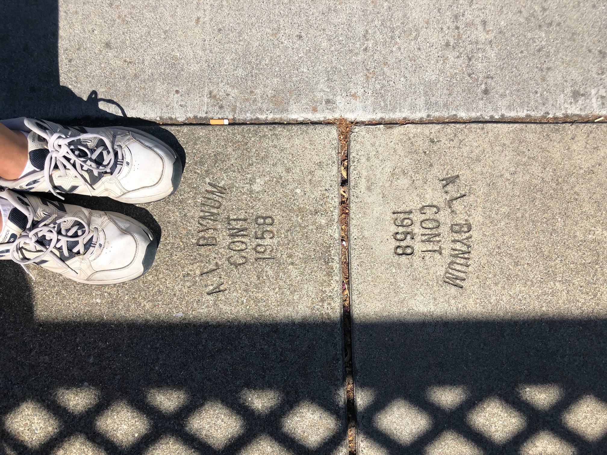
Despite the challenge of conducting rigorous research, there’s a certain joy in knowing that it’ll help someone connect the dots: why does the building have such a funny shape? What happened to the business that lent its name to the building? And guess what – anyone can do it, because unlike in other historical GIS projects, OHM wants everything to be mapped, even if academicians in an ivory tower would not deem it to be historically significant. I have mapped a favorite ice cream stand from my childhood and it gave me great pleasure. Take a break from the Internet, enjoy some ice cream, and then come back and share it with us on OHM.

4 Likes

Instead of having to infer this from the ruins being in the vicinity of a railway=dismantled, would it make sense to explicitly record it with something like ruins=railway_support_pillar?

At first glance this would seem like a win-win, but perhaps I’m missing something.

Note: I haven’t looked into whether ruins=railway_support_pillar (or equivalent) is in use. Conceptually though, it would make sense?

1 Like

You would think there would at least be something for ruins=bridge_pylons or similar, as there should be a few of them?

& after checking TI for ruins + bridge:

bridge 384

bridge_pier 5

bridge_pillar 3

pedestrian_bridge 1

railroad_bridge 1

1 Like

The problem with this is in distinguishing between the whole bridge (superstructure) ruins, and the still existing bridge understructure. The bridge piers themselves may not always be in a state of ruins, but are part of a bridge ruins. ruins= doesn’t allow this to be expressed. Using historic=ruins on every part result in multiple such feature. This doesn’t show the situation nicely. Therefore =ruins is best limited to ruins=bridge whole area, or collection of them.
There’s also no need for more disorganized ruins= , which should at least be in the already long list of historic= first. There are some historic=bridge , in support of the above method. The piers are physical structures, therefore bridge:support= + ruins=yes is enough, same as building= + abandoned=yes to describe how it exists now. If it’s really broken to unrecognizable, then a sole ruins:bridge:support= may be considered.
Fundamentally, man_made=bridge doesn’t include use info, surely for many good reasons. I don’t see a difference here. It would immediately fail for road-rail bridges, and bridges that have change between road or rail uses (although I could see some merit in showing what class of load the bridge was originally designed for). Bridges often carry utilities. This might be equally important or prominent in history, and the role doesn’t need to be diminished.
Furthermore, mainline trains or heavy rail, trams, and later metro are different. Using some railway doesn’t show what it is for, and will fall into the same defect as railway=abandoned still requiring abandoned= / abandoned:railway to be fixed. Again, it will fail for bridges that changed between different train uses. As a secondary concern, such railway terminology may cause it to be misunderstood as not including tramway or metro in the use of some languages.
If there’s truly a need to directly show what they are used for, maybe some form of train=yes etc is better. This allows the structure and function to be separated.
If the want is for relating them explicitly, type=bridge is purpose-built. That’s better than the generic and perhaps tricky =site , although some may want to debate whether ruins should still use type=bridge , or =tunnel for tunnels.

2 Likes

I agree with a lot of what you say, but what characterises OSM’s rules and methods is that we do not have a doctrinal adherence to rules and methods. We have a doctrinal adherence to “what works”. Encouraging contributors, rather than rulebook-ing them, is what works.

railway=dismantled is a lesser sin in the observation/inference sphere than (deep breath) proposed roads, maritime boundaries, all administrative boundaries come to think of it, bus routes, post/zipcodes, unsignposted road refs, the US Bicycle Route System, exactly what is a highway=tertiary (contd. p94).

Hook Norton Viaduct is much more clearly a dismantled railway than US 17 is a bike route. How anyone can justify mapping the latter but not the former genuinely baffles me.

4 Likes

It’s actually very easy to do that (even before posting here). Just search at taginfo for ruins, and filter by railway:

1 Like

I have no problem with mappers connecting the past to the present in OSM. The past always lingers in some form. I contribute to both OSM and OHM simultaneously, often mapping two aspects of the same feature in tandem. In this manner, the two projects strengthen each other.

Ironically, the counterexamples you’ve cited include some types of features that the community chooses not to map, chooses not to map directly, or has a very uneasy relationship with. To the extent that we map any of these things, it’s because mappers have been able to make the case that they have some practical utility in a use case focused on the present. Case in point: giant time zone boundaries are technically verifiable based on a few signs here and there, and theoretically on a multitude of wall clocks, but practically speaking they’ve all been mapped based on a close reading of the legislation. For these boundaries, the issue of verifiability is really a distraction. It doesn’t take a lot of imagination to come up with the real justification, that these features are useful on a general-purpose map; indeed, they’re widely used in time zone selector maps.

Unfortunately, every time the abandoned railway issue comes to a head, it’s a case where the railfan has already engaged in self-censorship in a futile attempt at playing by “our rules”. I do find that sad. If we were to allow them to fully map what interests them, what we would have is OHM. (Whether to merge the two projects would be a topic well beyond the scope of this thread, and a bit of the tail wagging the dog.)

1 Like

That’s not really a characterisation I recognise. I don’t map (or not) Hook Norton Viaduct out of self-censorship, I map it because I see “dismantled railway viaduct”.

What’s useful on a “general-purpose map” isn’t and shouldn’t be a principle for OSM. There were adequate general purpose maps in 2003 and there are many more now, these days often produced by some guys in Mountain View. OSM’s strength has long been in specific-purpose maps.

As always, it’s about harnessing the many different enthusiasms of millions of contributors, rather than corralling them all into a singular vision which they may not share. There are lots of things I don’t like in OSM, including many I don’t think should actually be there at all (mutter mutter East Coast Greenway mutter), but I don’t start threads proposing they should be removed. Why? Because the cumulative effect of motivated, empowered contributors is much more important than my own personal interpretation of data purity - an interpretation that may not be shared exactly by anyone else. I would far rather write one line of code to say “don’t give the East Coast Greenway a routing uplift” than write 1000 lines of forum spleen, thereby putting off countless contributors, to say “don’t map the East Coast Greenway”.

And here I am, once again having been sucked into writing 1000 lines of forum spleen to defend a status quo which works. Hey ho.


It’s no coincidence that the Ordnance Survey, the inspiration for OSM in so many ways, actually uses the phrase “Dismantled Railway” on its maps:

(extract from OS 1:25k map of Hook Norton, used here under fair dealing provisions)

…I’m a bit worried that I’m giving the impression Hook Norton is only remarkable for its viaduct. Hook Norton is chiefly remarkable for its beer. If you like beer you should visit. (I don’t. I like viaducts though.)

I do find that sad. If we were to allow them to fully map what interests them, what we would have is OHM.

I fully map what interests me and what I have is the New Adlestrop Railway Atlas :wink:

5 Likes

I bring an example to better understand why I think that razed railways has been mapping wrongly some time.


This is a situation near where I live. That razed railway (a tramway to be correct) has been dismantled since 1917 (Fornaci–Treviglio–Caravaggio tramway - Wikidata) but it’s still being mapped in OSM even if there’s nothing left of it. Why should it be mapped?

4 Likes

Hook Norton Viaduct has clear remains so I expect that extreme minority would oppose mapping it.

Railfans are problem where they map bridges/railways/stations in places where all remains are utterly eradicated.

Potential confusion is caused by some people using “railway=abandoned” for “some traces are remaining” and “railway=razed” for “nothing at all remains in place of former railway, all traces are gone”.
While Proposing to deprecate railway=razed and railway=dismantled - #64 by Richard describes a different use of tags (and I would love if this tags would be used only in such way).

(similar in size to people who wanted to limit name to names signposted on physical signs, replace name tag by using wikidata tag where names would be stored and similar fringe ideas)

1 Like

Well, what remains is a terrain feature that runs for miles and miles, even including bridges with very low ascent/descend. For one this is still visible (“hello” to the principle you quote) and second this may attract hikers and bikers, i.e. has practical impact.

3 Likes

Perhaps, then, I’m reading too much into this discussion based on other flareups that have happened on the mailing lists and Slack, involving well-respected community members who wound up demotivating everyone else by their idea of data purity. To paraphrase: “You must consult me before touching any of the rails I’ve mapped, because I know a lot about this subject.” Does anyone recognize OSM in this proof by authority? I don’t, and every time this issue flares up, I have less sympathy for those who take this approach to defending their turf. To be clear, I greatly appreciate that folks here on the forum have been much more magnanimous; if only that were always the case elsewhere.

We may not agree on the precise contours[1] of what constitutes a “general-purpose map”, whatever that is, but why spend all this energy defending a small subset of rail history when the real deal is such a greenfield waiting for our attention? If someday OSM feels FOMO from all the rich content in OHM and relents on this point, we can all celebrate.


  1. Don’t look now, but we don’t map contour lines either, and those are essential to some widely used OSM-based maps. :wink: ↩︎

Yep. There are two (IMO) important nuances to this though.

One is that “all traces are gone” is in the eye of the beholder. A subject specialist may be able to see traces where a casual remote mapper couldn’t. In this case we should always defer to the subject specialist. OSM thrives (I’m repeating myself here) by collecting the knowledge and enthusiasms of subject specialists.

The other is that mapping an absence of something can in some circumstances be valuable information. If a railway trackbed is mostly in evidence, but it has been bulldozed for 100m by a motorway crossing[1], then railway=dismantled is actually pretty useful to say “hey, this bit of the trackbed is the exception in that it has gone”. This is personally how I’d judge @Mannivu’s example - if significant other parts of the tramway are still extant then it’s worthwhile to say “this bit has been blatted”; if the tramway is almost entirely lost then I wouldn’t.

An analogous situation happens fairly often in the UK, where a public right of way (the legally defined path) crosses a field, but the actual path as walked by people goes round the edge of the field. In this case it’s useful to map the PRoW in a way that conveys “there is an absence of a path here”, because the presence of a path is what people would otherwise expect.

As always, these are my own personal judgements. Other people might prefer having no way in the “blatted” case, for example. I believe it’s more important to foster community than impose my own judgements on other mappers, and I would hope others take a similar approach.


  1. …I could link to a subreddit here which conveys my view on car culture but won’t because its name would set off various alarms ↩︎

2 Likes

Hi,

As always, it’s about harnessing the many different enthusiasms of
millions of contributors, rather than corralling them all into a
singular vision which they may not share. There are lots of things I
don’t like in OSM, including many I don’t think should actually be there
at all (mutter mutter East Coast Greenway mutter), but I don’t start
threads proposing they should be removed. Why? Because the cumulative
effect of motivated, empowered contributors is much more important than
my own personal interpretation of data purity - an interpretation that
may not be shared exactly by anyone else.

This lovey-dovey line of reasoning (in a similar discussion on the
German forum someone said “live and let live”) could, in this
unqualified form, be used to support any number of really damaging
mapping activities in OSM.

Of course we all want to be friends and be happy together with our great
project, and have a nice time and a fulfilling hobby, attract new
contributors who add useful data and do new and unexpected things with
OSM. Yay for world peace!

But the individual’s freedom to map what they fancy must find its limit
where their activity hinders that of others, and for me that point is
reached when someone draws a railway line across the center of the city
just because there used to be railway before the apartment blocks were
built. (This has actually happened in the city where I live.)

And this is not something that you can fix with “writing a line of
code”. On the German forum the abandoned railway enthusiasts have gone
so far as to say “well if you find that this is a problem for your
mapping, just set your JOSM filters correctly” - and certainly “having
to install JOSM and fiddle with its filters” is not the path to
“harnessing the many different enthusiasms of millions of contributors”.

Bye
Frederik

8 Likes

As I said above, I’d love to take data from both OSM and OHM. It sounds like I’d need to take some types of features only from one, and some only from the other. Technically that’s doable, but it does mean that all railway=dismantled etc. would need to be moved from OSM to OHM. It would appear based on posts above that that isn’t going to happen for licence compatibility reasons.

A solution would be to for the people who hate seeing railway=razed and railway=dismantled in OSM to resurvey all these features from OHM compatible sources and add them to OHM themselves. That would be a lot more work than creating long forum threads on Discord and here, so it’s unlikely to happen.

If that’s not an option then a discussion about individual features does make sense. Hook Norton Viaduct does make sense to map in OSM as something. We can discuss the best “something”, but what’s in OSM now is one good option. The “railway replaced by a lignite mine” makes far less sense to map in OSM (OHM might be the perfect answer there, but someone needs to do the work of adding it). In between the two are things like this - where there’s nothing left but it’s really quite obvious when stood at one end where it went.

Obviously a “discussion about individual features” is pretty much what the current status quo in OSM is right now. You might not like the way that some things are mapped (or even that they are mapped at all), but like we all do all the time you need to just Deal With It and carry on.

4 Likes