Since this is the Year of Vector Tiles on the Main Website, I was excited to try out the demo of Shortbread vector tiles that @pnorman just posted, which is updated minutely based on OSM. Unfortunately, the Shortbread schema omits railway=abandoned/razed/dismantled, so a style based on this schema can’t display abandoned railways even if it wanted to.
By coincidence, OpenHistoricalMap also has minutely-updating vector tiles, so we can composite both tilesets together on the client side so that users won’t know the difference. I filtered the OHM features to just the railways tagged with an end_date=*, so as to avoid duplicating OSM’s comprehensive coverage of the present day. I gave the defunct tracks a heavy blur so that you can distinguish them from extant tracks.
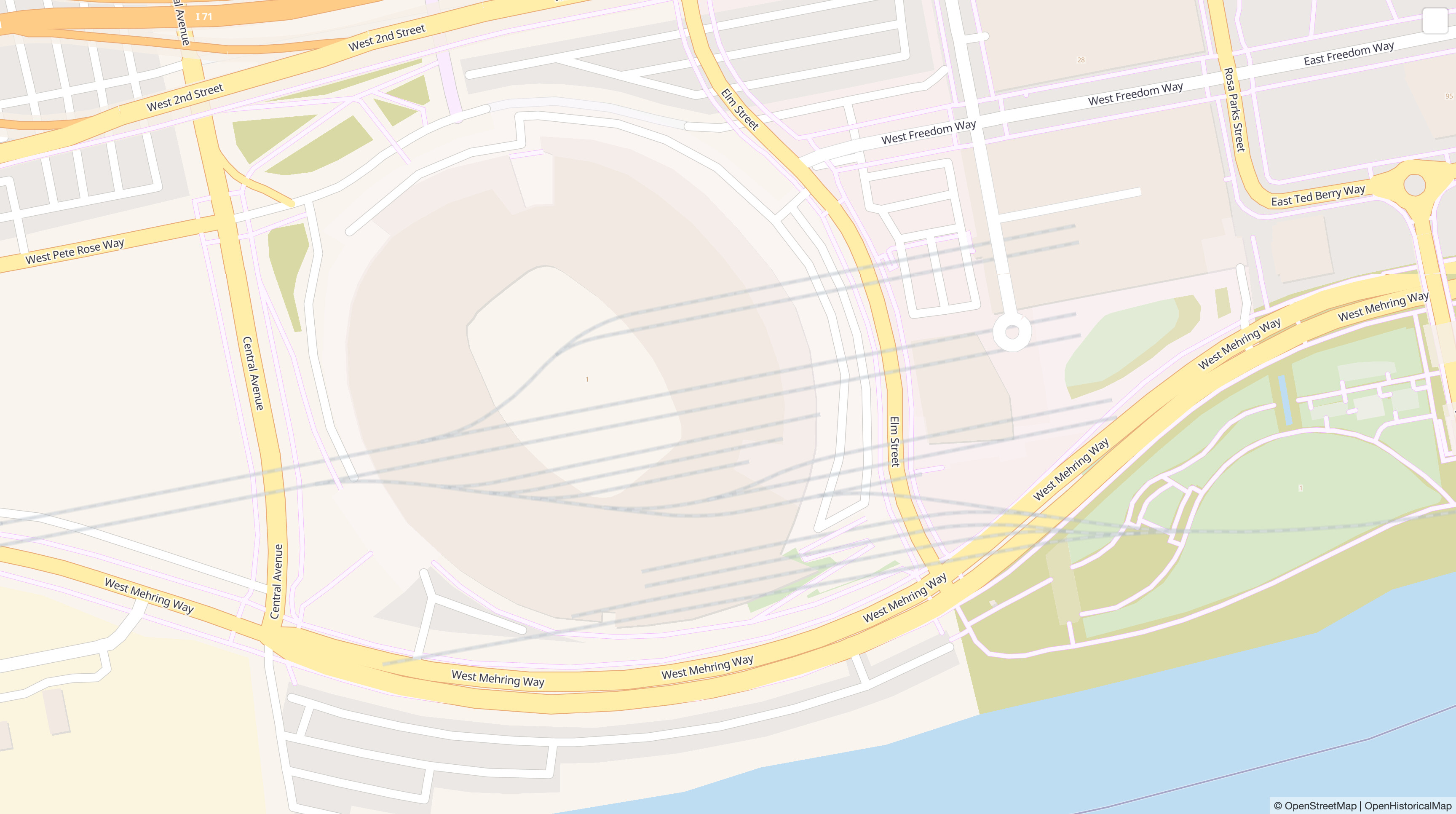
This rail yard in Cincinnati has since been redeveloped into an NFL stadium and extensive parking lots. The former sorting yard is well known to locals who remember the 1990s, but it was thoroughly obliterated and has never been mapped in OSM (compare):
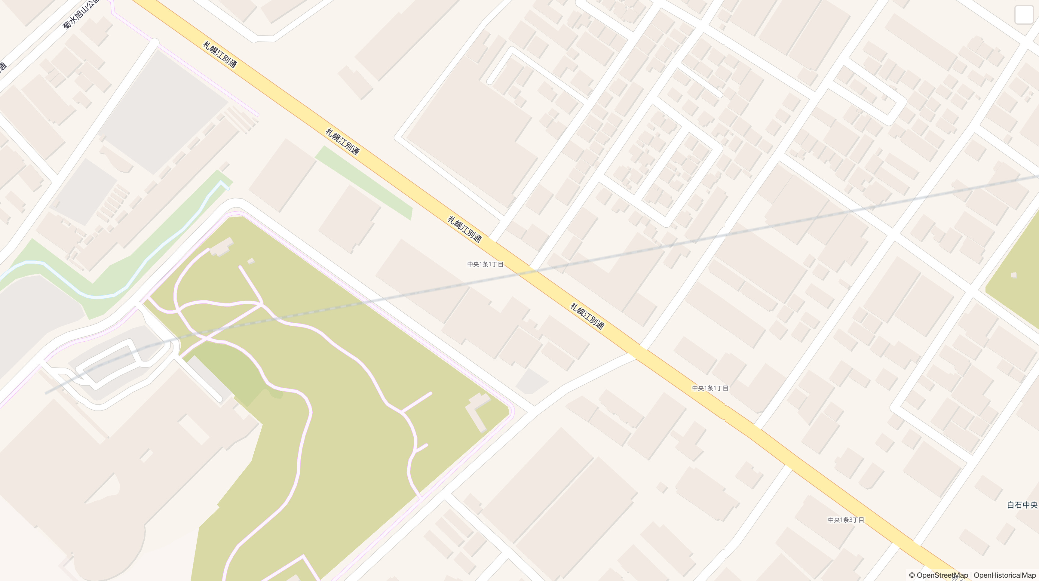
On this day in 1945, a spur of the Chitose and Jozankei Railway closed in Sapporo. It has since been built over (compare):
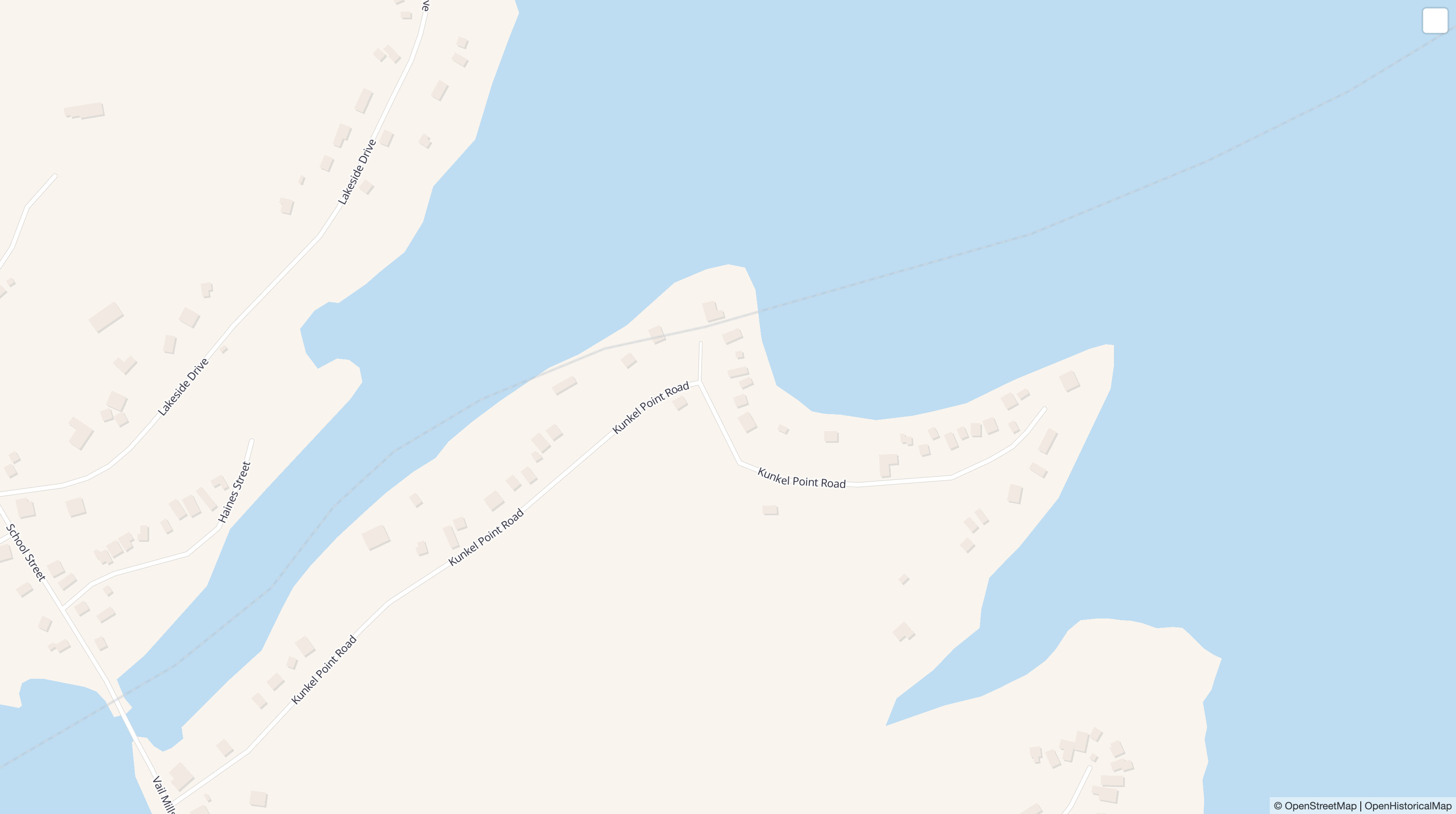
Actually, I fibbed. The track was built on dry land, but it was inundated when a newly built reservoir flooded ahead of schedule. One mile (1.6 km) of trackage was left under the reservoir until the following year. There’s still a railway=abandoned in OSM, under the assumption that some portion of the embankment must surely still be present after all these years – right? But I didn’t wait around for a wealthy eccentric to fund an expedition to the lake bottom. I added the tracks to OHM with an end_date=* and refreshed the page 15 minutes later (compare):
With a bit more copy-pasting, I could have also restored defunct highways, buildings, or riverbanks onto the map, or varied the opacity based on the elapsed time since dismantling. We’re living in the future!
The source code for tweaking the demo style is available on GitHub, in case anyone is interested in learning how to composite two vector tile sources like this.