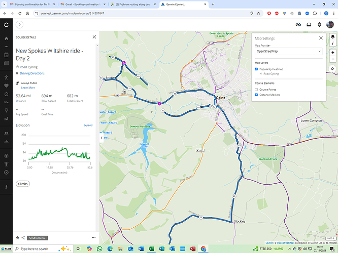
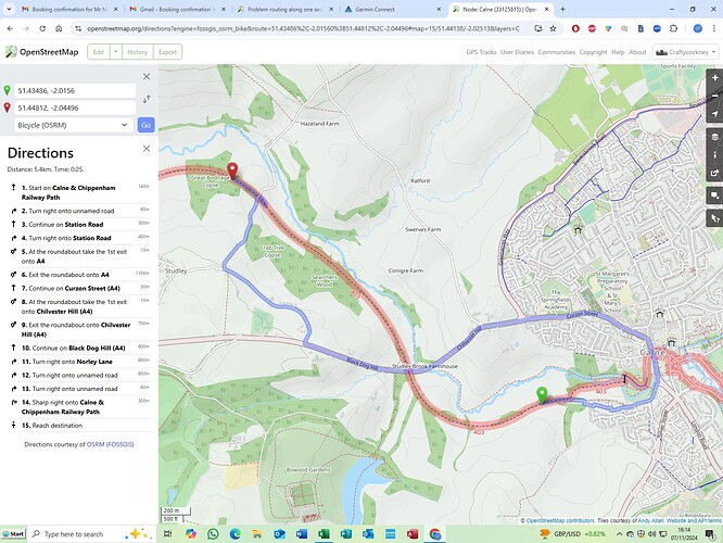
Can anyone see what is wrong routing a section of the Sustrans cycle route 403 northwards from Calne to Chippenham UK near A4 crossing? Acts as though route blocked but no evidence of it. Only seems a problem with Openstreet maps?
There’s a small gap in Chippenham, but I presume you aren’t asking about that. Can you link to something that gives an incorrect route? It might just be a router being slow to update its data.
I don’t see a problem per se, it’s probably just that the bike routing profiles you’re using on osm.org prefer paved minor roads to cycleways with “intermediate” smoothness and an “unpaved” surface.
Thanks. You have identified the problem. I had set profile to ‘road’ on connect which normally works fine on cycle paths . Tried ‘gravel’ which gave same problem but profile ‘mountain bike’ works! I wouldn’t say the cycle path was a motorway but seemed perfectly ok on a touring bike
However a quick glance at the descriptors for the cycle path section that works with ‘road’ is the same for the section that doesn’t work. Why?
What might help would be to link to the actual way ID in OSM that it’s avoiding - zoom right in at osm.org, and then use “query feature” (the arrow / question mark icon) to see which way it’s avoiding.
One problem that it might be is that something is using “German trunk road rules” (that you can’t walk or cycle on what they’d tag as a trunk road). That affects at least one of the routers on osm.org, and unfortunately also affects foot routing even if a sidewalk is mapped.
I don’t know what Garmin Connect is using internally, but I do know that Garmin uses OSM POIs extensively now. I also know that the Garmin GPSMAP65s in my pocket is infected with the same “German virus” - in this case entirely my fault as I’ve not amended routing rules for trunk roads from the mkgmap default, which apparently has the same “feature”.
Thanks for the response. I am still finding my way so your query check may be beyond my skills at the moment. . The section is a cycle path which is described as far as I can see is exactly as preceding section that the road profile accepts. surface = intermediate which should be ok for road cycling. I am considering reinstating the problem section so see if it makes a difference?

