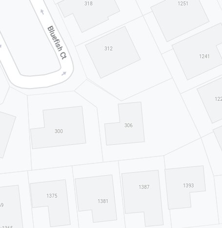
Cadastral boundaries are extremely useful, but as someone who manages them for a county as my day job, I can tell you that they are very approximate at best. In some areas, they are off quite a bit, and it’s a massive task to actually get these things located correctly. Bringing parcel data into OSM would almost certainly be imports from “authoritative” sources like the one I manage. I’ve worked with surrounding counties as well (admittedly a sample size of a half dozen here), but all of them are pretty iffy in places, and I would be wary of importing any of it wholesale.
Also, in Illinois, maybe other locales, only a licensed surveyor is allowed to legally say where a boundary actually is, and showing the information anywhere else has to come with big disclaimers on it.
But anyway. I think cadastral data from counties and similar should be treated the same way that we do TIGER data: maybe an okay starting point, but requiring a lot of checking and cleaning before it can be considered reliable, current, and accurate.
For OSM specifically, I think we very quickly run into the problem of verifiability. The average person is not equipped to go out and locate the boundary markers, so how can we add these features to OSM with any confidence? Or edit them after they are imported? At least with TIGER, you can see where roads are in an aerial, and an offset by a couple feet isn’t huge.
With property boundaries, though, even a few feet can make a huge difference, and there’s no clear distinction between well-located boundaries and approximate ones in your typical cadastre. Also, they are always changing. We split hundreds of parcels a year, and are always working on refining the placement of existing boundaries. You couldn’t do a one-and-done import, and changes to boundaries would not be obvious in aerials or on the ground. Keeping this kind of data up to date would be a massive undertaking.
I’m not against adding this data to OSM, but I think it’s such a monumental undertaking to actually do it well, and maybe impossible / illegal to do with any claim of accuracy. But hey, more power to the one who wants to make the attempt!
