Just a general question because I generally see maps in Marble on my laptop, or on the main OSM page in my browser–that makes no difference–and I always apply a 2.2 gamma correction to make things visible and colorful.
I think the map would be beautiful and colorful on an old PC with a CRT monitor, but washed out on many laptops with LCD’s. That’s the case with my laptop, anyway.
Has any thought been given to the colorspace into which map tiles are rendered?
Most image formats can carry colorspace tags and modern browsers are capable of interpreting them. Possibly not the case with Marble, though. Old Macs, prior to OS X, operated in a “split the difference” 1.8 colorspace, iirc.
Just wondering, and I haven’t found a forum specific to rendering.
I’ve looked at some tiles and they are indeed tagged sRGB. They are still washed-out even viewing directly in firefox. Must be a crappy LCD screen. I used a tile representing both mapped and unmapped areas, /14/3942/5895.png.
Does anyone see the main map as washed-out? If so, what are your viewing conditions, e.g. LCD without any profile, etc.
sRGB approximates pre-correction with the inverse transfer function of CRT display, so when fed directly to a linear DAC (and suitably black level clamped) should produce the right grid drive for an (idealised) CRT to produce the correct colours.
The convention, on the web, has been that images served from a web site should be in sRGB colour space. The combination of web browser, OS and device driver, should apply the appropriate transfer function to make them work properly.
An image recorded with gamma 1, i.e. the number directly reflects the light energy received, would actually look too dark on a correctly set up browser, so your additional gamma 2.2 correction is almost certainly being applied in the opposite direction to that needed on an image in any colour space that is likely to be encountered on any current real device. As such, I think the images are intended to be in the sRGB space already, and you just don’t like the the relatively bright (and low saturation) colours being used.
My guess is that the the designer wants to maintain a high colour contrast between the background and the text labels, which is important for accessibility, for those with poor vision.
(If you needed to darken the image by gamma 0.455, on a system that displays web images correctly, it would mean that the image would have had to have been pre-corrected by gamma 4.4, which is just not a colour space anyone uses, even by mistake.)
The other possibility is that your browser/OS/driver combination is set up not to apply the sRGB profile when displaying web images. That would produce a seriously washed out display, but would represent a broken web browsing platform, possibly as the result of not installing the correct ICC profile.
Yes, my “correction” is in the opposite direction. I don’t actually have a profile applied, but instead have a script to run “xcalib” to adjust for various viewing conditions. One of the problems is that this is for a laptop mounted in a car, where I may be viewing at a glance a display with a lot of incident skylight (and it really is a crappy low contrast display). However, an OSM map looks better (to me) at gamma 2.2 even under idealized viewing conditions.
Another viewing condition is nighttime use, where I want to minimize total light output so my eyes can retain their dark-adaptation, hence the script, which I’ll reproduce below.
I have verified that firefox applies corrections for images it is displaying, and they mostly look approximately right with no additional correction applied; it is just OSM that looks especially washed-out, so I thought I would ask.
Here is the script:
#!/bin/bash

if test -f ~/.inverted-display; then
    if test -f ~/.altered-display; then
        xcalib -c;                    #this is a normal display
        rm ~/.inverted-display ~/.altered-display;
    else
        xcalib -co 66 -a;             #nighttime away from city lights
        touch ~/.altered-display;
    fi
else
    if test -f ~/.altered-display; then
        xcalib -c;                    #nighttime inverted display
        xcalib -red 0.7 0 100 -green 0.7 0 84 -blue 0.7 0 67 -i -a;
        mv ~/.altered-display ~/.inverted-display;
    else
        xcalib -gc 2.2 -a;            #high gamma for incident sunlight
        touch ~/.altered-display;
    fi;
fi;
Yes, there are people who don’t like the washed colors on the default map style (called OSM Carto), but it seems to me that we need more or less toned down palette for backgrounds, so the lines and POIs can be more visible.
The OSM standard rendering isn’t intended to be used in that way. It is a map for mappers, not a map for drivers, so it is intended to be looked at closely, not glanced at. OSM doesn’t have the resources to provide free tile servers to end users.
Well, I am convinced the choice is deliberate (and the tiles are properly tagged), but I would note, given that most streets at Z>12 are white, and the rest are wider, have higher saturation, and are fairly bright, that just about any addition to the map serves to increase contrast. I find that an aid to my old, presbyopic eyes, and I think a more detailed map is a better map.
I don’t see much difference using the map for mapping or for navigating, either way it is a reference as to location or to see the general state of an area, after which I set it aside. I don’t do many POI’s, but I’ve done plenty of amenities, ranking them after addresses, buildings, landuse, and natural features.
I do gamma adjustments in JOSM also, increasing the gamma space for the OSM map, and decreasing it for imagery. For imagery I am trying to bring details out of the black.
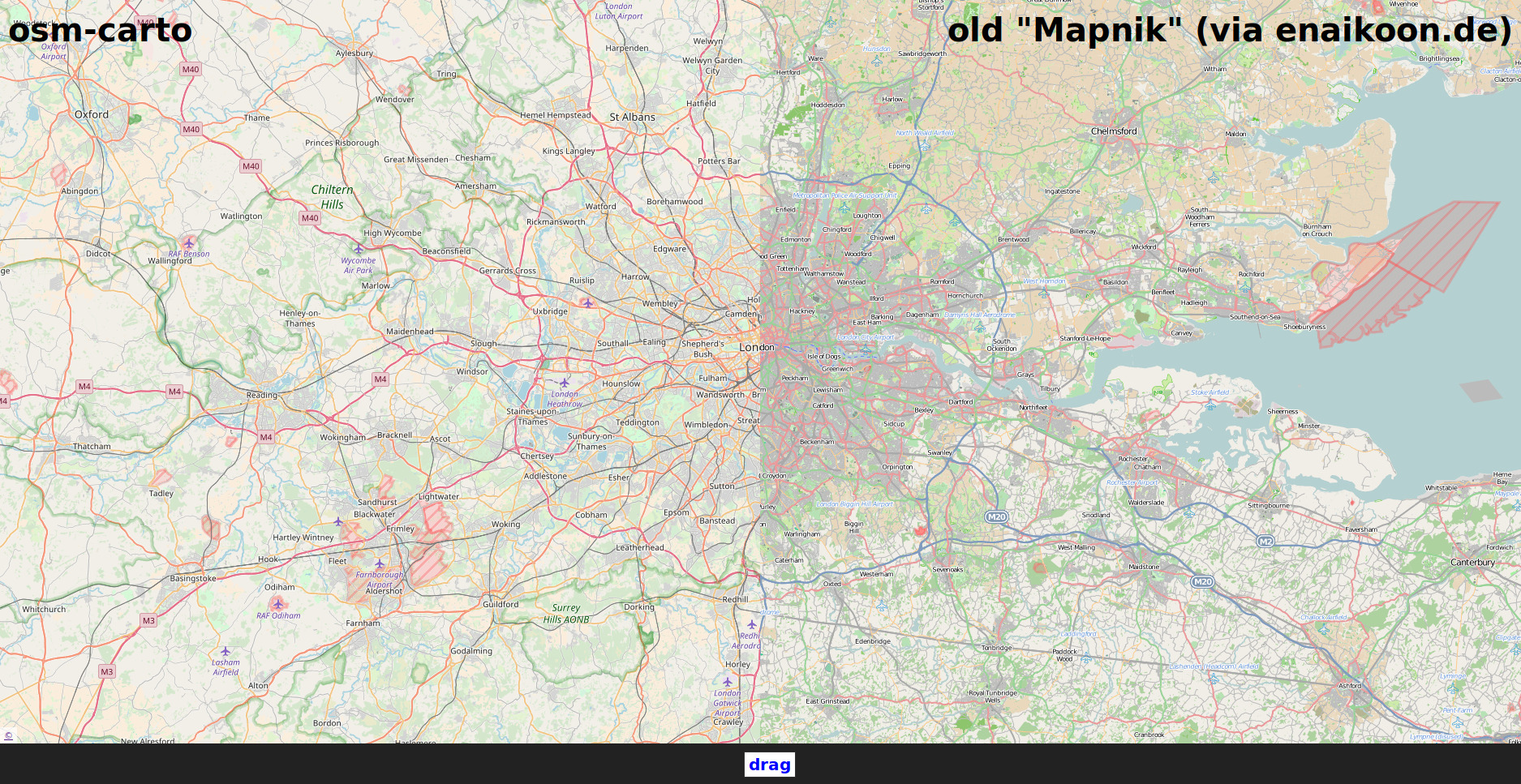
There are some styles with strong colors, but that doesn’t mean better contrast. When everything is saturated, you loose details. Just look at this comparison:
@rhardy Rather than adjusting the brightness of existing rendered tiles why not create your own map style with features in the colours that you want? There are quite a few different styles out there but most are what could be called “special interest” or lack too many features to be generally useful.