I’d like to discuss the current usage of the barrier=fence tag on nodes. While I understand the general logic behind restricting this mapping approach in the current version of OSM wiki page, I recently encountered a specific case in my hometown that made me question this restriction.
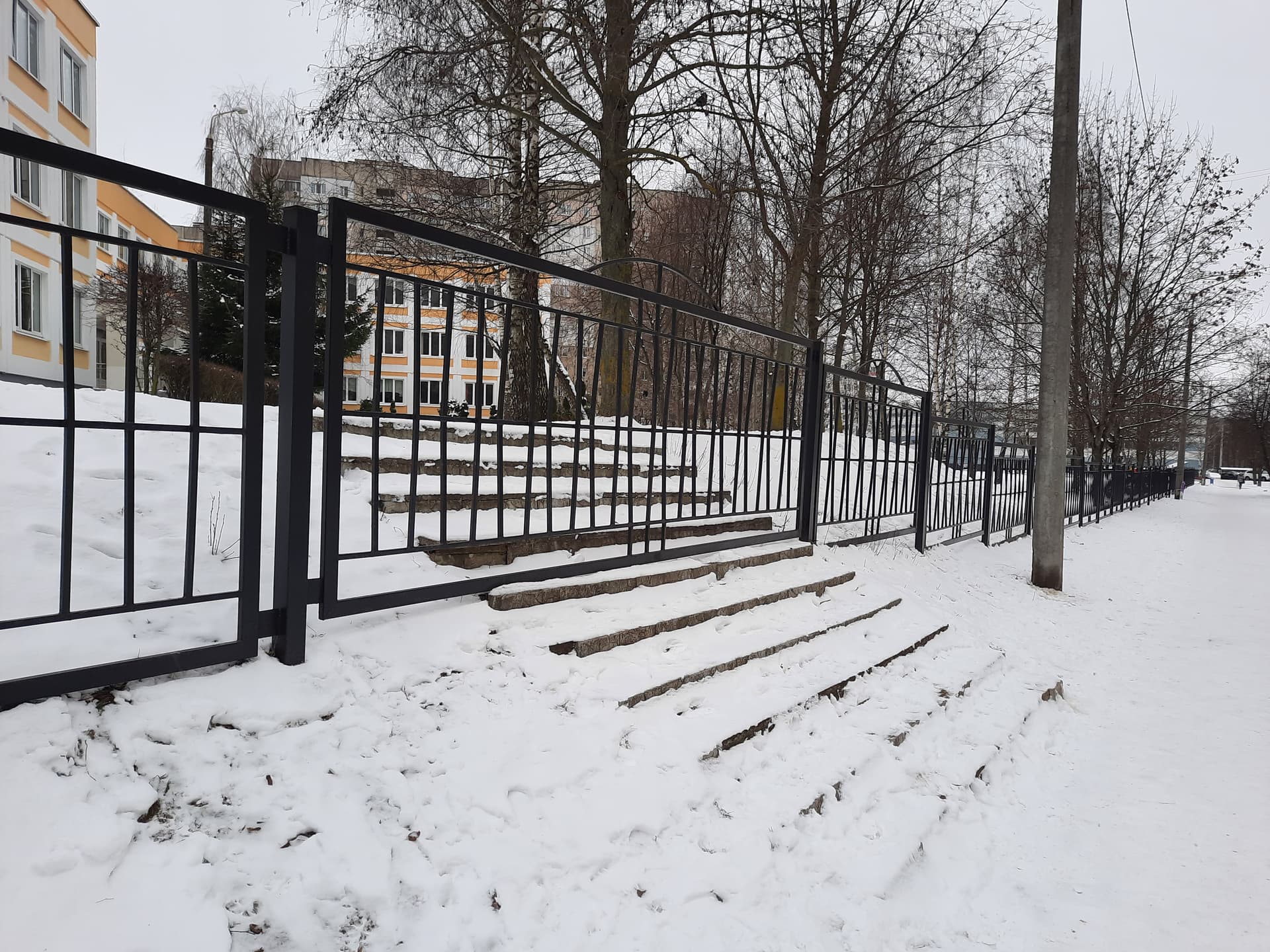
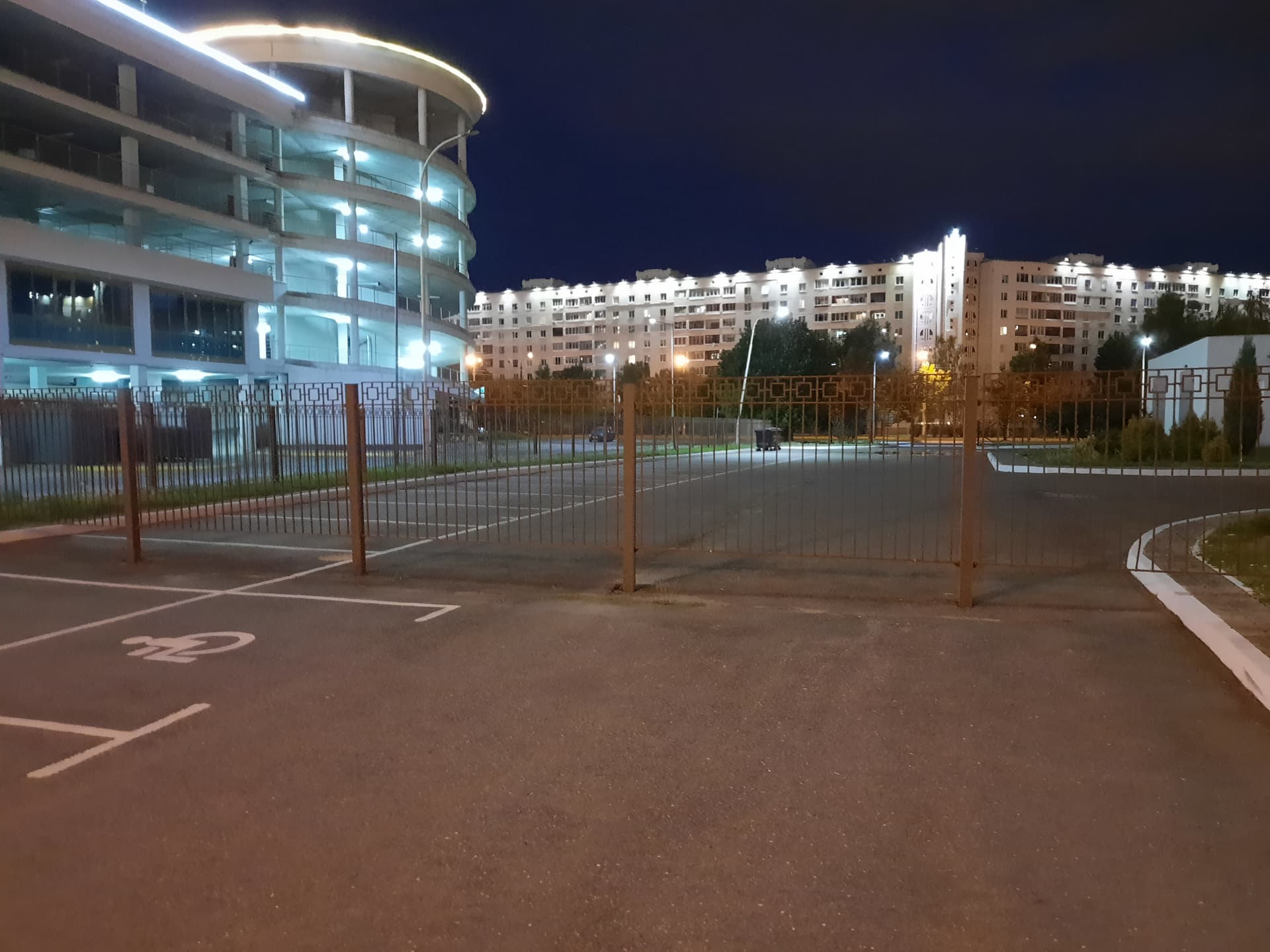
In my city, there was a municipal program a few years ago aimed at fencing municipal buildings, resulting in the blocking of many existing roads, paths, and footways with fences. Here are two examples:
I have come up with some mapping approaches acceptable to the Wiki and validators for such situations, such as splitting the road lines or using barrier=yes with explicit access=no. However, in my opinion, it could also be a logical option to add explicit barrier=fence with access=no to the road node, and here’s why:
The road itself still remains continuous; the only change is the presence of a barrier - fence in this case (but the ‘road’ definition may be questionable in this context, though). IMO it’s similar to other barriers like jersey barriers or blocks on the road, which are acceptable when mapped as nodes without splitting the road.
Satellite imagery often makes it difficult to distinguish between gates and fences in such cases. By explicitly tagging the node as barrier=fence, we can prevent potential misinterpretation and avoid connecting divided roads or adding non-existent gates.
From my perspective, using nodular tagging for fences in such situations makes sense and better reflects the physical reality. It’s worth noting that there are more than 10k existing nodes with the barrier=fence tag. While most of them might not be relevant to this specific use case and probably were added mistakenly, I believe some have been used in similar scenarios.
Note that it is quite normal that one continuous road in OSM is split in several OSM ways, even if there are no physical changes whatsoever (e.g. one might split a road to two ways tag that different parts of it have different maxspeed=*)
So I see no problem with road being split to two ways to put barrier way between them. But since that barrier=fence on the picture does not allow in any way for vehicles to pass through, I’d second @Mateusz_Konieczny that those are two roads indeed, and should be mapped as two separate non-touching ways tagged with highway=service (or other highway value), each with noexit=yes on its end (and with barrier=fence way going between those noexit nodes).
The fact that those two roads are separated with metal fence instead of (perhaps more common) concrete kerbs or brick wall is not of a big importance. If vehicle cannot get from one end of it to the other end of it, it is IMHO not a “continuous road” (i.e. not a single highway=residential or highway=service or whatever)
Sometimes having a fence or wall as a node can make sense, e.g. here: Node: 16157102 | OpenStreetMap or here Node: 4221664684 | OpenStreetMap where extra effort would be required to determine what the barrier is beyond the immediate vicinity of the road.
I can’t see if the fences on the photos continue beyond the steps/road they are blocking: if they continue, I’d map them as ways for their entire length. If not, I’m in favour of mapping them as fence nodes. Imagine a structure which is best described as a fence is blocking a road, but not the sidewalks (i.e. its length is the same as the width of the road, and it can’t be opened so it’s not a gate). Then it is not fundamentally different from other blocking structures like jersey barriers, bollards, debris, etc. So why should we bother to map them differently, like @Mateusz_Konieczny proposed? Mapping them as fence nodes is less “terrible” than mapping them with two no_exit nodes, I think.
Example of a guide rail used to block off a road: Google Maps
In a car of separately mapped sidewalks (useful anyway in such case) I would map that short fence section between sidewalks.
In case of mapping sidewalk as property: not sure how to express that you can walk through blockage. barrier=fence foot=yes is really confusing and looks like some mistake.
That some barriers are passible by some form of transport while not by others is not unique to fences. The wiki makes suggestions on how to map that (block, bollard, planter, etc.)
Yes, but for block, bollard, planter it is relatively normal that you can walk through it while for fences mapping “applies only to part of way” is quite unusual.
I find splitting ways overkill. Bollards placed on a way are already designed to stop vehicle access to the rest of a road way.
In this case bollards are being used to block access to the other half of the parking roads across an otherwise physically unbroken parking lot. They should automatically imply each way with a bollard is impassable by any vehicles larger than a motorcycle.