50 words for drainage…
I’ve said before that it’s a shame that OSM didn’t start in Germany because some of the terms are just more preciise.
Presumably the caveat to that would be to outsource all water features to the Netherlands ![]()
50 words for drainage…
I’ve said before that it’s a shame that OSM didn’t start in Germany because some of the terms are just more preciise.
Presumably the caveat to that would be to outsource all water features to the Netherlands ![]()
You mean präzise? ![]()
True…just like with any other discussions about proposals.
“Ditch” would be in my opinion what Peter said, usually by the side of the road (either dug on ground or built up with cement) used to gather the rain water from roads, and which may be standalone network or connect to stream/river. This connection may not necessarily follow the road till the end but go in-between farms for example.
As usual: function and appearance are intermixed with language differences and idiosyncrasies. We dig ditches for drainage: some say: drains, obviously, while others say: no, ditches, obviously. The OSM-result is that ditch and drain are considered equal.
Still, my preference is to use waterway=drain only for a specifically constructed channel to drain excess water from e.g. a mill (just learned that a mill includes all kinds of factory, not only or milling) that uses water eg for power or for cooling, which has to be drained afterwards. The Dutch word would be “afvoer” (‘carry-off’). Drains should have a clear origin, obvious flow direction, clear destination and clear purpose. Constructed rather than just dug out. So not everything used for drainage is a drain, and even if a ditch is mainly used for drainage of an area of land, it’s still a ditch.
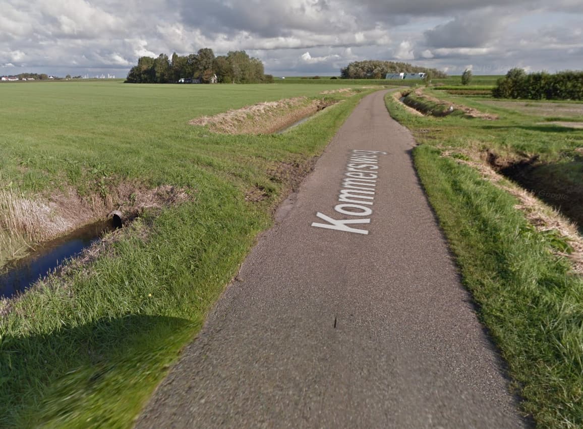
Ditches in a polder, Dutch countryside, below average sea level, protected by sea dykes with a foot width of 50 meters.
Blockquote Others think ditch is the word for Dutch “greppel”, that’s why they map a “sloot” as drain. A “greppel” is a roadside furrow, dry in dry weather and only wet when it rains, to get the water off the road faster. Sometimes connected to the water network, sometimes standalone. Which is… just like the elongated swales.
I think ditch is English for Dutch “sloot” AND Dutch “greppel”. I try not to hang on to one translation.
Yes, I admit I slightly forgot about the Dutch “greppel”. “Greppel” being the feature that is the majority of time dry, “sloot” the majority of time or always with standing or running water.
Still, even with that in the mix, few would call the features now tagged as “ditch” in the fields of the Netherlands “greppel”, because like the examples shown, “greppel” is usually for a larger, more deeply cut out furrow, and as you said usually for road side features.
Maybe it would be “greppeltje”, the diminutive form in Dutch, but I don’t know if farmers in the Netherlands actually have their own nomenclature for these features.
All in all, I feel the suggestion by @indigomc of waterway=swale is by far the best solution to represent it in the English language. Looking at images on the internet, the features shown for “swale” come closest to the form and function of these Dutch “greppeltjes-in-fields/meadows”: both being usually shallow, and a mix function of “just collect water from surrounding higher ground”, to “drain excess water to a nearby ditch or other waterbody”.
I would support such proposal and converting all of them to waterway=swale in the Netherlands.
Of course, any over-rigorous checks for non-connected waterways in OSM QC tools, would preferably need to add some latitude for the often non-connected swales, that simply cannot be really considered part of a true waterway network.
Geul?
I am currently mapping a lot of fields, mostly farmland, with a large number of non-connected ditches and water-collecting artificial depressions, which are currently not mapped. I could map those as ways tagged waterway=swale.
I am not prepared to tag water areas in those fields, because all the fields would become multipolygons. I don’t think these swale ditches are worth the hassle of MP’s.
So, only ways and only the ones that would otherwise not have been mapped at all; tagged as waterway=swale.
Going international would probably require a proposal.
We could do it for Nederland if we get consensus in the Dutch community. We’re not touching existing approved tagging.
Probably it’s possible to identify possible swales by selecting waterway=ditch|drain with both sides not connected to another waterway or water area. I couldn’t, but I’m sure for some mappers it’s a piece of windmill cookie!
It’s great to see such a productive discussion! ![]()
There are about 1,200 objects tagged note=swale around Santa Cruz, California. About 1,000 are from an import in 2009, the rest have naturally been added. Tagging @stevea who has recently touched such an object, so he’s aware of the discussion.
In my understanding, for objects that you mapped yourself, you don’t need a proposal to “legitimise” such an edit, especially as it’s a relatively small number contained in one small area and we don’t know of any data consumers using this tag. But of course a proposal could still be useful to get the community on board and make the tag more widely known.
The swale tagging (and it is a note=swale tag, so “not terrible”) came from an import I didn’t do and has associations with an intermittent=yes tag I have been improving (as have others, I think) and documented in our wiki.
Here I found some nice linear swales in a decommisioned meadow, in a rainy period:
(GM screenshot so not suitable for our wiki)
I have drawn many of these as waterway=swale in the last couple of weeks. Saved a lot of ditch mapping. I have also added quite a few natural=water, water=swale areas. And a lot of shoals that had mistakenly been mapped as tidalflats, which has nothing to do with swales except I didn’t know both and now I do.
From the usage of ‘swale’ that I’m familiar with, in the UK, it is never used (or rarely used) for flowing water. So it would probably be ‘water’=‘swale’, not waterway. But there are many instances of marking as ‘waterway’=‘swale’ in the US, which I’m guessing are occasional streams. How the latter differs from an intermittent stream seems unclear.
I only use it for non-flowing water. If it’s a very elongated, purposely made and shallow depression, I think it’s a waterway. If it’s usually dry except when it rains a lot, I would not draw a water area.
If it’s deep enough to be usually filled with water, I use waterway=ditch if its narrow and elongated, or natural=water if it’s a persistent pool.
If the surroundings are wet enough I look at the wetland types, wetland=wet_meadow|bog|fen. In that case I usually don’t map the depressions which may or may not have permanent water, without a clear water line.