The “light forest” is something that clearly has forest character.
by soil composition? Animals living there? Microbes? Humidity?
There are various definitions for wood, the FAO (UN) says tree crowns must cover at least 10% of the area and size must be at least 5000 square meters, which seems a reasonable lower end for both properties
I suspect this diagram from Ellenberg Vegetation Mitteleuropa mit den Alpen (6th edition, p. 684) may clarify. I assume you are referring to what the diagram calls “lichter Wald”.
Note that, somewhat to my surprise both Baumgrenze and Waldgrenze are given as standard terms in my English Dictionary of Ecology, which also use Krummholz and Kampfzone for the area between these two lines.
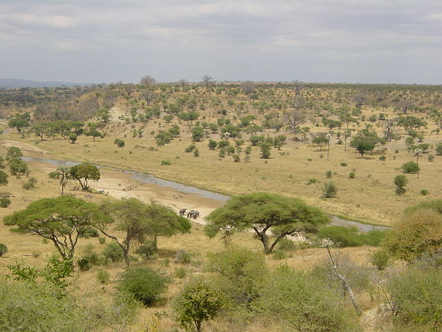
I’m inclined to try to introduce a new top-level tag (knowing it would be a hard sell to the community). See the above image of an African tree savanna – those areas are vast and should get a dedicated rendering. And apart from dehesas and alpine forests, I believe similar landscapes exist in other parts of the world. The tagging problem is currently worked around by not mapping almost any land cover in Africa.
These can be tagged with natural=grassland + grassland=savanna according to the wiki. New top level tags are always somewhat of a horror for data consumers. (And conversely, if software support for a tag is miniscule, there is little chance that it is widely adopted.)
If, as wikipedia asserts, savanna covers 20% of the world’s land surface it surely deserves a separate natural tag. However, the other options discussed, of having tags for canopy cover/closure and tree density, would apply equally well to this as a distinct natural tag, or if it was desired to map it as a subclass of natural=grassland or natural=wood. (sorry 'cos I was searching using a terminal “h” I didn’t see the grassland tag)
Most of our terminology for natural features, and particularly vegetation, is inherently boreo-temperate. Tagging is not even particularly good for types of vegetation encountered around the Mediterranean.
It may well be worth creating a separate thread for discussing savanna.
A useful picture. It’s a bit more difficult to decide for the borders of these areas on an airfoto, but that’s something we would have to live with. It is still better, than when it’s not existing, though. But I see the implementation seems to be quite variable in ideas.
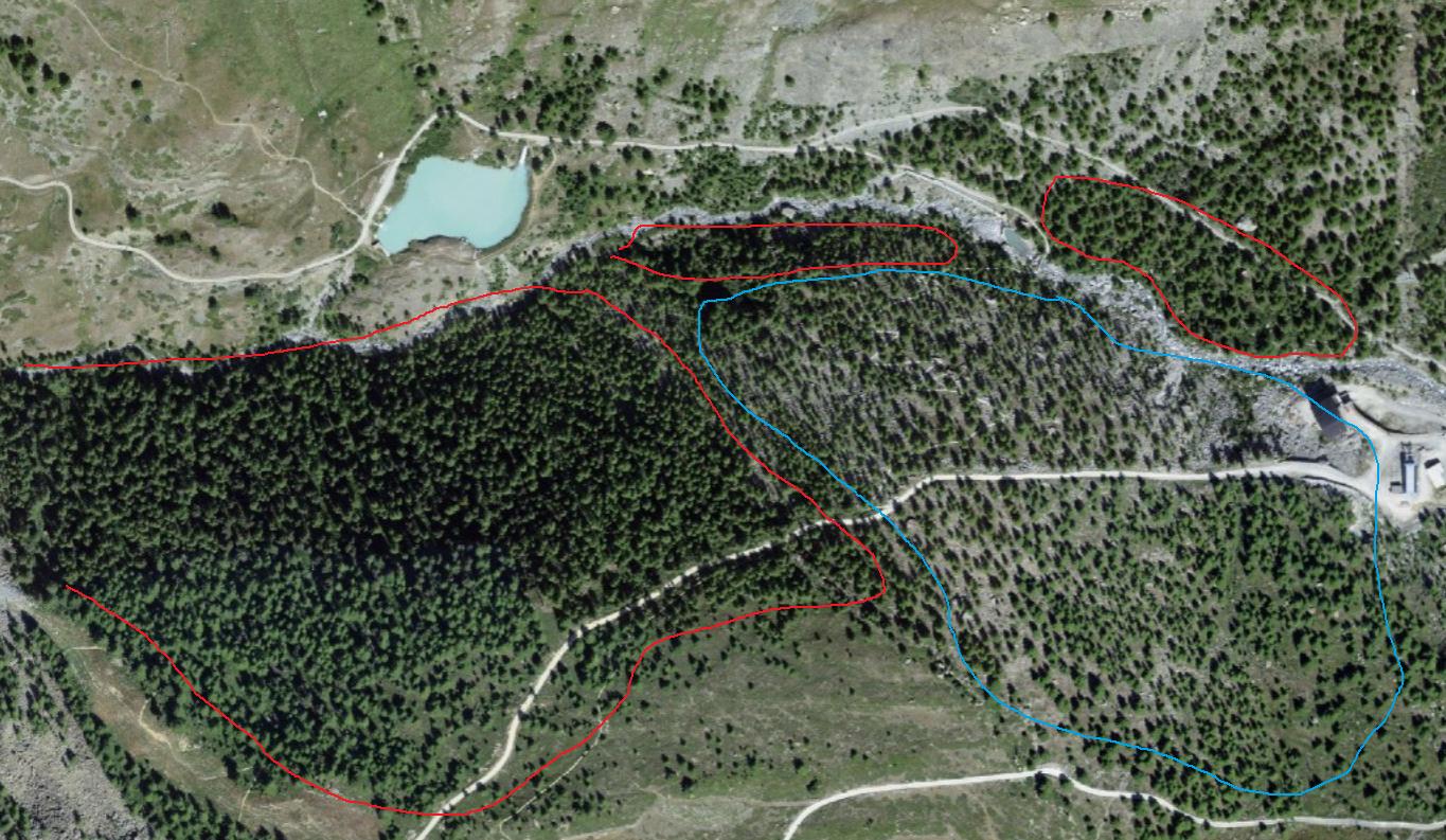
An example image of flyover photography in Switzerland:
The Red line surrounds dense(r), normal forest (I was a bit sluggish … the “south” has a bit of light forest included). The blue line surrounds a light(er) forest. Way to many trees to mark individually, but very clearly spaced much more with an alpinegrassland substrate they stand on. This spearation can be done fairly clearly … which I find such a tag or subtag (and also distinct rendering/border in ID editor etc) very useful.
Somewhat related:
In orienteering there is a thing called runnability which usually describes how dense the vegetation is https://wiki.openstreetmap.org/wiki/IOF_mapping
While density of trees does not equal runnability, maybe it may inspire you somehow. Also, forests may have a directional runnability - easier to traverse in one direction than the other.
An example: see how the forest color is white, light green and darker green showing runnability.
So if new tagging is to be invented, maybe it should not be an boolean yes/no solution, but have a gradation of density?
Here, grown planted wood (we call it Hochwald, all trees same age, ~40+) might be very runnable/walkable, yet the canopy is dense. To capture such, two gradients might be warranted? Canopy-density, value as percentage from aerial, and underbrush-density? Values for the latter, in order of traversabilty, not height of vegetation: fallen_needles|blueberry|bushes|blackberry or some such?
Ecologists tend to talk about the field layer (one of several layers in a wood: ground, field, undercanopy, canopy, emergent). The classic bluebell wood in Britain has no field layer, but many woods have a thick field layer (bracken, brambles etc). This is usually captured in vegetation classifications where the various plants in ground and field layers discriminate between different kinds of wood with the same dominant trees, but I have long thought it might be appropriate to have a distinct tag for these. Use cases: pretty woods (bluebells etc); runnability etc.