I’ve noticed that the iD editor’s Bing satellite imagery in my area (Surrey, UK) has just been upgraded! I checked it out for the first time since December 2022 and, to my delight, it’s much newer, clearer and more detailed now.
I’m not sure if this change was from Bing “releasing” a new version of the imagery, or an update to editor-layer-index or iD, but I’d like to say thanks to anyone who helped update it. I’m sure that it’ll help my mapping, and hopefully similar upgrades for other areas will follow.
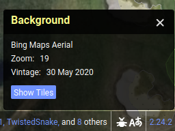
I’ve noticed for Greece last year (don’t know the releases’ years of the imagery), it updated from a 2015-ish imagery to a 2020-ish version, which apparently looks exactly the same as Maxar, even by alignment. Before that they were completely different.
If you are editing in the UK (specifically England, Wales and Scotland) please use the OSM UK Cadastral Parcels layer. This is properly aligned and aerial imagery should be adjusted to line up with it.
Thanks for the reminder! I always try my best to line the imagery up with existing OSM features, but I should definitely use Cadastral Parcels more often to get proper alignment.
I’ve also noticed that some areas of the UK have amazing quality BING imagery. I really hope this is rolled out everywhere.
You can map individual bollards OpenStreetMap
Didn’t know Maxar was available again to OSM. (Thought to have seen a post how to set the link in (JOSM) preferences too but cant find it again and there’s only a Maxar listed of the Sidney area)