Additional 25cm imagery has now been collected. Upload starts next week. Hopefully this will fill most of the missing 25cm coverage.
That’s amazing quality. I suppose it still needs to be processed to be available as an end-result in JOSM?
It has been awhile since I posted.
I’ve had limited time to get the imagery hosted properly. There are also large missing gaps which need filling.
Currently I have another disk with NGI in Cape Town onto which they are copying the latest set of 25cm imagery.
Hopefully I can make the imagery properly available to the public soon.
1 Like
Very excited to have come across this topic. Looking forward to when it’s available!
1 Like
The 25cm imagery is now finally live on https://aerial.openstreetmap.org.za/
It should already be available in JOSM and iD as a background layer. The name is South Africa: CD:NGI Aerial or similar.
Note, the imagery is still a bit slow, but I will improve performance over time.
2 Likes
Awesome! Just made my first edits on JOSM with the new imagery!
1 Like
I have now received an additional 3.4TB 25cm imagery from CD:NGI and over the next few week will start incorporating it on http://aerial.openstreetmap.org.za/
The first new bit is 25cm (was 50cm) imagery around Jansenville in the Eastern Cape. The imagery was captured back in 2019. Most of the new imagery is 2022 and 2023.
Thank you to @Adrian_Frith for collecting the disks and helping with the transfer to the server.
1 Like
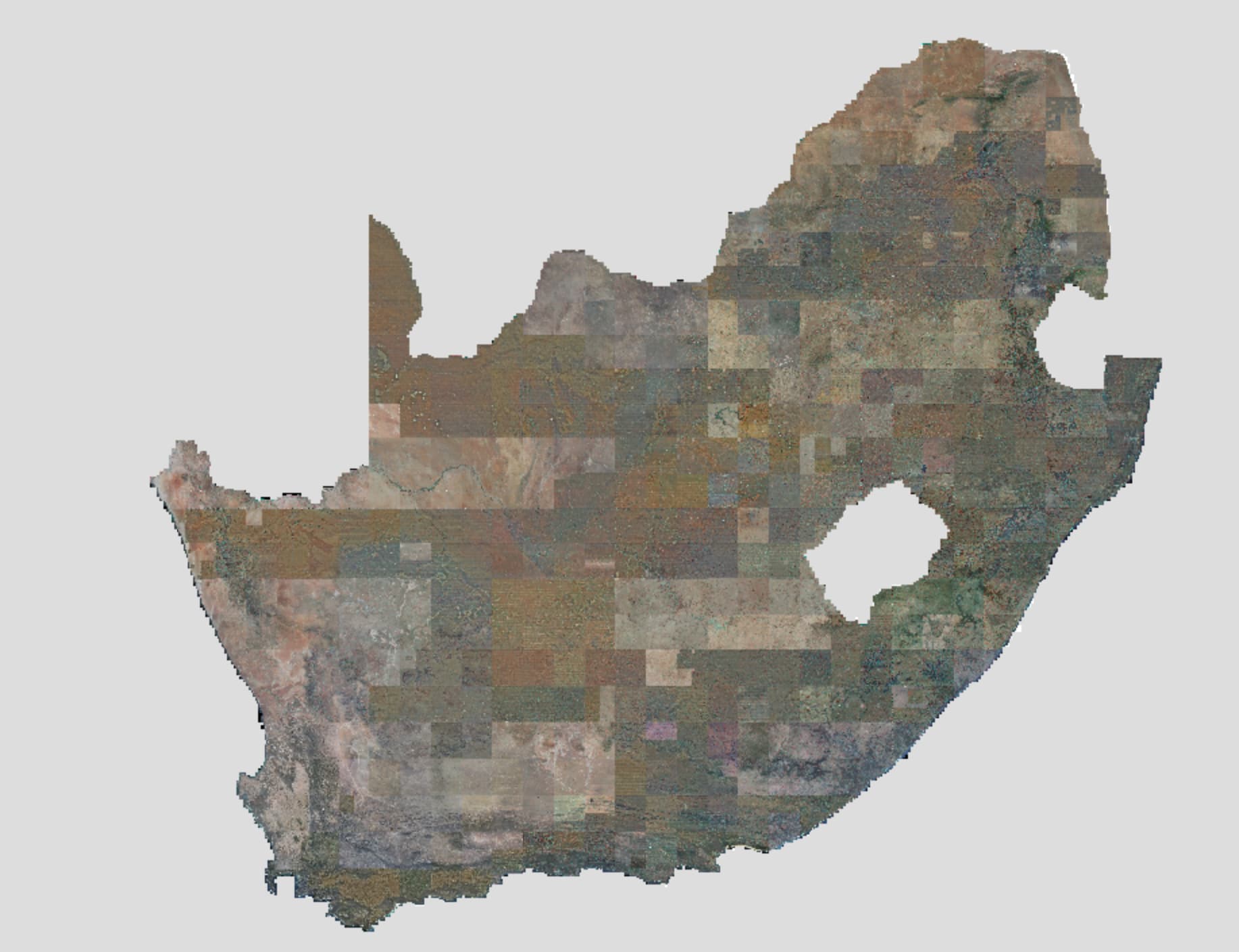
The 25cm aerial imagery available via https://aerial.openstreetmap.org.za/ continues to grow.
Below is what is now 25cm (Captured 2017 to 2023). There are a few gaps in North Cape and Eastern Cape due to missing source files. I am trying to get copies from NGI.
The missing sections south of eSwatini & Mozambique are are still being flown and not yet published by NGI.

Here is the latest progress update from NGI:

Source: https://ngi.dalrrd.gov.za/images/stories/pdfs/orthos_0p5_and_0p25_2024_05_14.pdf
2 Likes
Sorry I lost track of this when changing jobs at the end of last year. Well done for getting this done Grant!
1 Like
New progress update published by NGI: https://ngi.dalrrd.gov.za/images/stories/pdfs/orthos_0p5_and_0p25_2024_07_01.pdf
The external 22TB USB disk will be dropped off in the next few days to collect the most recent updates and hopefully collect a few of the missing source files.
I have kindly received a few donation to help reimburse me for the cost of purchasing the 22TB USB disk. Thank you! ![]()
I have finished re-processing all the source files, https://aerial.openstreetmap.org.za/ is now slightly clearer when zoomed in all the way. I was able to squeeze around 3cm extra resolution per pixel (From 28cm to sub 25cm) by re-processing.
The external 22TB USB disk is still with NGI. I have also requested the 1st August 2024 updates from them.
1 Like
New imagery now live. Mostly new 2023 imagery for the Free State. Still not 100% coverage, but getting closer.
Next update likely early December 2024.
1 Like
NGI have just published their October 2024 progress update.
Looks likely they may finish the 25cm coverage in November or December 2024. Just a small section of North Eastern KwaZulu-Natal remains.
1 Like
NGI have just published their November 2024 progress update.
It looks like they’ve reached 100% coverage at 25cm!
I will arrange getting a copy.

3 Likes
@Firefishy just came across this and it’s great. Brainstorming the use of the imagery with the South African affiliate of Slum Dwellers International who we are supporting on a geodata project in Stellenbosch. Thanks!
Is the imagery for Stellenbosch on https://aerial.openstreetmap.org.za/ showing the 2023 coverage?
The Stellenbosch imagery was captured in 2022. Kayamandi Informal Settlement area would be subject to large changes, particularly after the fire earlier this year.
1 Like
Thanks Grant. Good info…