Hey there! I found that for many railway stations in Europe (more than 1000), multiple railway=station/halt objects exist because stop positions, platforms, station buildings etc. erroneously have that tag too.
I created a maproulette challenge to fix this and I’d be glad about your feedback before making it public, especially to make sure that it is easy to understand and compliant with the tagging scheme.
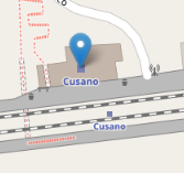
Its a new area for me. I did an easy one in Nederland: using the instructions and the linked image I could do it. I don’t know if it’s compliant with the tagging scheme, though the duplication of values under railway AND public_transport seems weird. Probably a new scheme was implemented and an old scheme survived, something like that.
Addition: I looked at a larger station, Arnhem Centraal. The railway=station and public transport=station tags are present on the main entrance as well as on the station area. This makes sense, I guess, but I don’t know if the schemes allow it, so I won’t touch this one.
I didn’t understand this part of the instructions:
" When there is a landuse=railway around or a public_transport=stop_area relation, these don’t have railway=station or halt as well"
I thought that one object tagged as railway=station would always be needed even if these other tags exist. “landuse=railway” applies to lots of things that are not stations (yards, depots) so I think there has to be something that tells you it is a station. And public_transport=stop_area seems like additional information for public transport mapping that groups multiple features of the station in a relation, but still requires a node or area for the station itself.
I don’t think that is right - my understanding is that if these tags are on an area they should not also be on a node. But I could be wrong.
It is quite confusing. In theory railway=station could be for goods only, so if you only use that tag, you are not making clear it is a station for passengers. And public_transport=station could equally be a bus station, so if you only use that, you are not making clear it is a train station. It feels like there should be a more concise way to express this, but it seems that since the approval of the “Public Transport v2” scheme we are stuck combining bits of that scheme with bits of the scheme that was already there.
Looking at this further, I note that the instructions link directly to the “mapping as a node” section of the wiki. It would be possible to follow that link and not notice the previous section on “mapping as an area”. That could be confusing if the station is already mapped as an area (which was the case in the first two examples I checked in my local area).
More generally, I don’t know how complete the instructions should be and whether they should be understandable to an inexperienced mapper - I don’t use MapRoulette normally so I am not sure what the expectations are.
To avoid losing any information a mapper would need to think carefully about how to combine the two. Simply deleting the area would lose information about the extent of the station. Transferring the tags from the node to the area and deleting the area might be better, but the mapper would need to take care to add the area into the stop area relation, and would have to decide which name is correct. All of this seems to require a reasonable amount of familiarity with railway station mapping (including the whole wiki page, not just one diagram).
And this is for just about the simplest possible station. For a more complex example, with 4 railway=station objects, one of which is mixed with a train station building, see Node: Antequera AV (6572847598) | OpenStreetMap. Full confession: I have actually known about this one for a while, and even mentioned it on Mastodon. but before tackling it I was waiting for a conclusion to the 90-post thread on station mapping at Railway=station as an area?. Then I forgot about it!
So happen to have done one yesterday, both a node on the rail track and same info on station building, then change the building=railway_station to the common train_station. The former would not be hard to clean given TagInfo says there’s just 52 cases of railway_station https://taginfo.openstreetmap.org/tags/building=railway_station#overview
Notably some stations have 2 station nodes, not seen more, one each binary on a 2 track station. Not looked if each was in a separate route relation.
Identify the object that wrongly has the railway=station or halt tag and re-tag it:
Only one object (node or area) has the tags railway=station or halt and public_transport=station. All of the following don’t.
Nodes on the rails have railway=stop and public_transport=stop_position
The station building has building=train_station
Platforms have public_transport=platform and railway=platform
landuse=railway and public_transport=stop_area should contain the railway=station object, and not have that tag repeatedly themselves.
Note that multiple railway=station or halt nodes can sometimes be correct, e.g. if different station parts are officially considered as different stations. Select “Not an Issue” in that case or “Can’t Complete” if you’re unsure.
Move around tags (e.g. uic_ref, operator etc.) to the object they belong to according to the tagging scheme. And make sure that all objects are contained in the public_transport=stop_area relation, if there is one.
Is this better to understand now?
Regarding the station Antequera AV - I think the wiki is quite clear that there should be only one railway=station node in this case.
I think that version addresses most of the issues.
One small point on “make sure that all objects are contained in the public_transport=stop_area relation, if there is one”. This should probably say something like “all objects relevant to public transport users”. It wouldn’t include landuse=railway, as well as other objects not mentioned like signals and switches.
I think nobody who has replied so far has done a lot of railway station mapping - I certainly haven’t. I’d like to see some feedback from people who have.
maybe add a sentence about node vs polygon: when a station is mapped as both, you should keep the polygon and remove the node (as it bears fewer information).
AFAIK, there is a difference between public_transport=station (some mappers say this covers only the area where the general public can go) and railway=station (all of the station), so these 2 tags do not necessarily have to be on the same object.