Lanes in such a roundabout are spiraling out. It is normally required for a driver to chose the correct entering lane based on the desired exit. Usually it is not possible to make a full circle, i.e. to exit on the same road as entered - but there may be exception for some of the approaching roads.
It would be nice to add a section to the above page, explicitly stating the preferred way of mapping such roundabouts. Are these roundabouts at all?
You need to distinguish the original Dutch type with physical separation between lanes (so they are often drawn as separate lines), and eg German ones with road markings only. I have seen a few of the former.
I believe this is only a matter of effort in micro-mapping. If someone has the time, they are welcomed to increase their level of detail in the spirit of iterative refinement.
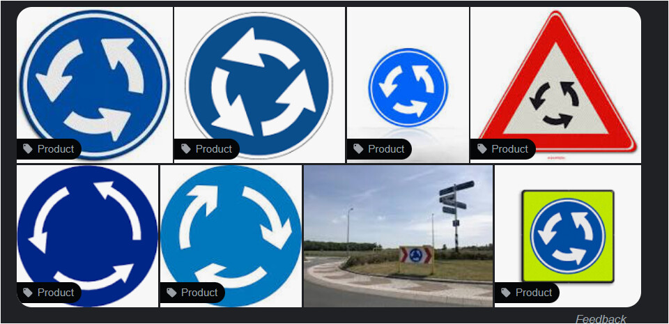
UK has spirally marked roundabouts only. Circle physical center islands, not angled as in turbo-roundabouts.
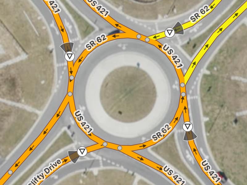
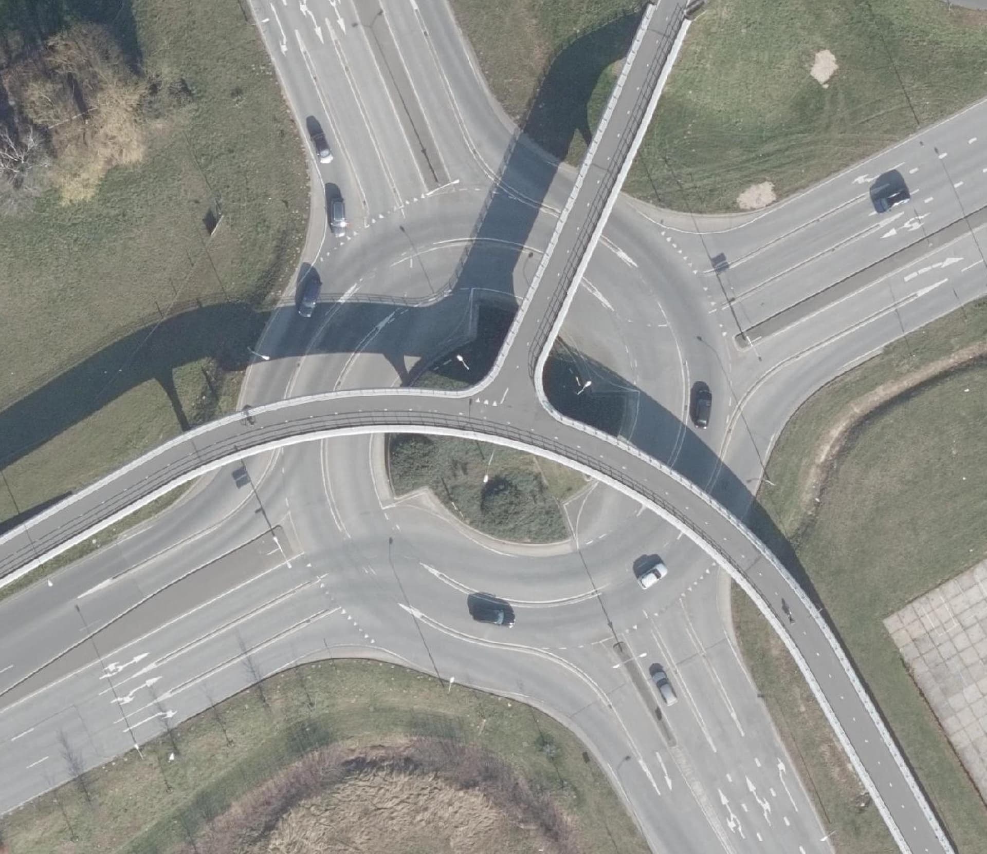
The Dutch have developed a mapping instruction for turbo roundabouts. I have tried out this method by refining the (micro)mapping of several roundabouts, and wrote an OSM diary entry about it.
It’s in English, but I didn’t check all the terms yet, so please forgive me if it’s not exactly the King’s English.
I tested the result for this roundabout using the three routers on osm.org. The routing works fine IMO and actually tells exactly on which lane to enter the roundabout, and how you are guided over the junction.
I imagine a navigation app or device could base a proper lane detail view on this information.
One experienced mapper is working on a how-to-map section for the wiki page roundabout=turbo.
The latter are very common in the U.S. these days. They’re sometimes called “turbo roundabouts”, but formally they’re known as “multi-lane roundabouts”. The approach lanes are channelized, but only using virtual gore areas rather than physical traffic islands, so usually the lanes aren’t mapped as parallel ways. Within the roundabout it’s just ordinary lane markings.
OSM-based routers are able to route through them decently well, as long as you don’t allow an entrance way to meet the roundabout at the same node as an exit way. This can be challenging because the road geometry really makes you want to connect them directly. But doing so would short-circuit the roundabout in any routing graph.
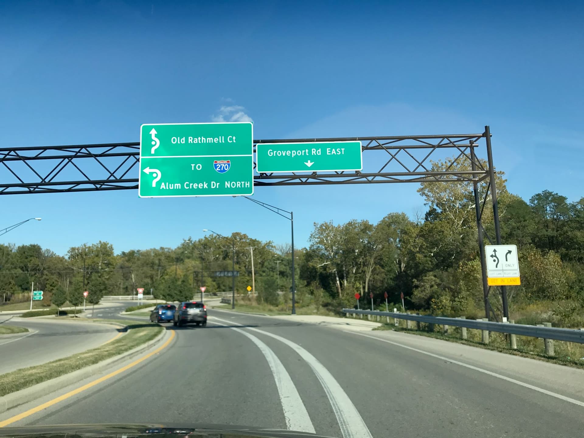
Unfortunately, routers don’t provide good guidance with multi-lane roundabouts. The current crop of routers produces instructions like “Take the 3rd exit”, but in the U.S., each exit has a direction rather than number; I don’t think drivers are very used to counting the exits. The lane assignment signs have funky-looking arrows, but even if you use the standard left, through, and right in turn:lanes, routers discard this data because they only look at the immediate “intersection” at the entrance and deem the turn:lanes values invalid.
Possible solutions might include standardizing new values for these funky arrows, or using connectivity or manoeuvre relations to more emphatically communicate the turn lanes to the router.
It would be very nice to help users get into the correct lane at these roundabouts. We American drivers are still learning how to use roundabouts, even single-lane roundabouts, and could use all the help we can get.
The example shown is not a turbo roundabout, in my opinion. Turbo’s are not just multi-lane. The idea is that you can’t switch or choose lanes on the roundabout, and in the end the lane you follow always exits the roundabout. Map that correctly and routers will not have a problem, even if the turn:lanes tag is ignored.
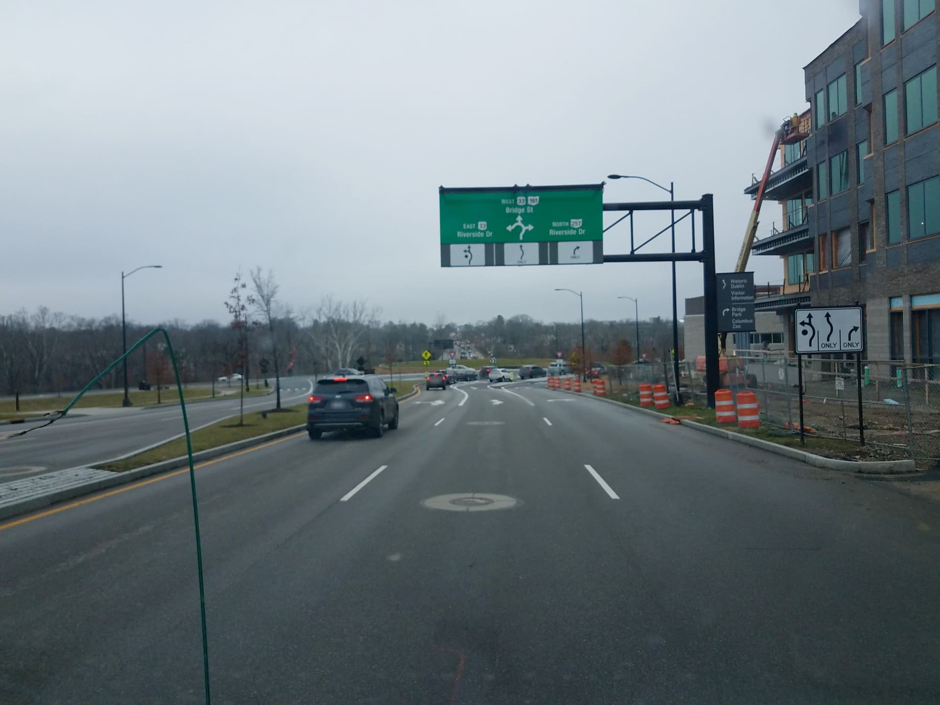
The arrows on the sign map as turn:lanes=left|left;through;right
Why would this need a different tag?
The horror video is fun to watch! Looks like the lineage and the signage isn’t in place (yet?), so drivers can’t see they are supposed to go around. And indeed, it’s way too small for a large truck. But it’s not the concept that is to blame, it’s the … who thought you can just dump a circle and some sand there to solve the problem. Probably saw a drawing in a magazine and thought hey, nice, we can do that, and we can be the first so we’ll make the news! But let’s do it cheaply, who needs experts, measurements and signage, right?
PS Maybe we need to define better what a turbo roundabout is.
I’ve been looking randomly at some roundabouts in the UK. Some have no lineage at all, some allow the driver to drive around the centre island indefinitely. So these are not turbo roundabouts.
That’s effectively how the U.S.-style roundabout works, except that it’s usually only enforced by painted lines and chevrons, so we use change:lanes to indicate the lane change restrictions.
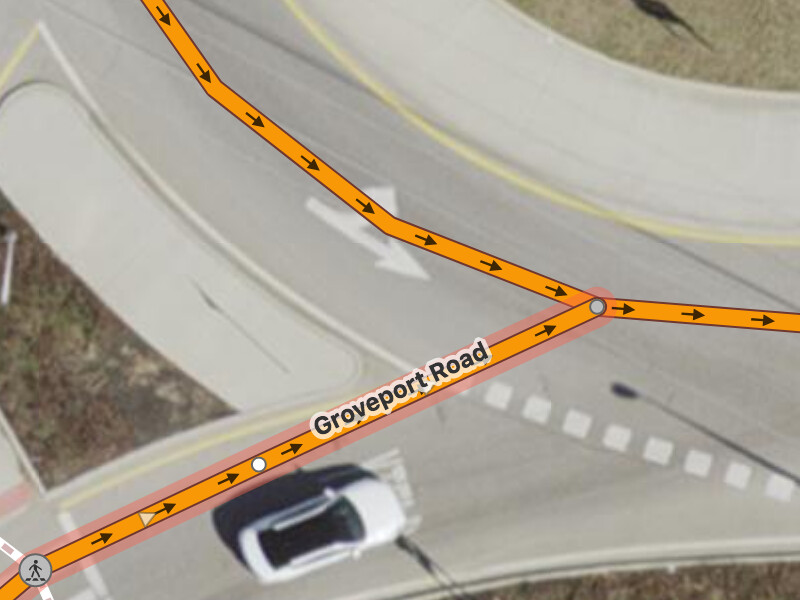
Sometimes the right lane does peel off into its own physically separate channel:
These are special forms of left, through, and right arrows that only appear before you get into the roundabout, akin to the difference between a slight turn and a sharp turn. They’re designed to emphasize the need to go the long way around. Maybe if that roundabout in Kentucky had had these signs up…
I’ve been using left, through, and reverse in turn:lanes, but routers drop these tags in validation. If you’re a router and the selected way is tagged turn:lanes=left;through, you’d think it’s in error unless you know how all the pieces of the roundabout fit together. But even determining that the eventual exit to the right represents a “left turn” movement can be tricky because of how roundabouts and their exits can skew or curve.
These make it very clear that it’s a roundabout, not just a oneway street.
Further, it’s definitely not a turbo roundabout, because a. only for one exit there is a double lane, the rest is single lane, and b. you can keep driving around if you want, c. you can still choose lanes on the roundabout, not only because it’s only a line, but it’s not a “do not cross” line. Basically, the lineage is suggestion rather than guidance.
Now this layout is not typically US, I think. Many roundabouts have “preference” lineage like this. I think the round arrows could be helpful in Nederland too. BTW, our TomTom navigation says “Go left on the roundabout…”, while in fact you only take right turns and it’s illegal to actually take a left turn on a Dutch roundabout. Oh well.
This one appears to have been implemented for purposes other than can be achieved by the design.
The design increases throughput on the major road, by banning manoeuvers on the roundabout; at the same time increasing safety. For motorised traffic, that is. If you mix in level cycle crossings and level pedestrian crossings, you lose much of the advantage.
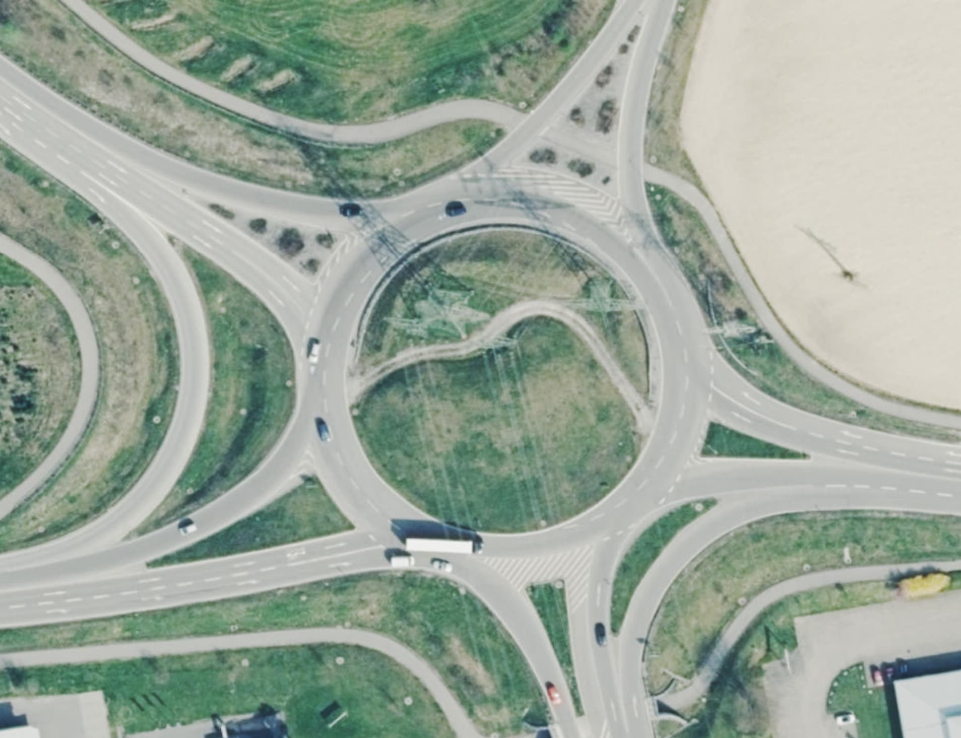
In my wider vicinity, there are some large multi-lane roundabouts where it is possible and permitted (and sometimes necessary) to change lanes. The lanes start from the central island and lead outwards, although it sometimes happens that an exit of the roundabout does not get its own lane if the exit is not important enough.
Nevertheless, they are called turbo roundabouts by everyone including me, the newspaper, the police and the fire brigade.
I don’t know why it should be a mandatory requirement for a turbo roundabout that one cannot or is not allowed to change lanes. Perhaps the German designation for a turbo roundabout simply does not correspond to the designation in other countries.
If you were to say to someone around here: “Let’s meet at the turbo roundabout”, they would immediately know that I mean this roundabout:
If we take two steps back, there’s a standard-issue Irish roundabout warning sign, except the arrows go counterclockwise for some reason. I’m inclined to let that slide because of the “ROUNDABOUT” sign below it.
Yes, this is not a multi-lane roundabout. I only used it as an example of a physically separate right lane, which can occur in combination with a multi-lane roundabout, such as here in Dublin (still in the U.S.):
You’re right that these solid lane divider lines are less forceful than “do not cross” double lines, but in the U.S., those are pretty much only used on freeways (beside the HOV lane or inside a tunnel or construction zone), not on surface streets. You can still get a traffic citation for crossing a single line without a very good reason.
(To state the obvious, the U.S. isn’t a party to the Vienna Convention, so it isn’t feasible to apply its rules very strictly to tagging here. We look for analogues but don’t require highway departments to break the law.)
In that case I woud not map these lanes as separate ways.
If changing lanes on the roundabout is possible and even necessary, that defeats the very idea of the turbo roundabout: choose before you enter, do not change lanes on the roundabout, and you are led to the right exit without any manoeuvre.
What, in your opinion, makes the roundabout in your vicinity a turbo roundabout?
The suggestion lanes? I think these lines just indicate the trajectory traffic ideally takes on a regular two-lane roundabout, but a driver can never be sure other drivers will not get in the way. The turbo roundabout design enforces the safe trajectory and ensures there are no side movements on the roundabout. That’s what increases the capacity for the main traffic stream.
This Federal Highway Administration white paper and presentation make clear that whatever I’ve been informally calling a “turbo roundabout” definitely isn’t a turbo roundabout in a strict sense. I can see why you consider it important to make this distinction, though documentation still needs to accommodate the wider definition, however flawed, so that mappers can know what they’re looking at.
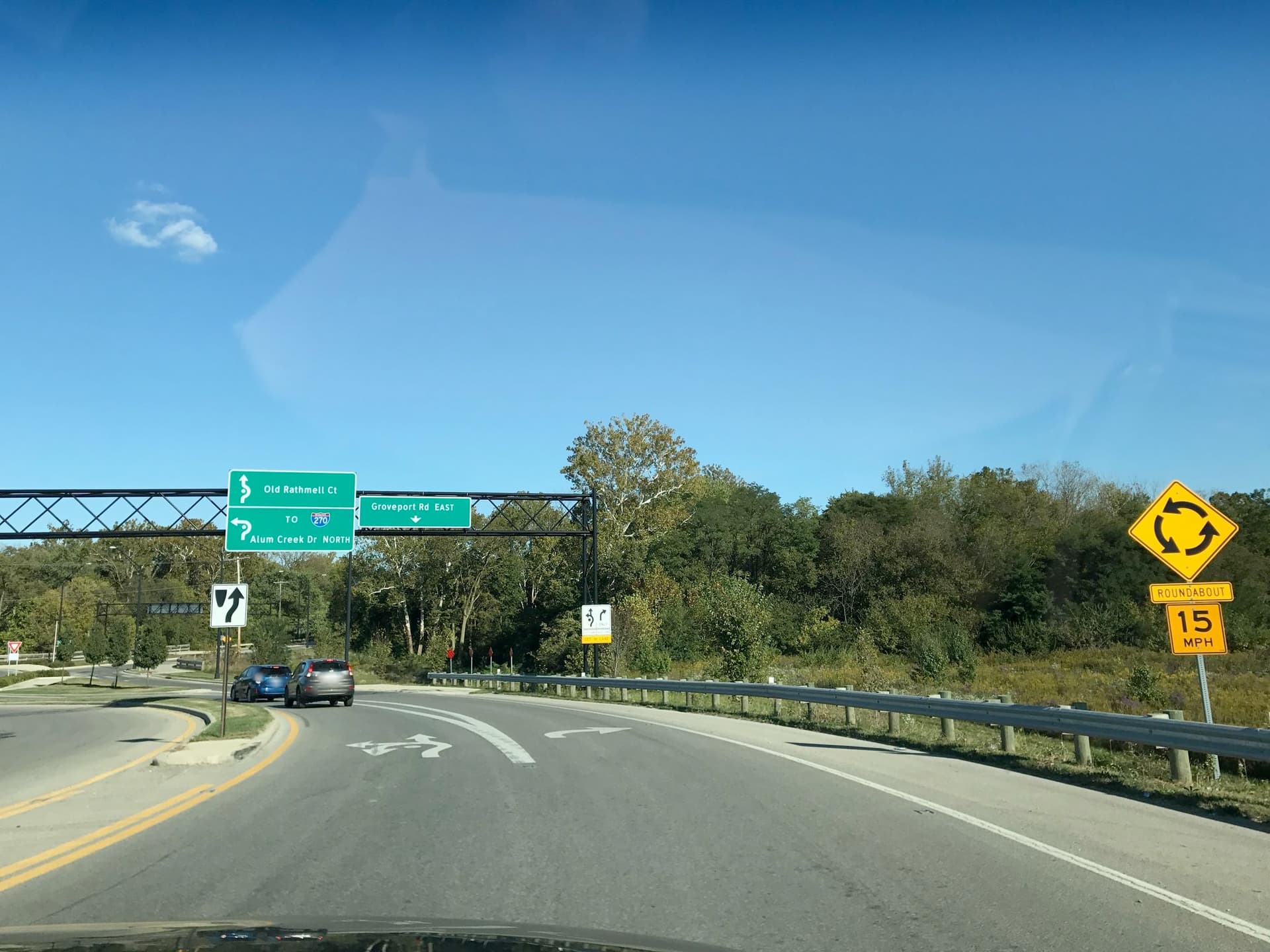
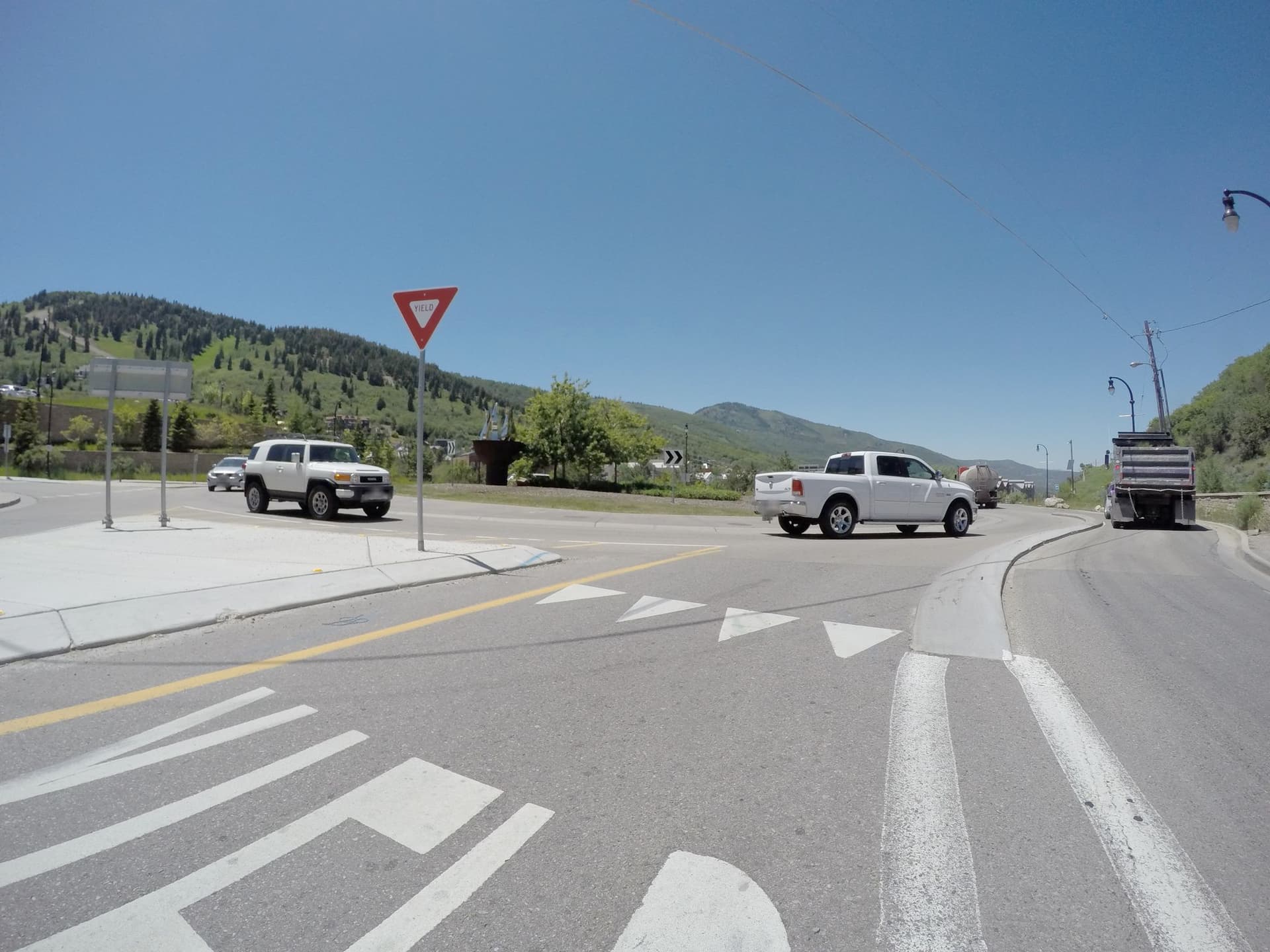
Apparently there are roundabouts that come closer to meeting the standard you outlined. A hybrid “2×1 roundabout” in Conway, Arkansas, has painted areas that simulate traffic islands but only on the multi-lane segments. (Solid paint is used to simulate a traffic island in many situations, such as curb extensions.) This single-lane roundabout in Park City has a raised curb partway around to separate a channelized right turn lane, but that’s along the lines of the Groveport Drive example above that you already discounted. These examples only imitate the concept of channelizing the lanes, but they don’t incorporate the geometric improvements in the Dutch designs.
Dutch mappers are rapidly converting roundabouts from two-lane roundabouts with one ring mapped as change:lanes=no|no to detailed turbo roundabout mapping with separate lanes on the roundabout.
We resolved some minor issues regarding names, highway level of bypass lanes, explicit give_way nodes or not, and turn restrictions on the roundabout which are implicated by the geometric layout. No major issues; rendering and routing look fine.
The mapping and tagging scheme is, in fact, not that special! All the lane sections on the roundabout are marked as junction=roundabout, which in fact just replaces oneway=yes. The rule that you can’t change lanes translates to several only_straight_on turn restrictions.
Typical for the Dutch situation is that give_way on entering the roundabout is not implied by the roundabout, in fact it’s the other way around: all approaches need to have give_way markings and or signs, or it’s simply not a roundabout but a rotary!
Another Dutch rule: jurisdiction is that traffic on the roundabout has to stick to the arrows on the chosen presort lane. This is the basis for some movement restrictions on the roundabout that are not physically impossible. After all, the physical separation has gaps, or nobody could enter the roundabout at all.
Sometimes this rule leads to this absurd situation: two vehicles, moving exactly in the same way exacly the same lane, approaching a choice: exit now or continue to the next exit; then one is allowed to continue, while the other MUST exit, just because it came from a different approach. We did not tag conditional turn restrictions based on the presort lane you came from!
Long story short, it works! We do have some issues concerning routers. The core routing is fine, but the step-by-step directions leave something to be desired. I have made the text for an issue I plan to post to OSRM, Valhalla and Graphhopper, being the 3 routers available on osm.org. I think I will post the text here first, maybe you guys&girls know solutions (or more problems) I just didn’t think of.
PS we tagged all the ways on the roundabout area with roundabout=turbo. We also found several fake turbo’s which we just tagged as roundabout=turbo_lookalike without converting them.