Is it possible to map the track of a slot car club?
This is important for these drivers, to identify how the track is.
Is it possible to map the track of a slot car club?
This is important for these drivers, to identify how the track is.
Is it possible to map the track of a slot car club?
Is that something like sport=rc_car + highway=raceway ?
It is similar but the model cars are not radio controlled. They run in slots and there is some minor use of sport=slotcar (3 x) for it.
You should be able to copy & adapt Tag:club=model_railway - OpenStreetMap Wiki fairly easily?
Is it possible to map the track of a slot car club?
will speed limits be mapped at scale?
I think sport=rc_car may still be ok, although I see it on the edge, and rather not as a sport.
But these suggested combinations are even more far fetched:
Useful combination
when were these decided? Are we sure we want to recommend this?
This could be the most appropriate for the POI, to identify where the place is.
However, it does not identify the track.
Sorry, didn’t realise that was what you were after.
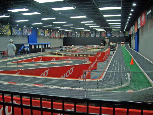
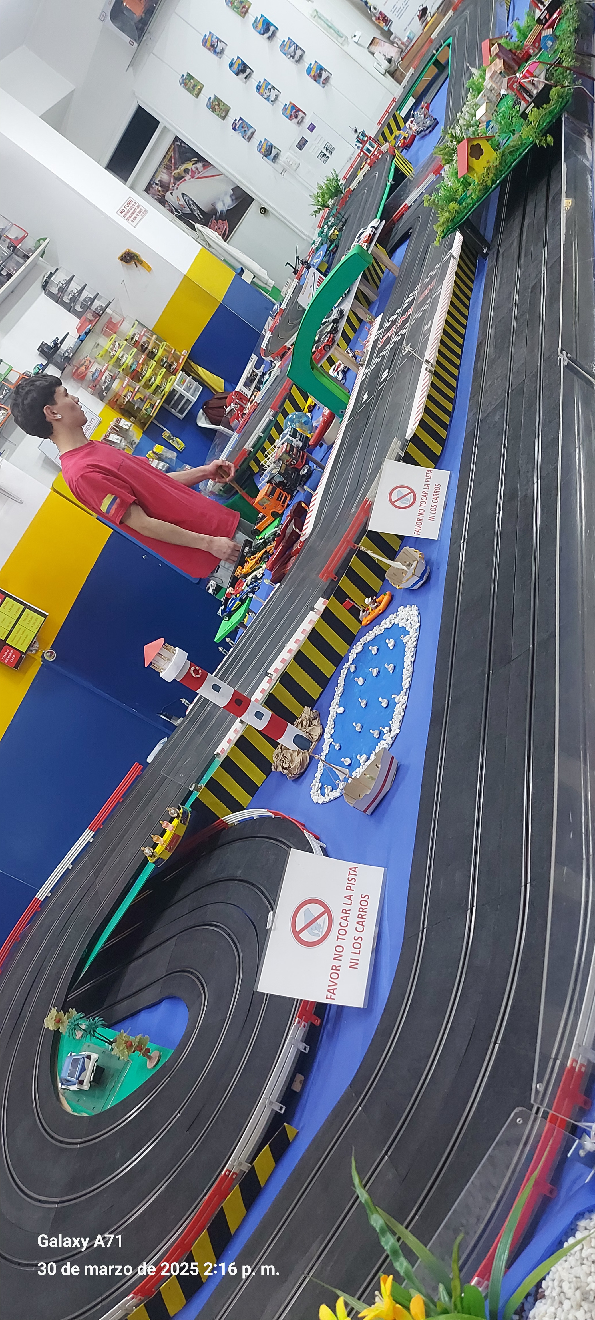
I’m not sure it could be done in OSM? Even big, commercial, slot-car layouts I’ve seen in the past would only be ~5-maybe10m long x ~3m across?
Would you be able to map a track as a closed way in such a small area?
My purpose is to give an idea about how the track (bridges, tunnels) is. The size of a track could be some meters as you said.
Regarding the OSM precision, it is near 10 cm between nodes in the equator, and JOSM can perform a lot of zoom to map in that way.
However, I will need to do an indoor mapping first of the building, to get the size of the space/club, and then I will be able to map the track inside that.
there are some bigger ones, but it would still be not easy to survey (as they tend to be indoors, so no aerial imagery support), and it is definitely a lot of detail, similar maybe to mapping field markings or sth like this: