Two lines are frequently used on carriageways with a painted median or when the physical median is easily crossed by car. We also use roundabout circles even if the centre island is painted and physically allows you to drive straight across.
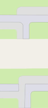
Mapping separated footways or cycleways along central street as one tagged line versus mutiple lines
At least I can verify that iD does not recognise *way:crossing:markings in its rendering.
I’m afraid we don’t do that. You should use highway=mini_roundabout for most cases.
1 Like
Regardless, we do do it.
But of course the overall point was that of separate lines not being synonymous with impassable physical separation.
There are other intersections where the kerb runs through and cyclists have to cross the kerb to go from one to the other, but pedestrians do not.
1 Like
Not opposing your point, just wanted to point to our local (well, national level) cycle map that does render the basics of cycleway:*=lane.
yeah, that can be two-liner easly!
Could easly be mapped by one line as well with the sidewalk=right|left tag as well and i see that your local mappers did it that way.
But i have looked around, coz your bike infrastructure is really cool and i’ve found this two-lined example Where this footway has to first cross the cycleway in somewhat informal spot, but closeby is a crossing as well, and that one is marked (crossing=uncontrolled), because it’s mapped with two-line design, we are actually able to map those with this crossing type difference.
People gonna argue, that it allows two-line mapping only because of that grass separation, but that side path that goes right through the grass, in an obviously not designed space, proves that this is an arbitrary separation.
We could tag a sidewalk here with sidewalk=right|left, but we wouldn’t be able to mark the crossings properly.
I hope for more people to speak up, so we can see their reasoning
You can’t have tactile paving on a differently marked or unmarked pedestrian crossing?
You can have tactile_paving marked on on one kerb and don’t have it on the other end. You can have multiple kerbs over one crossing.
But i have not seen footway:tactile_paving specified or used anywhere and i have not seen it used over a kerb node as well
1 Like
For future reference here I am describing one of crossing/intersecting problems:
Say you have a crossing where pedestrians have to yeld and one where cyclists have to:

If you try to draw it one line, you can’t say which one is which and so routing for people with sight disability doesn’t know eighter

- Additionally if
tactile_pavingis present, it can have missing continuity over the cycling dedicated asphalt or have it continuous - Surface can be described in detail over the crossing traffic collision part and not just vague
- kerbs are not visible on rendered map, but those are passed as warnig or information by a routing.
- kinda important info for a routing is that the cycleway goes straight and it is actually only the footway that has to zig-zag over it
@SomeoneElse do you think i should make more examples?
Actual photographs (especially of edge cases) would be great!
Here’s one example that divides some mappers in PL.
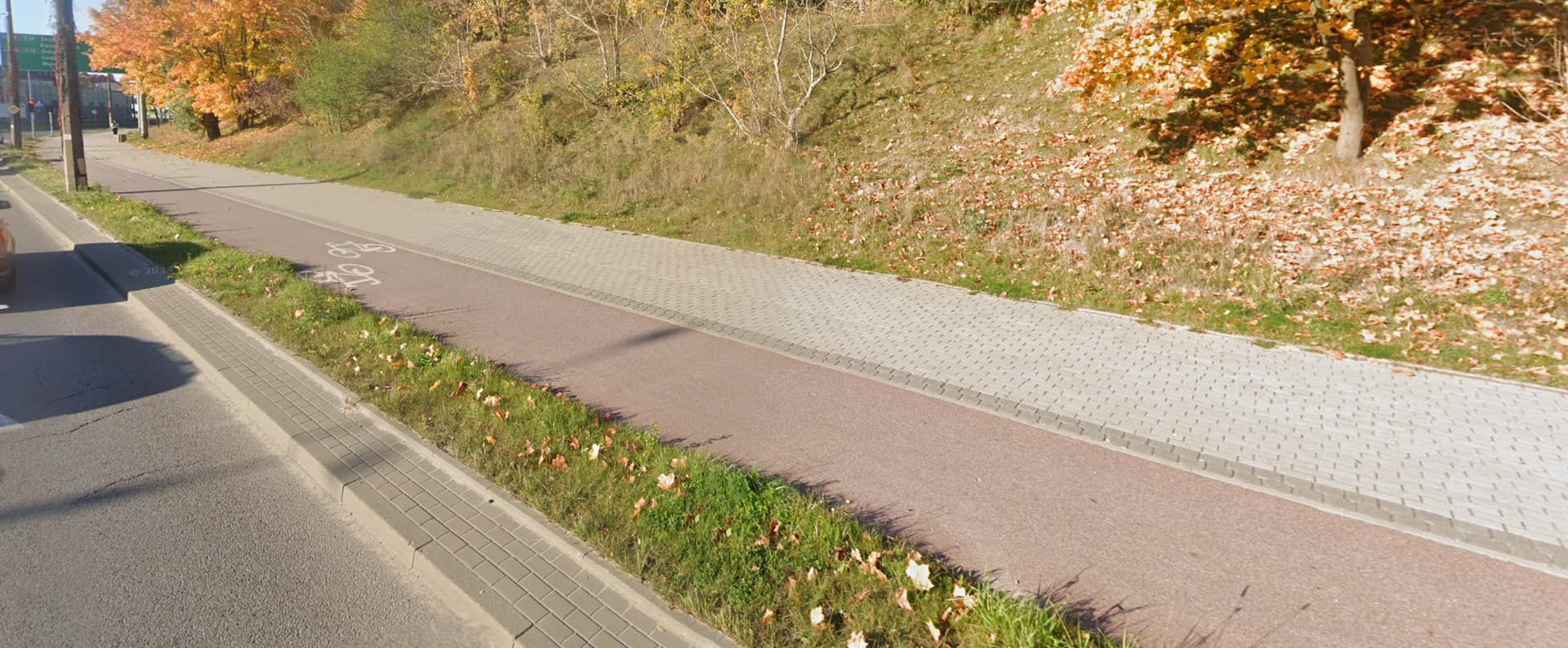
I asked on OSM Poland Discord how to map it and most mappers replies as 1 line with proper tags like segregated=yes. We even had local discussion for paths in Tricity, because there were some paths like this mapped as 2 lanes, some as 1 lane. Most mappers opted for 1 lane with proper tags.
@SomeoneElse Do you accept links to google street view?
meanwhile user @theDM refuses to discuss intersections and all other points i have raised and instead posted images of straight highways instead, which or not places i have described at all.
He has also reverted all of my changes without remapping anything of what i have mapped with precission.
This is a big problem, because he should give valid reasons before doing it, while i have proven mine.
It was raised in Polish forum that You shouldn’t change somebody’s work to the other option just because You prefer it. It only creates the edit war and adds nothing. So You should not have changed @theDM’s work in the first place.
1 Like
I did not change his work. He did change mine without asking how he can do it better than i did.
Anyhow, that’s not primarly why we map. We do it so people can route their way to a destination and know what they find on the way.
I did map those details and explained precisely why i did it that way.
So far noone tried to show how to map exactly those details in a different way.
I encourage you try
Photographs that you have taken while you are there are better - they are more likely to be up to date!
Looking at the pictures above**, I suspect most people here would map them with one line, either as segregrated=yes or as a “cycleway with a sidewalk” (as some poeple from the Netherlands have suggested).
** You might be able to find places where the photos above aren’t typical - please post them!
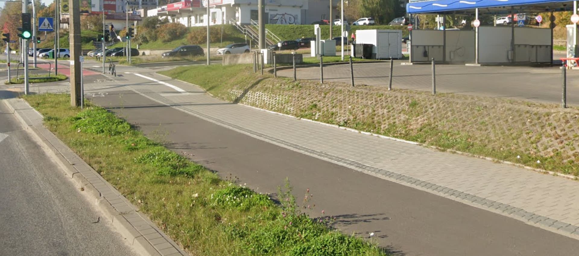
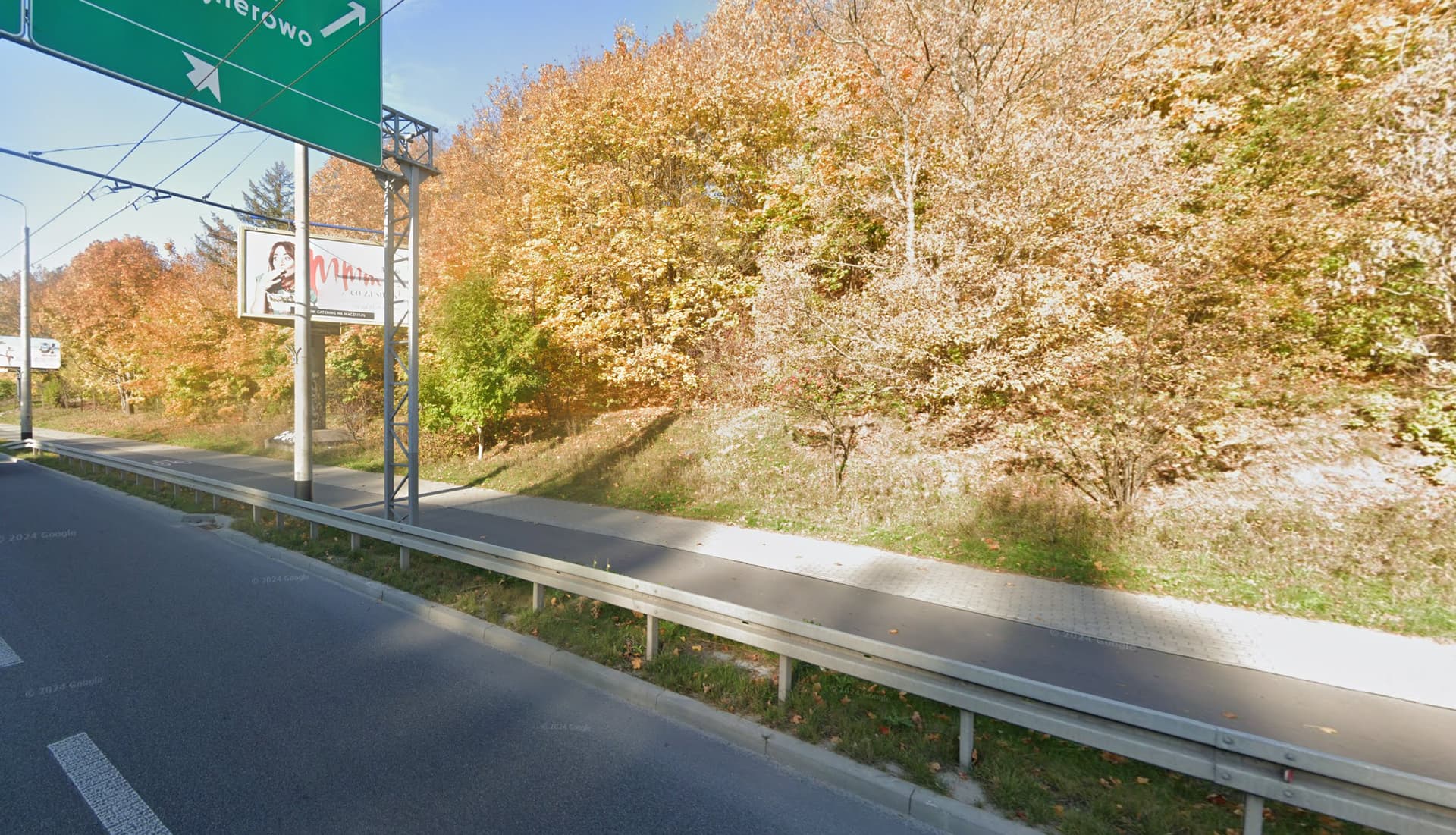
I uploaded these photos to show the rest of community how this path looks. These photos are up to date, but I can take some in the next week if you’re interested, I go there to work.
1 Like
take a look here
the tactile_pavement is continuous on the sidewalk part and the cycleway breaks, so it’s the bikes that have to yeld.
Two crossings like that are visible on this one spot there above.
But in this example closeby
it is the footway that end with a kerb and so pedestrians have to yeld to cycling traffic. tactile_pavement looses continuity and it’s marked in the kerb area.
Those two examples present a widespread modern method how road infrastructure is designed these days around here.
But of course not everywhere, not everytime. Mapping multiple lines is not always necessary, but it is clearly not against rules
As i’m proving that in this scenario it is actually the only way, as noone else proved otherwise
Both of those links are 2024 streetview sources. I have linked em, coz only taking a screenshot and posting em to to community.openstreetmap.org is not permitted, right? Links are okey?
I write about it, coz @theDM in his post did take his screenshots on g street view and posted them here, which is another rule break i gues.
1 Like
Uploading pictures here (like has been done above) should be OK, but may depend on your reputation (such as number of posts) in the forum.
@SomeoneElse As far as i know google doesn’t allow taking screenshots from their street view service and post em around in the internet.
It is not forbidden explicibly by OSM rules i gues, because you know em.
It might be forbidden to map OSM directly from google sources tho, so i heard.