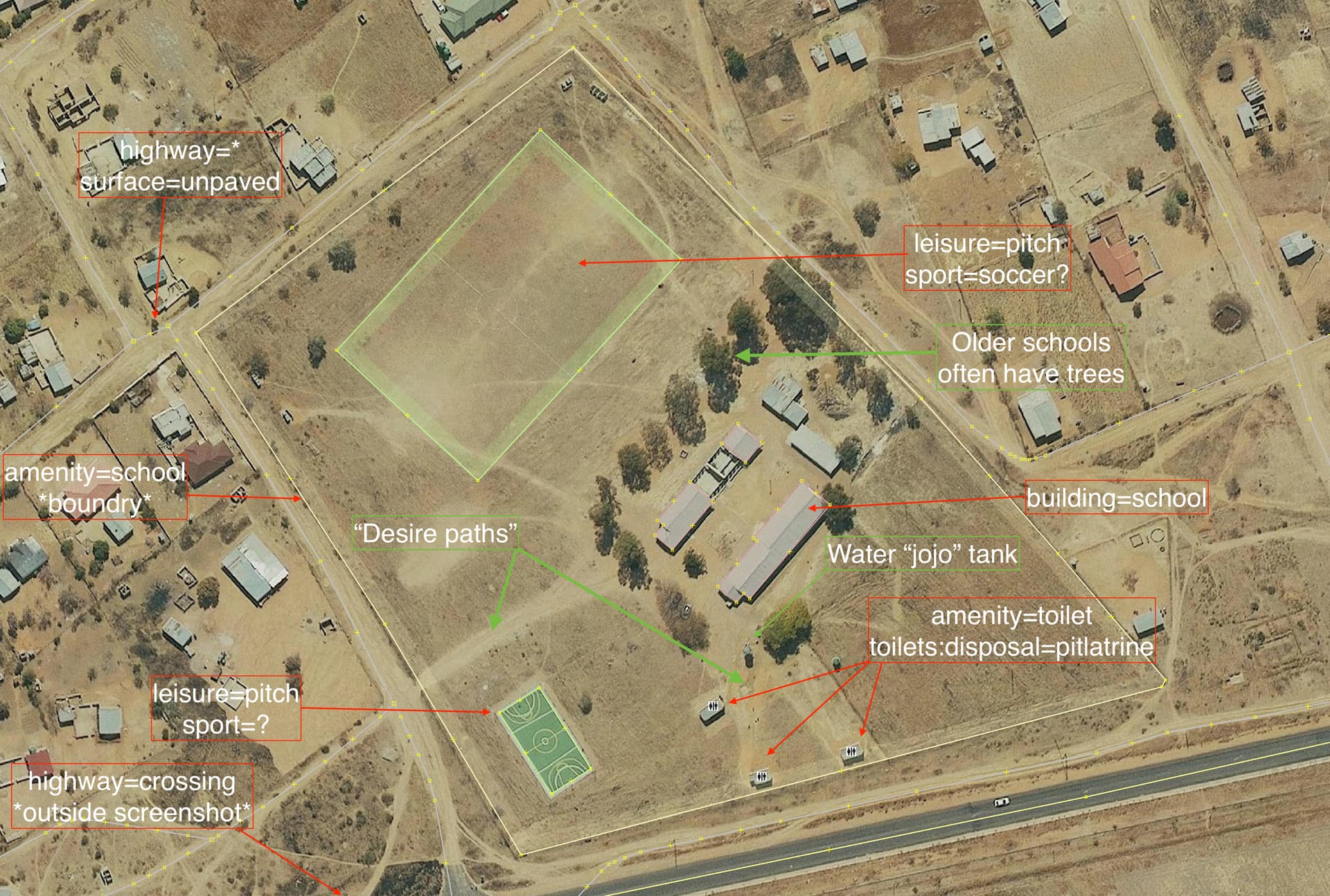
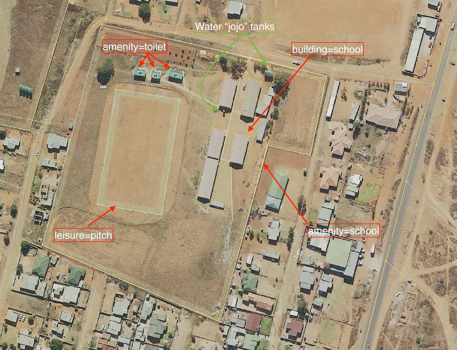
I have started to add rural schools to the map. Initially the schools are not easy to recognise, but hopefully this image will help you spot the visual clues.
3 Likes
SchoolSearch and the EMIS Master List might be helpful.
1 Like
Yes, I have been thinking about the EMIS Master List, and recently ran a little experiment with ogr2ogr for converting the XLSX document to a GeoPackage.
Example download the National Ordinary Schools XLSX file and create file National-Ordinary-school.vrt as follows:
<OGRVRTDataSource>
    <OGRVRTLayer name="Sheet2">
        <SrcDataSource>National- Ordinary school.xlsx</SrcDataSource>
        <GeometryType>wkbPoint</GeometryType>
        <LayerSRS>WGS84</LayerSRS>
        <GeometryField encoding="PointFromColumns" x="GIS_Long" y="GIS_Lat"/>
    </OGRVRTLayer>
</OGRVRTDataSource>
Then run (ogr2ogr is part of gdal):
ogr2ogr -f GPKG -skipfailures -mapFieldType All=string National-Ordinary-school.gpkg National-Ordinary-school.vrt
The output file National-Ordinary-school.gpkg can be opened in QGIS