Countless times I’ve drawn a line from a node or traced along the edge of a building to get the direction for to name a few such as those for traffic signs and onesided sloped roofs.
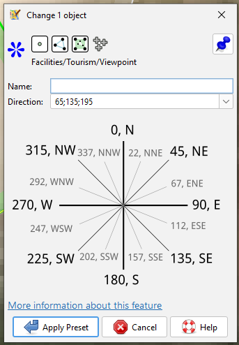
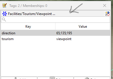
Today stumbled on the viewpoint preset and low and behold
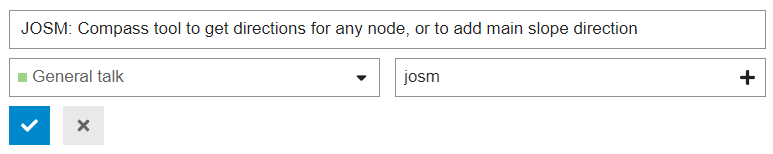
Now would it not be great if this becomes a plugin/preset feature for JOSM (searched in the official collection but hit on nothing), the idea being whenever the key word ‘direction’ or keyword part is encountered, e.g. in “traffic_signals:direction” of a tagging in progress. This feature to appear in the shortlist of presets related to an item like here
Of course as so often I missed something too simple and doubtlessly someone will share the trick without having to exit the tagging box to take the bearings. (The trick of taking the directions prior to starting a preset or direct tagging is one of those too simple and forgotten post-haste).
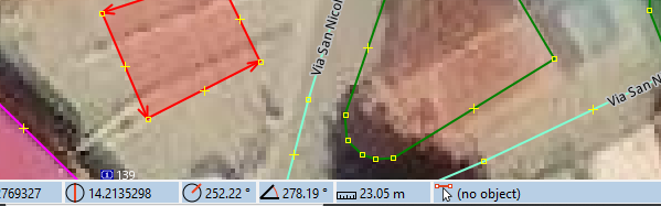
One of the things noticed yesterday is left bottom on the status bar the direction is shown of the last line/side drawn. An example of a freehand box, the last line top east to west which shows 252.22 degrees and stays there when the building is being tagged even when deselecting everything.
It would also be handy if you could specify direction as e.g. 0-180, for lookouts etc where you can see the full semi-circle eastward, all the way from north to south.
My practise is to just draw the line without setting a node, the longer the more accurate the positioning, read the direction left bottom and Esc-ape. nothing needing deletion. For benches I made a custom preset since the standard does not have a direction field
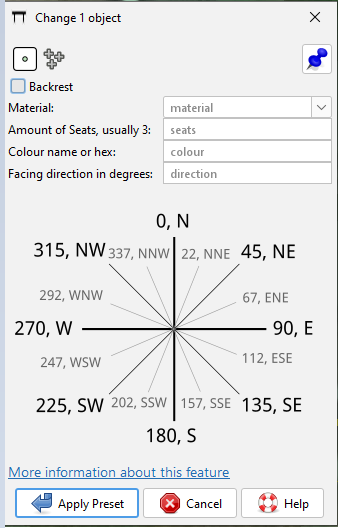
I can see this (and others) having the compass at bottom. mockup above, same as the viewpoint preset, not as precise as drawing a line and reading the degrees out but close enough FTM.
There’s multiple objects and tags that could use a range value. The compass reading could indicate e.g. SW-SE but that would require the data consumers to board. E(east) would be legal though. Search results | OpenStreetMap Taginfo
There’s a few dozen who did this
Have not tried that before but semicolon separated is not rejected so NE-SE would work for me better than hard direction numbers on viewpoints.
Similarly someone mapped a MTB track with a width of 1-3 m. There’s a road here of about 1.5km which is a constant steep up/down. There was a discussion on this but never heard back on an outcome. incline=up/down | Tags | OpenStreetMap Taginfo. There’s 3 ups and 3 down and 2 short flats… not going to cut up the road to tag each section up or down and in addition cut up the bus route member in addition, not to speak of the variable road surface quality. Mapping has sanity limits.
I think it would be a good idea to keep the “Help and support” category the “Help and support” category and have feature requests wherever the relevant developers want to have them. If that is on this forum then in a separate category and not here.