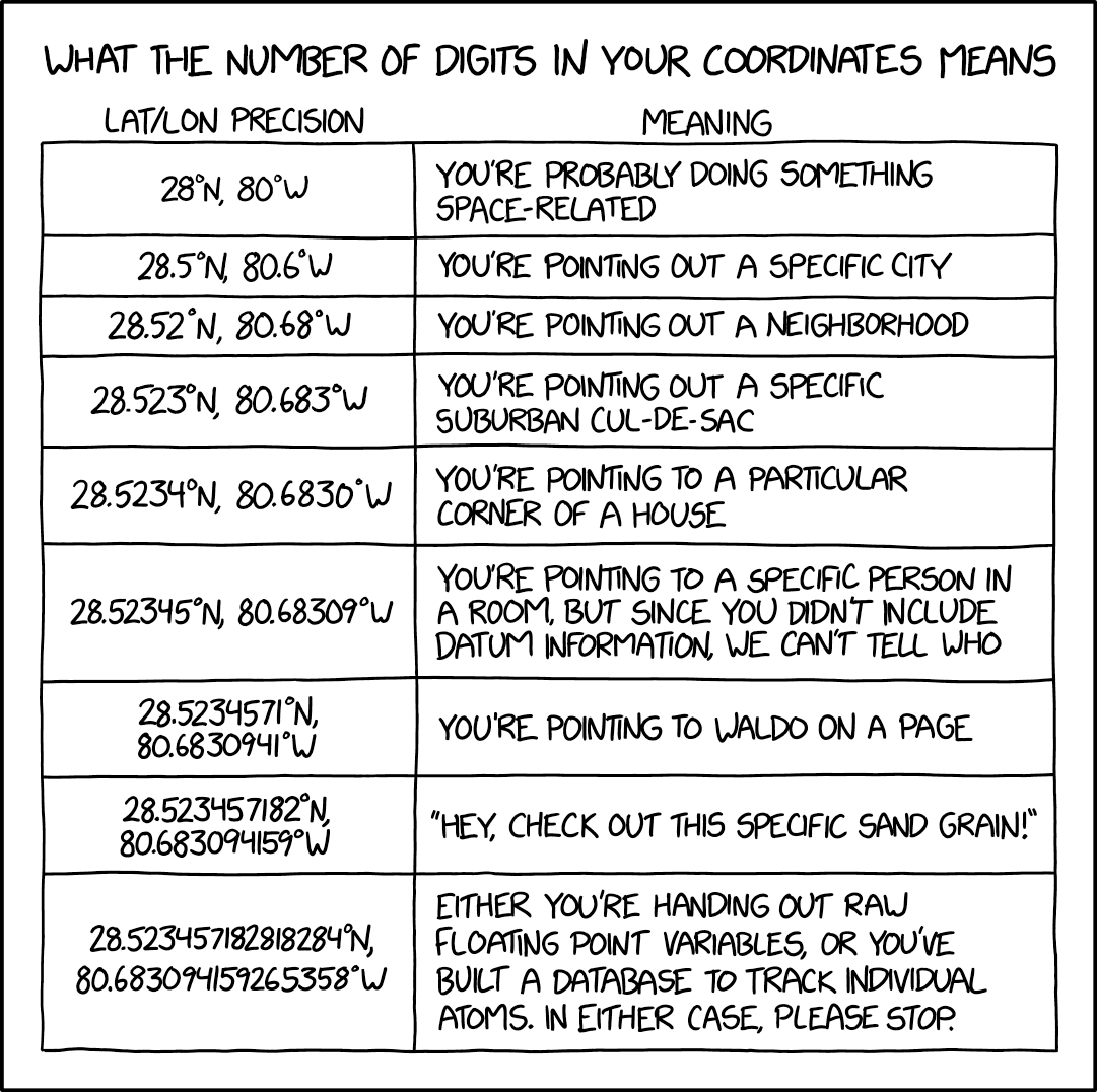
From what I’ve read, OSM only supports a lat/lon precision up to 7 decimal places (using WGS84 standard). Is there any plan to adopt a newer, more precise standard?
4 Likes
But from that linked page: “Warning: Just because a coordinate has many decimal places does not mean that it is an accurate measurement.”
If I’ve read (& understood!) it correctly, we currently use 7 decimals which = ~11cm (4") on the ground? With current technology, I don’t think we are able to map to anything greater than that! ![]()
8 Likes
You can, by buying an US$300 RTK kit. But reference frames, datum, and epoch need to be tackled before coordinates precision.
- StephaneP's Diary | You thought OpenStreetMap data uses the WGS84 datum? No it doesn't! | OpenStreetMap
- Reported as visible on consumer-grade device StephaneP's Diary | You thought OpenStreetMap data uses the WGS84 datum? No it doesn't! | OpenStreetMap
- StephaneP's Diary | RTK test, Aerial pictures accuracy, and OSM Database Accuracy | OpenStreetMap
- Revent/Key:datum - OpenStreetMap Wiki
JOSM can already highlight NMEA format single vs RTK float or fix
4 Likes
Yes, precision is easy, accuracy is hard!
5 Likes
As long as you don’t plan on mapping things like kerb joints as polygons, I doubt you’ll have problems with the 1.1 cm (~³⁄₇″) resolution.
3 Likes
It is ~1.1 cm (~0.43").
2 Likes