Is the current climbing wiki correct?

I just want to double-check if the current Climbing wiki page
https://wiki.openstreetmap.org/wiki/Climbing
has correct definitions of how to map the climbing sites. From what I understand, there would be nodes for climbing=route_bottom, or ways for climbing=route. These are added into a site relation of type climbing and sport=climbing + climbing=crag. Crags are added into another site relation of type climbing and sport=climbing + climbing=area.
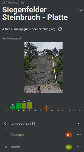
This is all, then, nicely depicted in https://openclimbing.org/, for example.

However, there is tons of information in OSM that follows various (older?) standards and Iā€™d like to know if the above is some sort of consensus on how to map climbing sites in general. In which case I would be adjusting some older tags and adding the relations.

The questions naturally arise for different aspects. I.e. a cliff marks a crag but there are no known individual routes. Should the cliff be added to the crag relation?
What about multi-pitch routes? Are they routes or crags? Is every pitch a separate route? Why, or why not?
Why are gyms left out of this tagging scheme? A climbing=gym tag seems perfectly matching, for example.
And so onā€¦

3 Likes

And what role if any does climbing=route have to play in the tagging of mountaineering routes that involve technical climbing sections? (Rock or ice)

Yes! Iā€™m actually concerned about that. Last weekend I was climbing some routes, level I-III, that can be done with or without a rope. Some of them are drawn as a path, some as climbing routes. Some even have short sections with chains as the climbing aid. Not ferratas, but it implies that one is not really expected to be on a rope.
These routes are found on climbing sites as easy multi-pitch routes.
Sometimes there are easy walking sections between the pitches, with a visible path. ID still complains that itā€™s a disconnected path.
It would be impossible to have them tagged as two highway tags so Iā€™m a bit puzzled how to go about it.

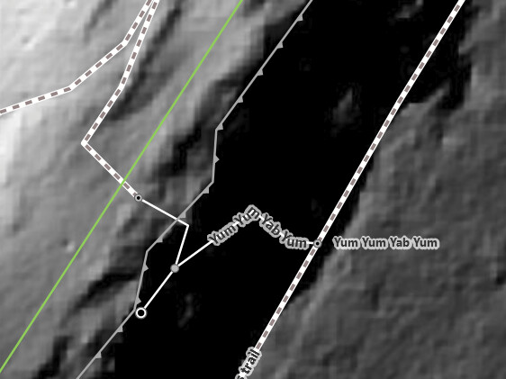
Iā€™ve been adding them as described in the wiki with relations for climbing=crag and parent relations for the climbing=areas that group them. Tagging the cliff itself with climbing=crag doesnā€™t usually doesnā€™t work well where Iā€™m climbing as either different portions of a long cliff-top get grouped into different ā€œcragsā€ due to how climbers refer to the different base areas, or conversely, Iā€™m micro-mapping different cliffs which all together make up a ā€œcragā€.

Is the current climbing wiki correct?

Yes and no. The climbing wiki page started as a proposal in ~2008 but was abandoned. Then around 2016~2018 it was decided that the tagging schema was ā€œin useā€ and as a result no community moderation/vote process occurred. This allowed the page to become official without resolving the various unresolved issues in the schema.

Since you are a knowledgeable climber and the main downstream data user I think it makes sense if you develop the schema further and edit the wiki page to provide more detail and clarity in how things should be mapped.

However, there is tons of information in OSM that follows various (older?) standards and Iā€™d like to know if the above is some sort of consensus on how to map climbing sites in general. In which case I would be adjusting some older tags and adding the relations.

I donā€™t think those are older standards. I think most people couldnā€™t understand the wiki page and as a result just did random things. Others then copied those random methods thinking they were correct. I would stick to the ā€˜site relationā€™ method as it makes the most sense long term.

Should the cliff be added to the crag relation?

Itā€™s hard to say. Should route_bottom, route, route_top, cliffs, approach paths, etc. be added? A defined schema needs to be worked out.

What about multi-pitch routes? Are they routes or crags? Is every pitch a separate route? Why, or why not?

I can see two obvious ways to map a multi-pitch route that should be supported.

The first method is to map it with one climbing route way and then use the climbing:pitches tag to describe the amount of pitches.

The second method is to map each individual pitch (climbing=pitch) (and highway=path ways for paths between pitches if applicable) and then group all of the ways into a route relation. This method allows naming of each pitch, naming of the entire route, and details about each pitch. Then the route relation is added to the crag or area site relations if applicable.

3 Likes

Thanks a lot for the feedback! Your suggestion for multi-pitch makes sense. I will try mapping them as such (breaks/no breaks) and work with the guys at OsmApp to add them to the Climbing overlay.

This other discussion about tagging anchors and (ephemeral) belay stations is relevant: Clarification of climbing tags - #8 by brightj

Some climbs are so vertical that this would all be stacked on top of each other, but many are actually somewhat slabby and it can be mapped in detail:

Thanks! I donā€™t have an issue with that.
From what Iā€™ve seen so far, there are longer multi-pitch routes, which are drawn nicely as a route.
The vertical routes are either (part of) one pitch or sports routes. For those, adding photos and topos from the belayersā€™ perspective, that are visible on OpenClimbing, is my preferred solution.
I added one, to learn how it is done, and will continue after I take photos at the crags I visit. This is better than anything that can be drawn on a map (wrong plane).

2 Likes

Oh Iā€™m not expecting this to replace topos, just to document where the route is so itā€™s easier to think about while looking at the map.

Iā€™m not sure how useful it is for simple vertical routes like this, though, so Iā€™ve only done a few as experiments.

No, of course. For this, one still needs the route/route_bottom to exist, so that it can be linked to the line (stored in a separate field). The line is then drawn on a photo, which is Wikimedia Commons (link).
This is good enough to identify a route with a target grade range from the ground.

But there is not much need to add routes that are (almost) vertical. route_bottom is enough. This view covers the actual route from the right perspective. Only longer routes (over a ridge, multi-pitch) deserve the effort of being drawn as a route, I find.

1 Like