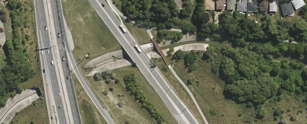
Around here we have a section of a river channelized (rerouted inside concrete banks, partially through culverts) for about 1 km, after which it resumes its more-or-less natural course:
Currently the channelized sections are mapped as waterway=drain.
I am thinking that it should be waterway=river throughout, because this section is not “used for carrying superfluous water” (as drain description says), it’s used for carrying river water. Is that correct?
If yes, is there a tag to indicate whether the river has “natural” or concrete banks? (Acknowledging that dirt banks aren’t necessarily natural)
Yes, I think waterway=river would be appropriate. You could map the channel as an area and draw a retaining wall along the edges, though it looks like this is a V-shaped trough, so calling it a retaining wall would be a stretch.
In one case, I needed to map a similarly shaped stone riverbed because it’s on a national heritage building registry. I resorted to a pretty desperate combination of tags including surface=stone (not surface=water, oddly enough) and landcover=shingle (because the natural=riverbed documentation recommends natural=shingle, which conflicts with natural=water). A more direct solution would be great.
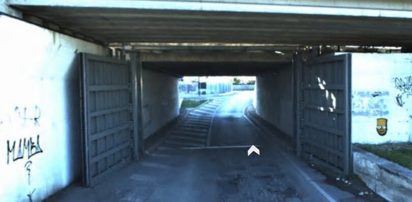
I’ve taken a liking to adding flood_prone=yes for waterway side or middle shingle areas (we have lots of underpasses that dive down in cuttings that are signed as flood prone too, not to speak of ways that cross river/stream beds and camper riders who think they’ve found a nice place to park for the night and wake up to a flash flood.
Since the 2012 flooding a person driving into an underpass and not making it we have lots of traffic signals (red only) and these signs, even flood doors have appeared.
surface= is appropriate, for what can be underwater, or tree canopy, etc. But landocver= alone would be wrong, as that describes what’s the cover on its own, especially with the intermittent=yes (you have stones floating up sometimes???)
tagging it as canal would be more understandable, even if I would still consider it as wrong
but waterway=drain seem simply wrong
BTW, I see that Way History: Mimico Creek (19454008) | OpenStreetMap is truly ancient - but I would still write to author that you are discussing their edits on a forum. It seems to be in a good tone to make them aware of it.
Only few people worldwide, if any, read every single thread at forums.
Why should a retaining wall not have a certain inclination? The wiki just defines it as
… a structure that holds back soil or rock from a building, structure or area.
I have just a couple of day ago mapped a creek passing through a village in a 2.5 meter deep artificial ditch with a base and walls of concrete choosing the same approach, tagging the waterway as waterway=stream and the sides as retaining walls + a railing on top.
I have not been aware of this tag so far. It could be used additionally but it does not give any information about the kind of refitting done. I’d say at least in Europe the majority of rivers and streams had been refitted over the past centenaries so this tag would not add much value there imo.
I have commented on Changeset: 508757 | OpenStreetMap. (I have in the past commented on andrewpmk’s changesets and sent them a DM once - never once got a reply, but commented now for completeness’ sake.)
Perhaps it could, but in the case of a V-shaped structure, the “wall” would take up half the width of the channel, so it would need to be an area, right? In the case of the creek I shared (Harvey Branch), one section also has a vertical retaining wall, so mapping the bed as a wall would get pretty confusing.
You are right and for sure there is a certain blurring where a sloping wall ends and an embankment begins, but that is not unusual in OSM, is it? If it is steep enough to be seen as a wall I would always draw the line at the walls crest, same as we do for an embankment. If it is more an embankment than a wall why not tag it as embankment with a concrete surface?
I think what I’m still missing is some way to explicitly indicate the material of the riverbed. I’ll use surface=* on the natural=water area as long as there isn’t a better solution, but I’m afraid that it’s prone to misinterpretation by other mappers or data consumers that might mistake it for a covered reservoir or somesuch. There’s also floor:material=*, but calling it a “floor” sounds a little too technically correct.
I’d say the surface of a river or creekbed is water and not the ground below the water. I think “floor” is most commonly used for floors in buildings but I know that in tunnel construction the tunnel bottom is also called “floor” so probably this would also fit for artificial creekbeds …??.. hmmm, sounds weird to me.
Why not use its own key for river- and creekbeds? There is
riverbed=* used 4 times
riverbed:type=* used 7 times
Not a lot but most mappers apparently don’t care about the material of a river- or creekbed. I habe to admit that for the creek I described above I also “forgot” about the creekbed material, just mapped the retaining walls …
riverbed:surface=* or riverbed:material=* could work as long as we’re OK with it applying to creekbeds and I guess the lining of a reservoir or swimming pool. (This is a creative bunch; I’m sure I would quickly get surprised at what else we use it for.)
I suppose it can be more difficult to determine from aerial imagery when the channel is full. Or even in person, if the water is murky enough.
I didn’t end up mapping the concrete river channel area, given the lack of consensus or clear idea how to map it right now, though I support creating a tag or tagging method for it… if someone else wants to put in the effort.
Thank you for this suggestion - I had searched taginfo for Canadian spelling channelized but didn’t find anything, and I forgot to use the British spelling. So now there’s 10 more uses of channelised=yes
I have now created a wiki page for channelised=yes: Tag:channelised=yes - OpenStreetMap Wiki to document how I understand it, and link back to here where it was discussed.
Corrections and thoughts welcome, especially from @Dimitar155 to make sure we have the same thing in mind when using the tag!