Inquiry on Cycle Path

Hello Nederlands OSM community,

I have an inquiry regarding a particular way (Way: 1090599426 | OpenStreetMap), currently accessible but linked to the residential way with permissive access for motor vehicles. Would it be appropriate to modify the way (Way: ‪Nieuwezijds Voorburgwal‬ (‪631792710‬) | OpenStreetMap) and way (Way: 1090599426 | OpenStreetMap) to a cycleway, indicating ‘motor_vehicle = yes’ or ‘access = destination,’ ensuring it is not accessible to traffic?

Thank you,
Salim

Wat voor verkeersborden staan er?


Zo te zien is de straat hier recent gehercontructureerd en is er veel veranderd. Ik wil dit wel oppakken.

@sbaido Is het voor jou mogelijk om wat foto’s te maken van de huidige situatie?

Thank you @Tjuro @JeroenHoek


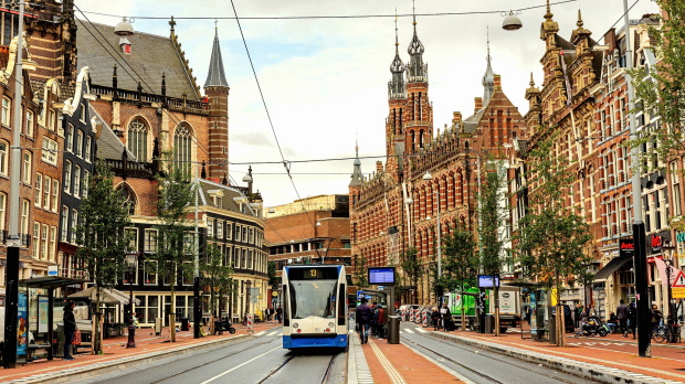
These are the pictures/images from the source and seems like a tram/bus lines and cycleway only, no information or infrastructure for motor vehicles available but apparently the construction as you said has changed the situation a lot.

Ah top, zover ik kan zien, is de rechter kant nu een fietspad, het midden een bus/tram baan en de linkerkant een gedeelde rijbaan:

En is er iets boven het zebrapad een kleur en materiaal overgang:


1 Like

@Tjuro
Do you want our support with your recommendations or will you or any of the community members will edit/correct/update it?

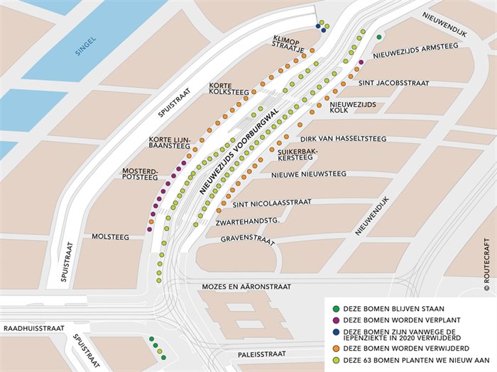
The reconstruction here is still ongoing. The area between the Mozes en Aäronstraat and the Paleisstraat on the Nieuwezijds Voorburgwal will be under construction from 22/01/2024 till around 14/02/2024.
This is also the reason that there are not many traffic signs now.

1 Like

So what is your recommendation?

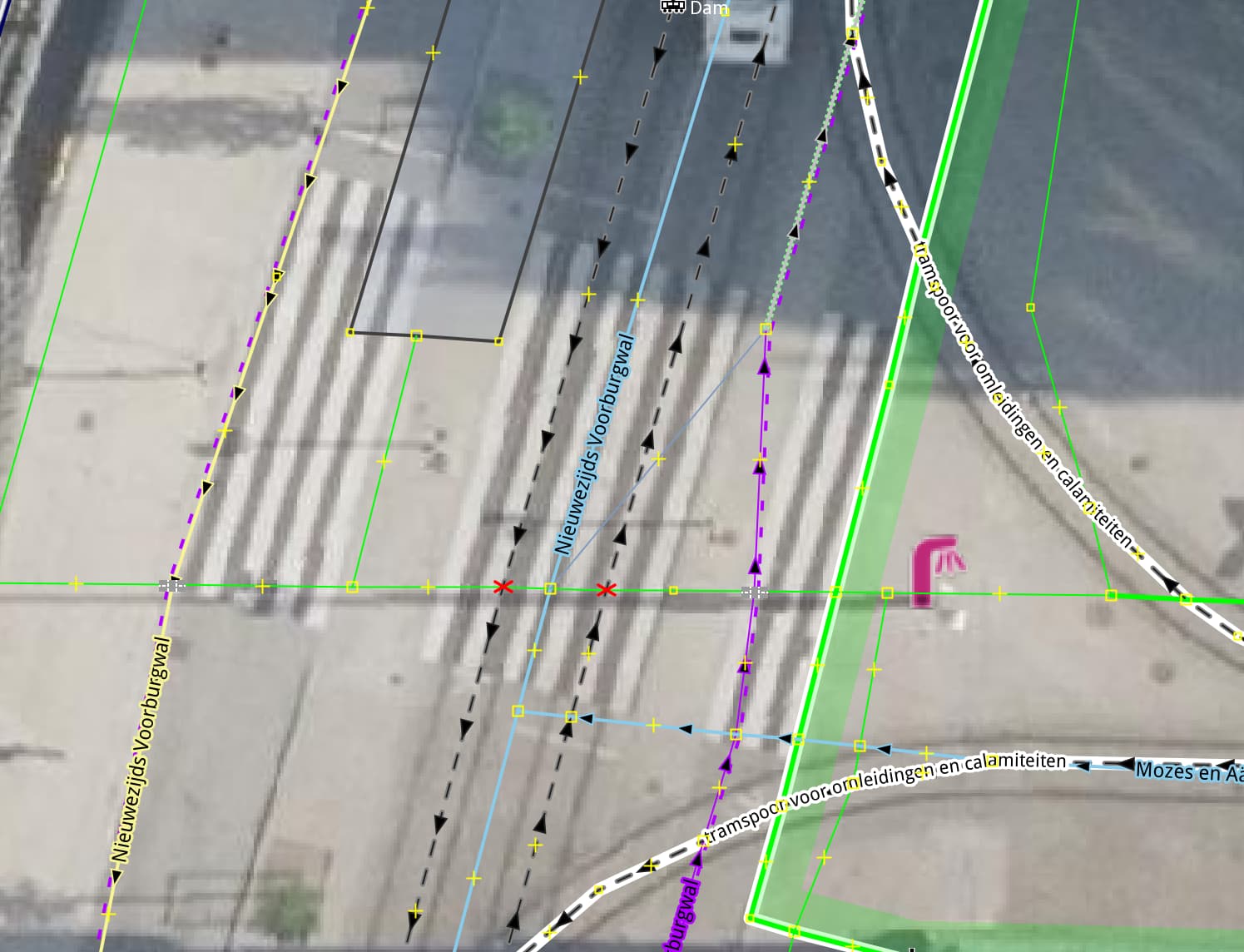
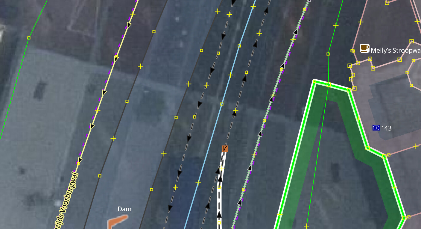
i have made some changes in the area including moving the platforms, and aligning the tram tracks. however the whole area is in a realy bad state right now.

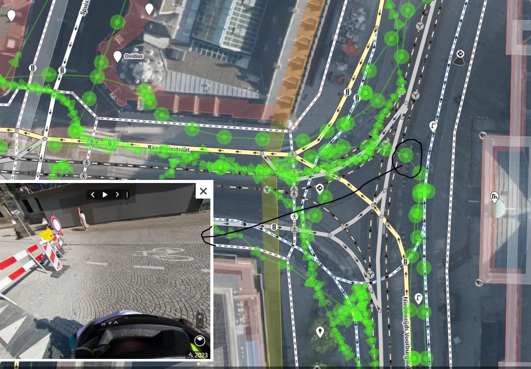
What i need to know is, do all busses use the center bus/tram way or do some use the shared road like:

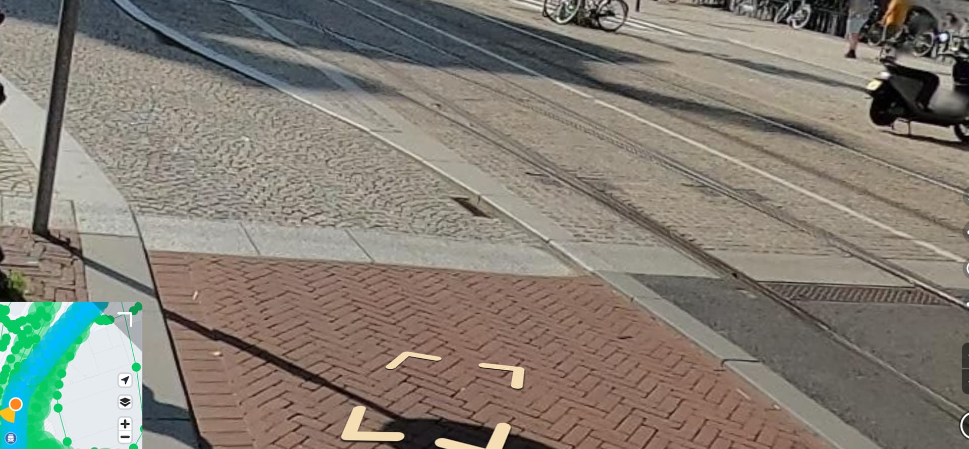
And for the busses that do use the busway, where do the enter the busway, currenly it looks like this:

Yes indeed seems to be a bit messy.

Checking and changing bus routerelations was not a priority.
All routes on Martelaarsgracht are changed now.

I’ve looked up some more detailed information.
On the 20th of December of this year (so in a few days) they’re finished with all the reconstruction. So I would advise waiting those few days till you start mapping the changes in this area. All the traffic signs will also have been placed then.

The construction that will happen around the end of January is only some better securing of the new tiles that are now used.

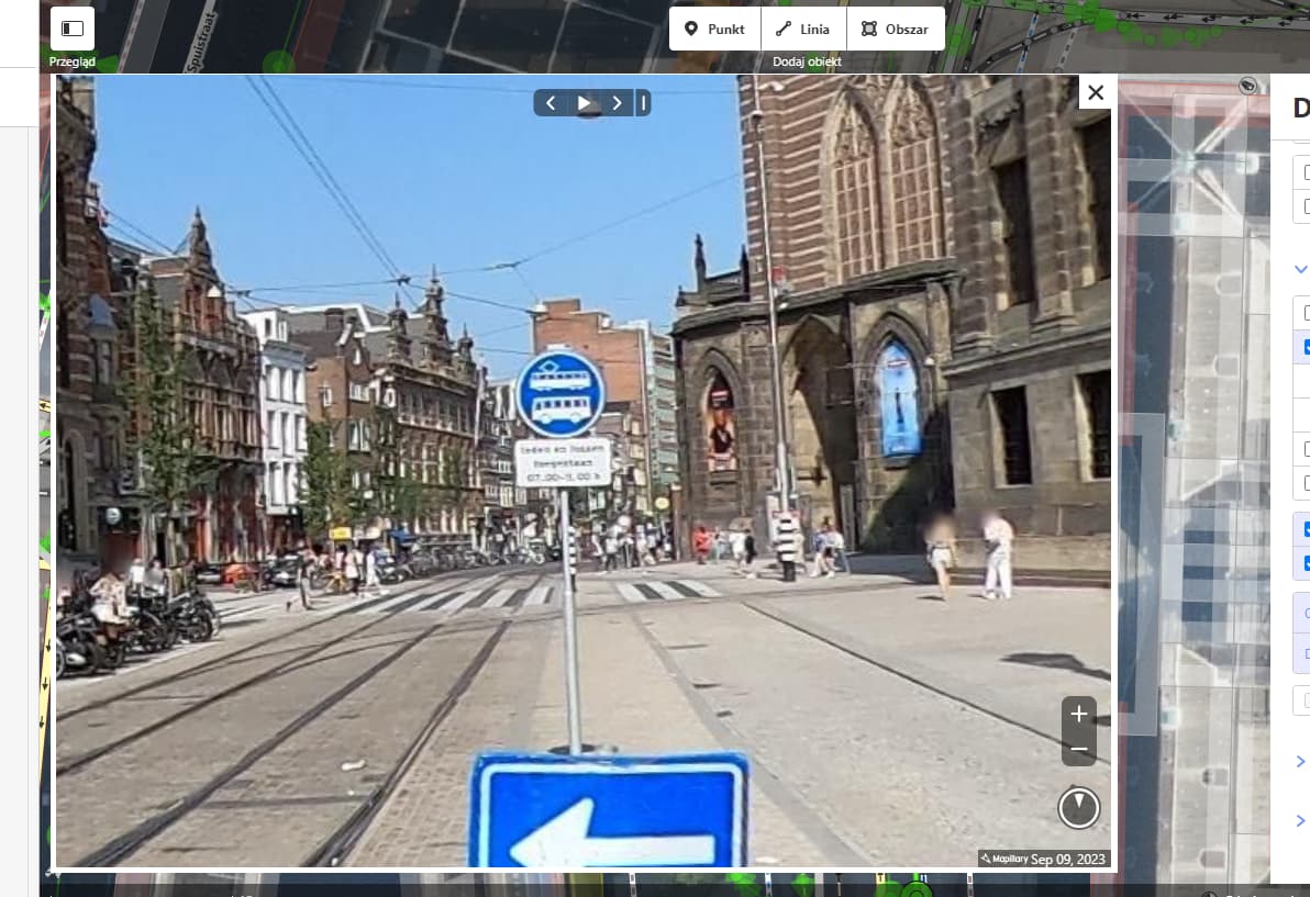
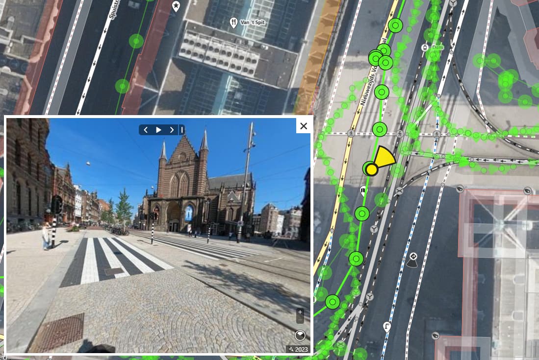
Here some pictures of what it should look like now:


In this picture you can see how they wanted it to look like.


The orange lines are the old platform locations. The blue line are the new platform locations.


The dark green and light green dots are the new locations for the trees. The others dots have been removed or relocated.

620x348_nieuwe_halte_dam_roos_trommelen
This a photo (looking to the south) of the new platforms.

I hope this information can help you.

1 Like

thank you @JASMein03M for the detailed information, we will look into your leads in the coming weeks that will hopefully project the reality after the full construction is done.