natural=fell is not rendered by carto due to reasons I don’t fully understand, even after reading a lengthy thread where this is discussed. I am quite extrovert, so I’d like to be seen (=rendered on carto). As I am a rather common occurrence in mountains, I think I deserve it.
I would stick to natural=fell and wait for the day when we replace Carto as the default renderer.
I don’t think natural=grassland is quite fitting here. Even in European settings, I mostly use it “abandoned, formerly cultivated land and wasteland, covered with wild grasses” areas (as Wiki says), i.e. those that apparently are not used as landuse=meadow. I don’t read the entry as barring its use in Europe.
A defining feature of fell, at least south of polar circle, are protruding bare rocks, but not enough to be described as natural=bare_rock. Yeah, goats and sheep can graze it, but hardly on the level that it’s worth tagging as a landuse=meadow.
@martianfreeloader This is also the case with PTv2, and frankly I’ve stopped caring about what Carto renders, e.g. for the past few years I’ve switched to strictly using only PTv2 for new objects, even though Carto doesn’t render it at all (for all the reasons you mention).
Keep adding data with the correct tags - some day, renderers will either grow up and do the right thing, or be replaced by something that does.
Then again, OSM is not a shared painting system - in my opinion, people with a mission to “colour in” every last white spot on the map are causing more damage than their little three-square-kilometre patches of whatever are worth. (This being a general assessment and not a comment on the area you wanted to add which might have been larger.)
I understand your issue but nevertheless the landscape you talk about is without doubt properly defined by the tag natural=fell.
None of the other natural tags mentioned here fits so using one of them would be “tagging for the renderer” in a quite blatant way. You can do that but I do not think you will get much support for it here in the forum…
I’m not sure this question has been answered yet. I would say it is possible you are a natural=tundra and specifically an alpine tundra.
Here are some things you should consider:
Is your subsoil permafrost? If so, in combination with what we can see from your selfies, you are likely a natural=tundra. (However, if you are an elastic flow of rock, permafrost, and ice, you may be a rare and coveted geological=rock_glacier!)
Are you within one of the recognized regions of alpine tundra? You mentioned you were in a mid-latitude alpine environment in Europe and there are examples of alpine tundra there. (You might also consider the list of recognized tundra regions although it has few examples in the mid-latitudes.)
Are you treeless because of human activities (e.g., grazing or clearing)? If so, you are not a natural=tundra.
Are you primarily without vegetation? Your selfies show us some low-growing grasses and forbs, but sometimes selfies are more flattering than reality. If you’re not primarily covered in vegetation, consider natural=bare_rock, natural=scree, or some similar things which are all very nice in their own way.
Most of natural grassland areas (savanna, prairie, pampas) are outside of Europe. However in Europe, natural=grassland is used to tag abandoned, formerly cultivated land and wasteland, covered with wild grasses and/or other herbaceous plants.
The thing I want to map is neither savanna, prairie, pampas, nor is was it formerly cultivated. My reading of the wiki is that I should hence not use the tag in Europe.
I have no idea why the wiki says this, though.
Do you think natural=grassland would be ok for my use?
I know I shouldn’t tag for carto. But I’d really like to see it on the map. I find it hard to accept that such a prevalent landcover type isn’t rendered on our standard map. :-/
Renderers: We don’t render it because it’s not tagged correctly. Mappers: We don’t tag it correctly because it’s not rendered. Some geeks in 2004: Let’s take a different approach.
For what it’s worth, back then I tagged similar landscapes in Dinaric mountains ( Relation: 12204784 | OpenStreetMap ) as natural=heath, unaware of fell, since it resembles this Wiki example:
Since we hardly have a proper “heath” landscape in southern Europe, the tag can be appropriated for alpine fell/tundra/krš, and perhaps one day automatically retagged as fell or whatever.
Searching for natural=heath in Slovenia on Overpass Turbo shows very limited use of the tag, a good part coming from a strange “RABA-KGZ” import (I examined a few areas and found no obvious low bushes). On the other hand, someone mapping Triglav surroundings apparently had the same approach as I: Relation: 15040111 | OpenStreetMap
I urged the maintainer of my hiking app to render natural=fell same as natural=heath and they did that. Perhaps a slightly different rendering might be better still. From what I observe, what is mapped fell in the area of my local knowledge is very often grassy, with lots of rocks and a bit of heathy plants, ericacea or what the botanists call them.
Identity Crisis in the plural, reading above there’s no grassland here, yet the whole Apennines range is full of what locally is described as ‘prateria’ (likely tree covered in long ago ages), where ‘prati’ is grass, our gardner refers to it as that what’s behind the house. Visit the Voltigno Reserve, 360 surrounded by mountain ridges, a stiff 2.5 hour cycle trip from our place and you’ll see. My tagging for those areas is natural=grassland (hundreds of years old) + grassland=prateria similar to what spanish speaking would tag as grassland=pampas.
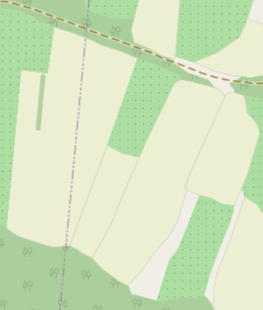
(Carto renders about 6 different landuse/cover types in an indistinguishable type of grass green, natural grass distinctly different in hue than what bovine graze on the lowlands). Wish there were (ever so faint) borders same as on farmland so adjacent parcels can be made out, often used as leads for fencing, ditches, hedging, farm tracks etc.
PS Puzzling the high hit pampas grassland in northern Poland…
There is not much incentive to map it at all in that case.
It looks very strange and ugly to have white areas between rendered heath and rendered scree or bare rock areas on a correctly mapped section of the map.
It’s a shame the renderers won’t render a quite common landcover type because some mappers use the tag incorrectly. But I guess this is another discussion.


