This follows up on a discussion that still confuses me, as seen here: How to tag unpaved tracks primarily used for access to agricultural fields, with the exception of one residence or hotel?.
I’ve provided a real-world example below based on a typical scenario in Northern Thailand:
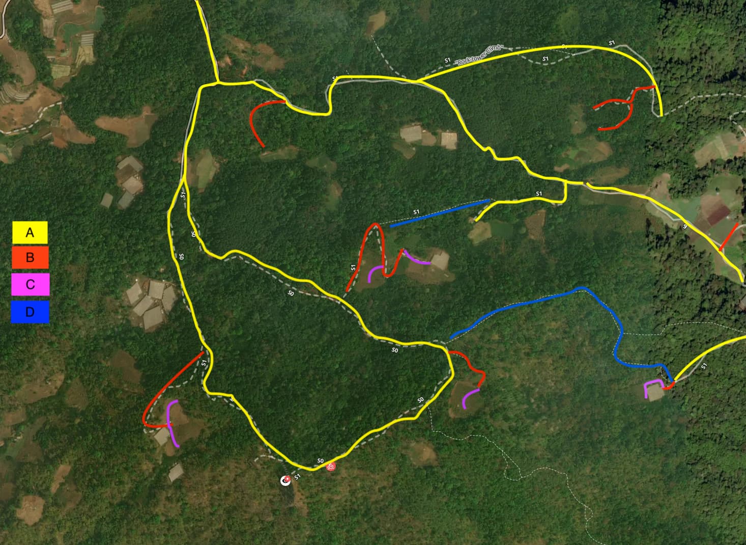
- The main tracks (A) provide access to multiple farmlands through adjacent tracks (B), where you may find ‘agricultural service buildings’ like huts or greenhouse structures.
- Each farmland could have additional inland tracks (C) used to access crops.
- Additionally, some old forestry track (D) may branch off the tracks to reach another area, but it’s not commonly used due to being in poor condition.
None of these tracks provide access to residential buildings or lodging.
Most of these tracks require a high-clearance pickup truck (standard vehicles in remote/mountainous areas), and a good portion of these tracks may be paved (concrete, concrete:lanes).
According to the wiki and the example above, how should tracks of categories A, B, C, and D be tagged?
Remember that tracks should be classified based on their function and not their surface alone.
highway=service(A,B),highway=track(C,D)highway=service(A),highway=service+service=driveway(B)highway=track(C,D)highway=track(A,B,C,D)- Other (please add it as a comment)
0
voters