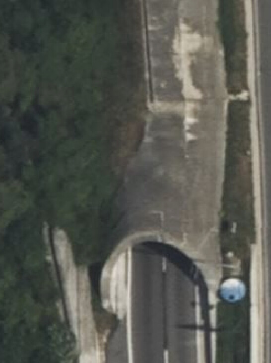
We can outline it, yes we can, but then, what to tag this with. A tunnel, full tube about 250m at the southbound end, build at the surface to prevent the hill landsliding onto the motorway. It’s half covered at left and a third or so at right. Has no gaps or windows to let daylight in at right side. Driving thru south you would not know it’s just a tube and counted as part of the full length of the tunnel. Northbound same section is open air.
Just a bit earlier today came across mapper A drawing a bridge at layer=1. A little later mapper B drew a tunnel for the cross road the bridge went over. Tunnel layer=-1. Not sure what was between, my bet, a reinforced concrete roof top of the retaining walls stopping the embankment caving in. Seen this combo many a time. Checking, there’s no bridge of 50 meters long, just that road wide underpass tunneled through the embankment the primary is on. The bridge went sailing.
I’ll leave it at man_made=tunnel as area, no layer since it’s at surface. None of the QA services have had a fit since mapping this 6 days ago.
Thx
PS would not be surprised the retaining walls came first before the embankment was piled up, at least that’s my amateur view on constructing someting like that… positively nothing natural between underpass and road above.
edit: As illustration for the bridge v tunnel discussion, part embankment. part in cutting (courtesy of Mr oogle… Cycled past here countless times.)