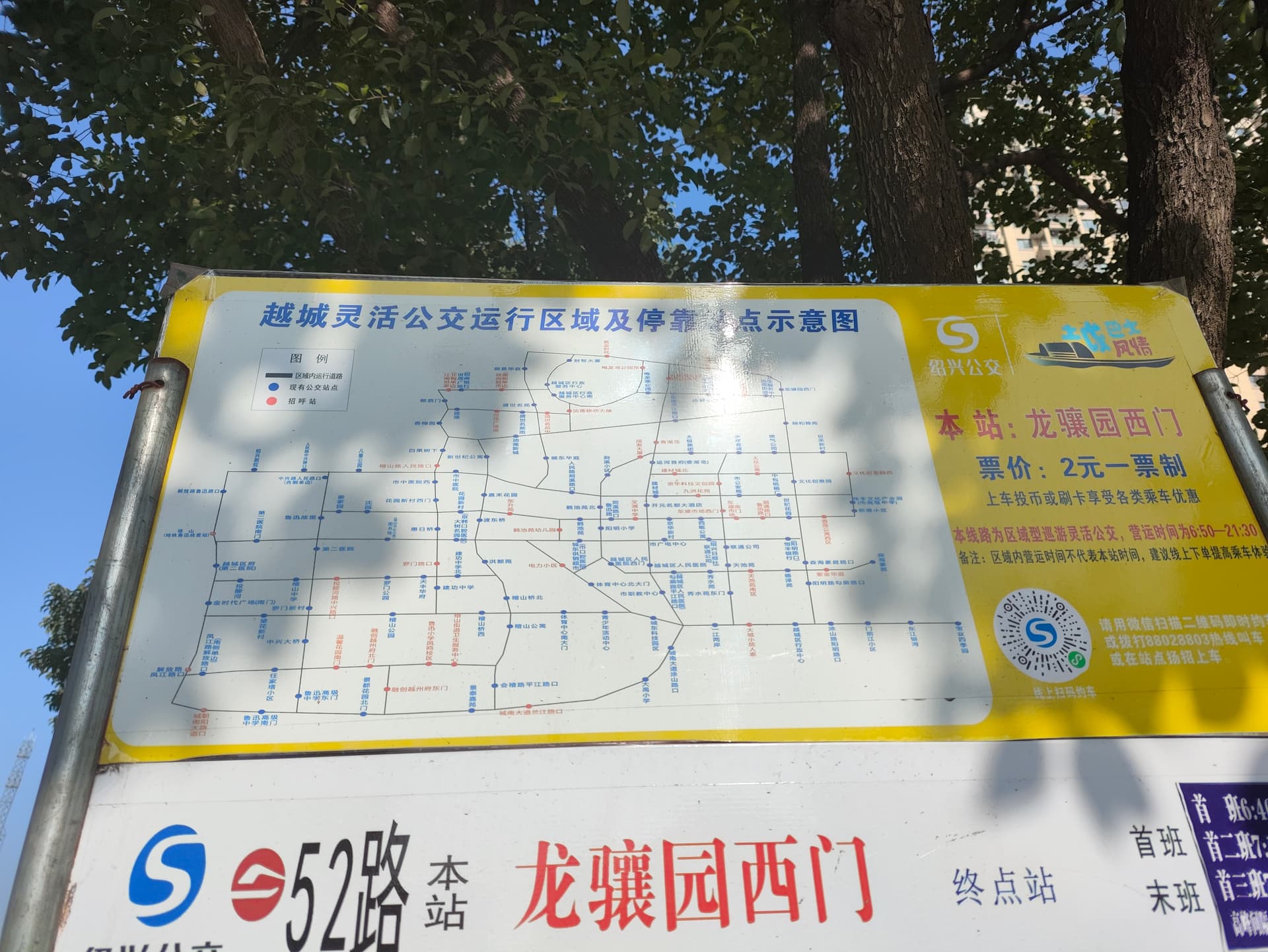
Citizens can take this kinds of bus via multi ways, such as call them via Wechat mini program and phone call or just hail from the bus stop.
Some of mappers suggested only add the node of bus stop to the relations. I wonder how to tag the boundary of the operational area in this way.
Plus some other types:
The area inevitably faces the question of verifiability and ground truth, besides the updatedness that’s more critical for these. Drawing virtual circles for every one of them all over the map is dubious.
Limiting to links to such info will be prudent at first. Ideally they should have a GTFS, although OSM’s gtfs:*= only has Static for now, not Realtime, and Flex.
Problem for =bus_stop etc is still the route=bus is expected to be an ordered list. Even if the 836 stop_on_demand . and 136 platform_on_demand , are adopted somehow, they are still considered to be in order. Furthermore, this is unclear whether it means a vehicle won’t pass through the stop at all if not requested onboard or remotely; or it’s a request-stop, which is already a standard mode of operation for many bus systems around the world. route | Relations | OpenStreetMap Taginfo hail_and_rail is again a fixed section of road that the vehicle will travel through. It doesn’t mean it will only be traveled on-demand.
There were some questions and ideas before. But they aren’t worked out enough yet.