In Thailand, the status of u-turns on major roads (non-motorway) often changes. Incidents, accidents, or fatalities can lead to temporary closures for days, weeks, months, years, or even permanent shutdowns. However, there’s also the possibility of swift reopening.
I’ve noticed diverse tagging styles for these closures, causing frequent reversals. Therefore, I’d like to standardize and document this for our local community:
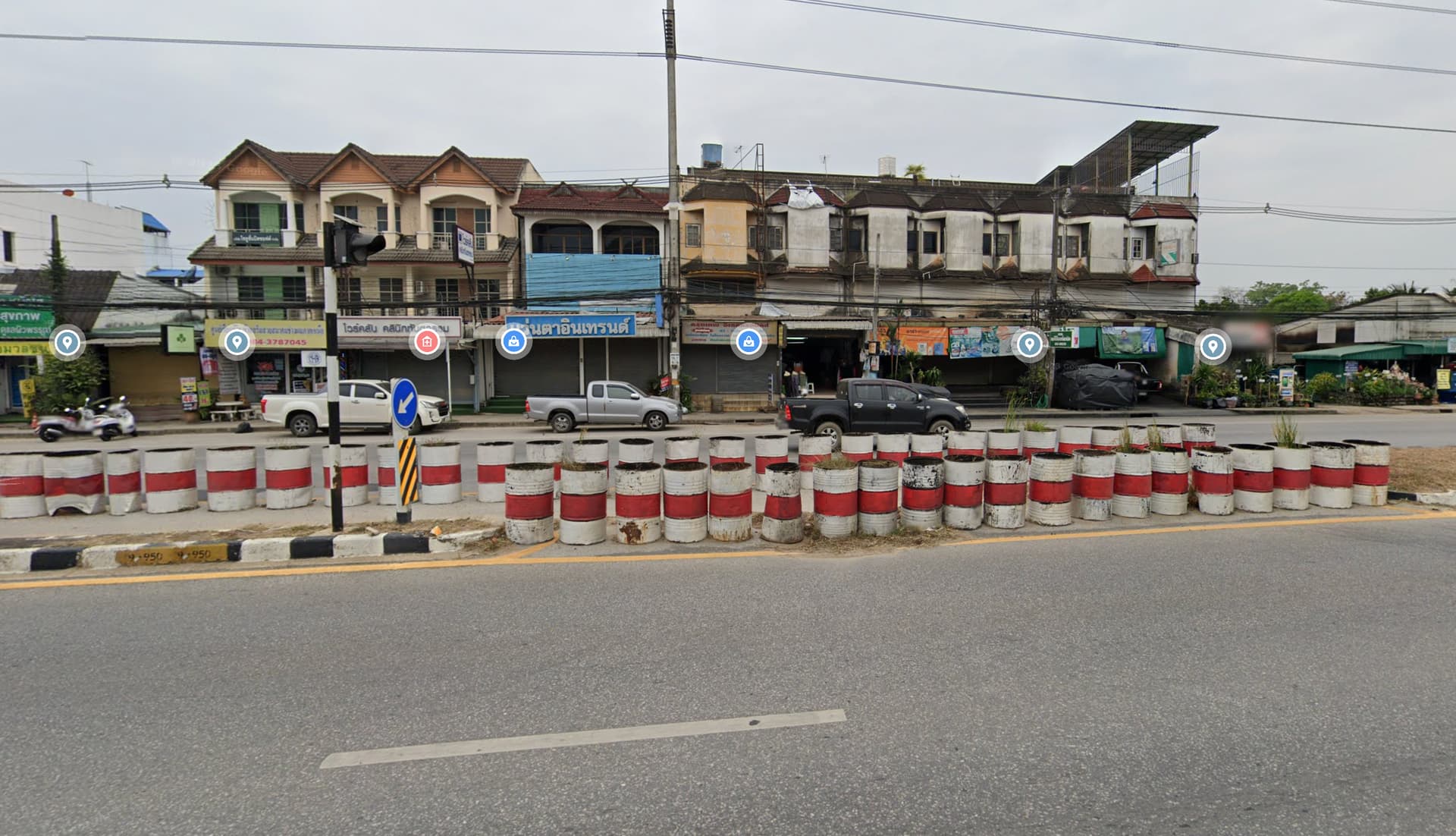
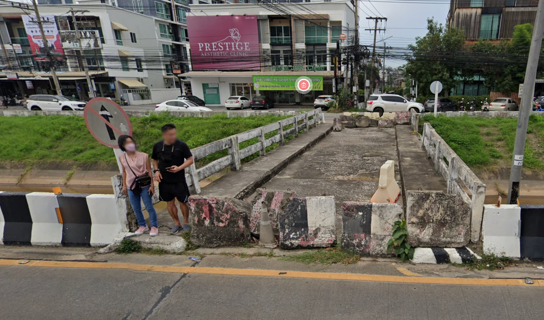
Most u-turns lack pedestrian access, but some people might use gaps between blocks (barrier=block) to cross on foot or motorcycle, even if it’s technically illegal.
Here are various tagging styles for similar highway=secondary_link closures that I’ve come across:
Map the jersey barriers as lines both ends which will stop routers from using these ways in their planning for vehicles an access=no {will stop alerts too} and maybe a foot=yes on way and a maxwidth:physical on the jersey to indicate what could get thru. A check_date will signal when last verified.
disused:highway= + highway= : Conflicting meaning to me. It’s still used, only differently. The ~5.6k use has many problems, including same disused:highway= and highway= that are obvious mistakes. Most are not changing between vehicular and non-vehicular roads either.
– I prefer was:highway= for these. Be aware Lifecycle prefix - OpenStreetMap Wiki and Key:disused:highway - OpenStreetMap Wiki doesn’t show this disagreement.
disused:highway= + =footway : Example 2 is physically a sidewalk of the per-existing road. The 2 linear features are different. disused:highway= + sidewalk= is still not routable.
disused:highway= : It alone doesn’t show it’s usable by pedestrians. Technically doesn’t show it’s reserved and immediately usable in emergencies.
Such median crossovers could be =service + service=emergency_access with appropriate legal restriction. foot=yes should not be used if it’s illegal. It doesn’t show physical usability, and is misleading. You don’t have to encourage anyone to do it, even if the law is stupid with 100m distance from a crosswalk. They can decide for themselves.
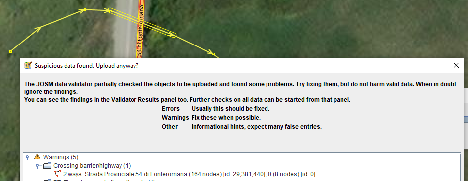
Tried different barriers, all give validator alert in JOSM until actually connecting it to the road at which point the validator is A OK.
Weird scenes inside the mapping mine.