I don’t think there should be a highway=footway + footway=crossing parallel to it. Which would extend Way: 1305953068 | OpenStreetMap toward the north.
The opposite side has a high curb, allows parking and a grass strip.
I would argue you can of course legally cross there, but it’s not physically built as such – on the west side.
The most logical answer would be not have it split at all (too low gain for all the disadvantages) but because it’s part of a cycling route, this small piece has to be kept split. In that case, I see the stub as it is: sidewalk:both=no because there is no place you can walk on parallel to it, only more road.
If anything, one can add a crossing on the other side to connect it with the driveway as a little, practical shortcut.
Not only is it part of the cycle relation, it has a different surface, which to me is different enough to have it be split.
Although i see now it is not (yet) tagged with a different surface.
If only because that little stub is being part of a route and different surface, than it can remain separate and now looking on a large screen in JOSM, no sidewalk on the present stub and in extremis another split where to road change over in asphalt.
It is not signed (no traffic_sign=DE:239), but that is not necessary in germany – only for clarification or other important reason should there be a sign for a sidewalk. Yes, the centerline could/should be tagged with foot=use_sidepath.
Yes, my mapillary image shows that aswell.
I’d assumed I split it to tag the different surface, but that was not the case.
The second split and correct tagging of surface could have an impact on cycle routing, since I vehemently avoid this street solely for this reason, but others may not care as much.
personally I would mark it as sidewalk=separate - if sidewalks would be mapped as on-road property for both major and minor roads this one would be marked as having sidewalk
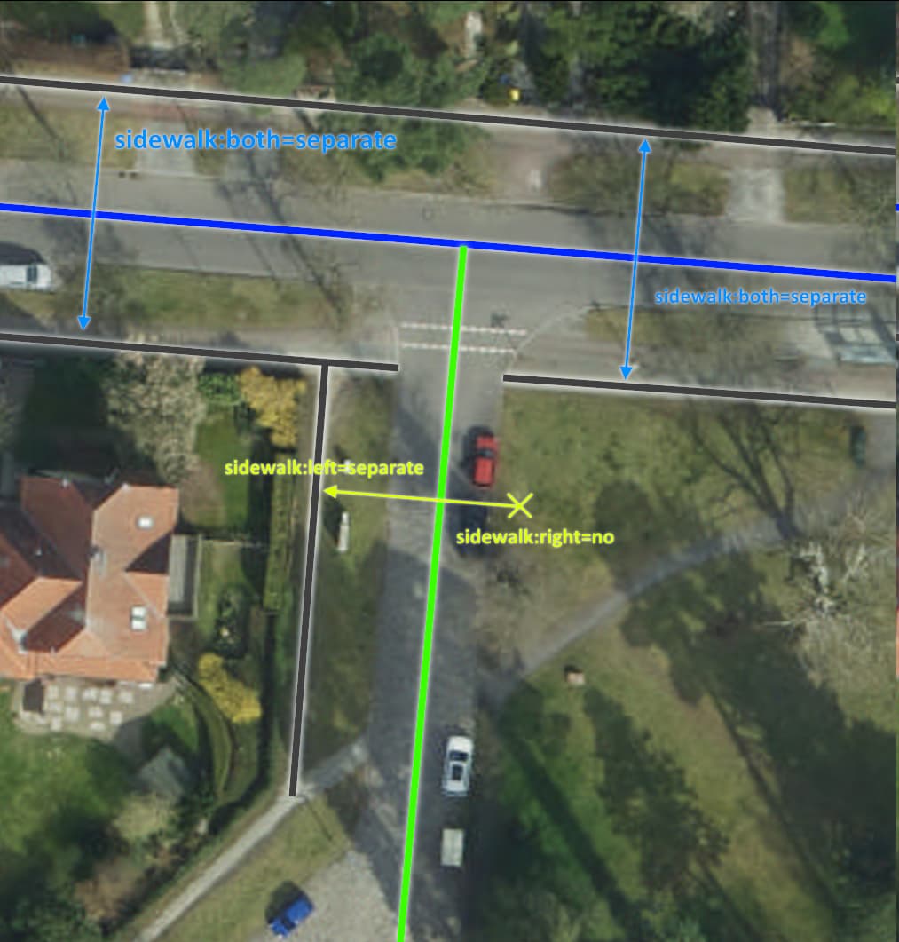
sidewalk:left=separate + sidewalk:right=no. Same as the rest of the street. sidewalk* tags on street ways are a less granular form of sidewalk mapping that should make sense in a dataset where separately mapped sidewalks are excluded. In a limited dataset like this, a value of separate would be treated the same as yes.
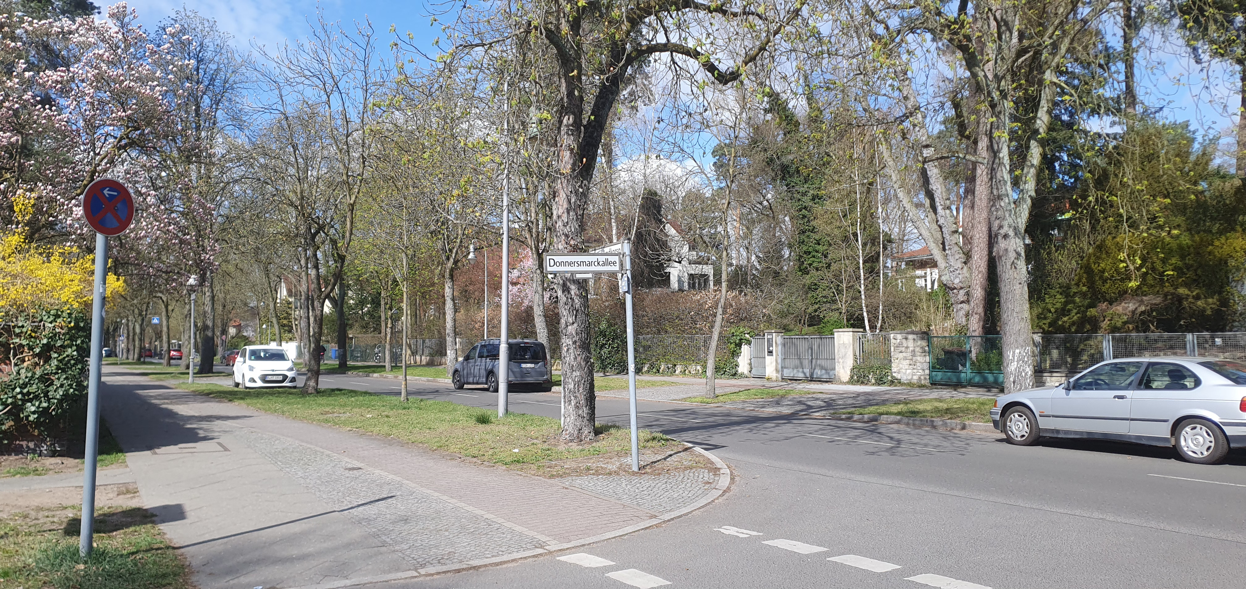
In this location one can walk down the left side of Donnersmarckallee on the sidewalk and then turn left on Sigismundkorso, continuing on the sidewalk. If there is a gap at the end of Donnersmarckallee tagged sidewalk=no then to a data consumer that is looking only at the main street ways it would appear that the sidewalk goes part of the way down the left side of Donnersmarckallee but then ends before the intersection with Sigismundkorso. This isn’t the case.
Seconding sidewalk:left=separate + sidewalk:right=no, for the exact reasons outlined above by @ezekielf.
This is the “mapping” - the shorter way is to be considered as part of the main (green) roadway for the purposes of sidewalk:<side>=yes|no|separate tags.
Mammi71
(One feature, Six mappers and still More ways to map it)
12
Da ich bisher der einzige bin, derauf sidewalk:left=yes (genaugenommen: sidewalk:both=yes) plädiert, muss ich das wohl erklären.
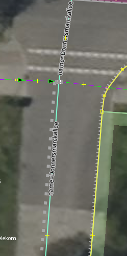
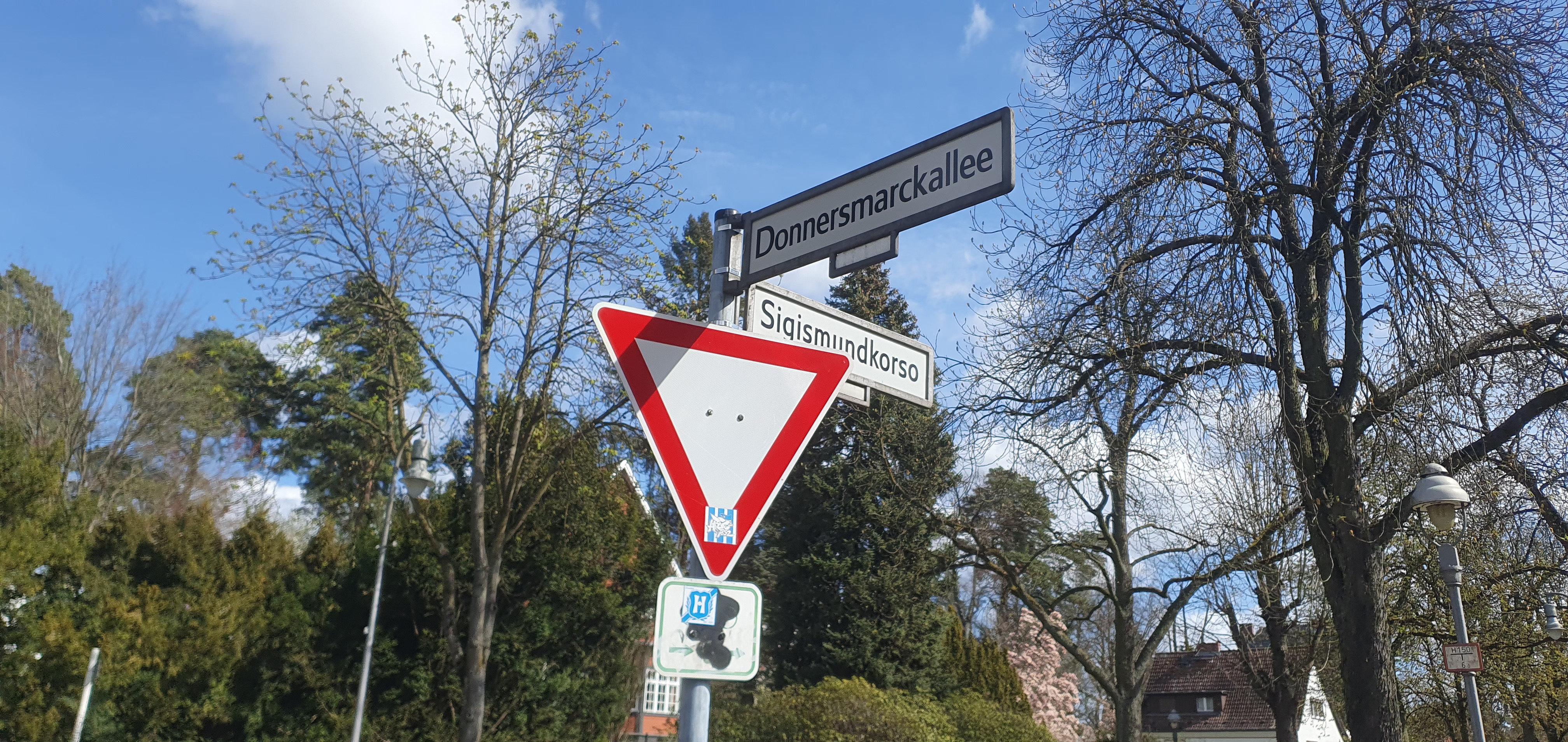
Zunächst muss ich vorausschicken: der Name “Donnersmarckallee” ist falsch. An dieser Stelle und der nächste Straßenabschnitt ist der Donnersmarckplatz: Mapillary und Mapillary
@cyton: es geht Dir um diesen kurzen Abschnitt der Straße Donnersmarckallee zwischen dem (nicht benutzungspflichtigen) Radweg und der Straße Sigismundkorso, korrekt?
Dann müssen wir uns bewusst machen, dass dies nicht einmal 8 m Länge sind. Und von diesen 8 m Länge sind 1,5 m die Breite vom Radweg und mind. 3 m die halbe Breite der Straße Sigismundkorso - also mehr als die Hälfte gehört woanders hin und kann gar keinen sidewalk haben. Es verbleibt bei 3 m über die wir uns Gedanken machen.
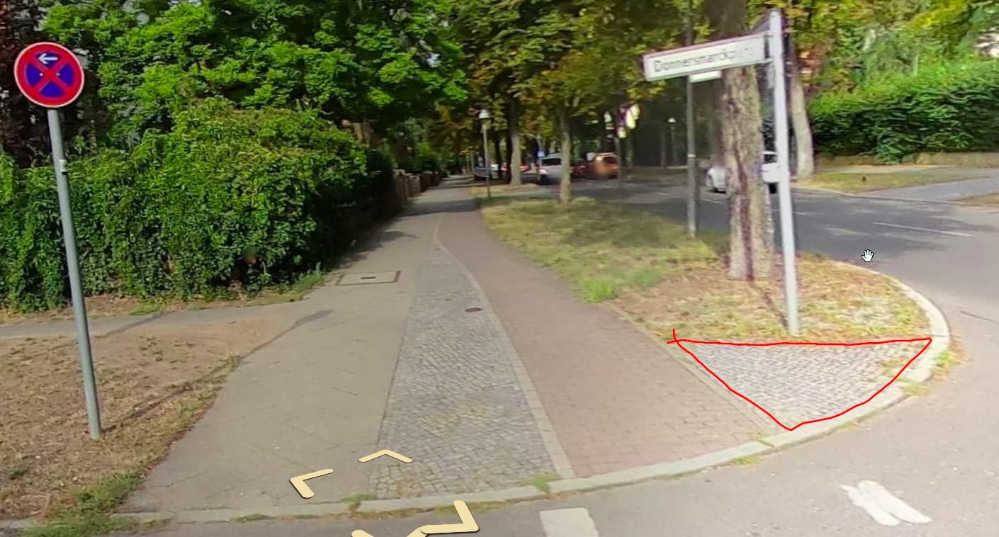
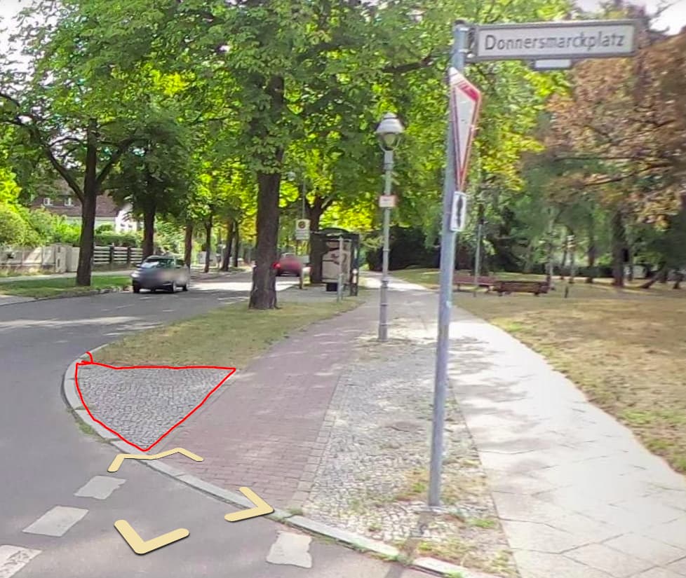
Ich komme noch einmal zurück auf die beiden Straßenschilder “Donnersmarckplatz” und legen wir unser Augenmerk auf die Flächen zwischen Radweg und Sigismundkorso:
Wie würdet Ihr denn die rot umrandeten Flächen interpretieren?
Für mich ist das ein typischer gepflasterter sidewalk.Deshalb ist meiner Meinung nach das Tagging sidewalk:both=yes
Im endeffekt könnte man einen halben footway=crossing bis zur centerline des Sigismundkorso kartieren, nur bringt das wenig befürchte ich, da es dort nicht als crossing vorgesehen ist, also auf der nordseite Sigismundkorso.
Daraus folgert dann das sidewalk:both=separate, genau.
Mammi71
(One feature, Six mappers and still More ways to map it)
14
Definitiv nicht als Bürgersteig (zumindest nicht im striktesten Sinne) sondern als “tote” Fläche: Gleiche Oberfläche wie des Schildes und der Lampe aber auch weil die Fläche als “Weg” nirgendswo weiterführt und wie die Grasfläche weiter hinten eher als Puffer zur Fahrbahn dient.